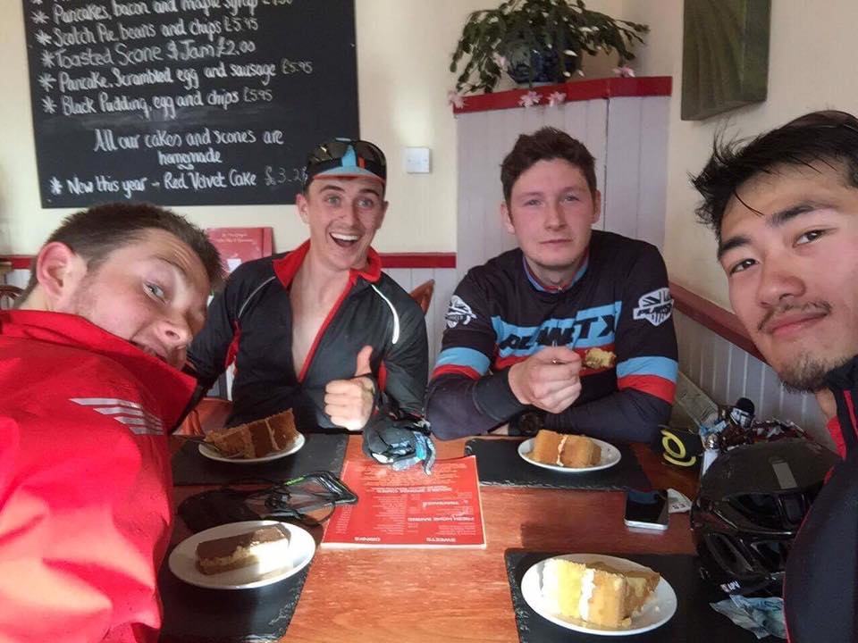
The windows of the cafe were completely obscured with condensation, as the cold November air outside collided with the steamy heat created by a group of cyclists inside.
It was my birthday, and a few (mostly new) friends and I had cycled from Stirling to Loch Venachar, over the infamous Duke’s Pass and down into Aberfoyle.
At the foot of this incredible climb sits MacGregors Coffee Shop – a wee gem of a place. The four of us were squished into a corner of the cafe; me, stuffing my face with cake and various other calorie-dense foods, buzzing with my newfound love of cycling and a bunch of new pals.
“Anyone need their water filled up?” asked Andre, who I had just met and would, over the next four years, become my go-to cycling partner. I asked for a top-up and Andre popped out into the cold to get out bottles.
The fateful brunch
“Erm…Ross?” he said, holding up my bottle. I looked up with my face full of coffee and walnut cake. “You haven’t drank anything!”
I laughed and shrugged it off. Whatever! I had eaten loads. I wasn’t about to bonk.
We left the cafe and began the cycle home. I made it about 500m along the road…before I bonked. Hard. It was a hard way to learn a lesson about fuelling on a bike.
Andre sat in front of me, blocking the wind, his little stuffed turtle swaying beneath his saddle. “Just follow the turtle!” he shouted, towing me home.
When I started cycling, I was thrown into a whole new world of customs, unwritten rules and lessons that needed learned (that drinking is just as important as eating to stop a bonk, for instance!)
What is a chaingang? Should you wear your sunglasses over your helmet straps? What’s the right sock height? Do I need an aero bike, a climbing bike, or something else? What the fuck is gravel riding? Why does my arse hurt? Do I need to like coffee? “Just kick it” doesn’t always work. Sometimes, sprinting every climb isn’t conducive to a long ride.
A younger Andre and I after chasing each other around another ride together
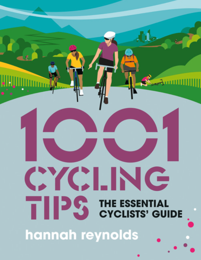
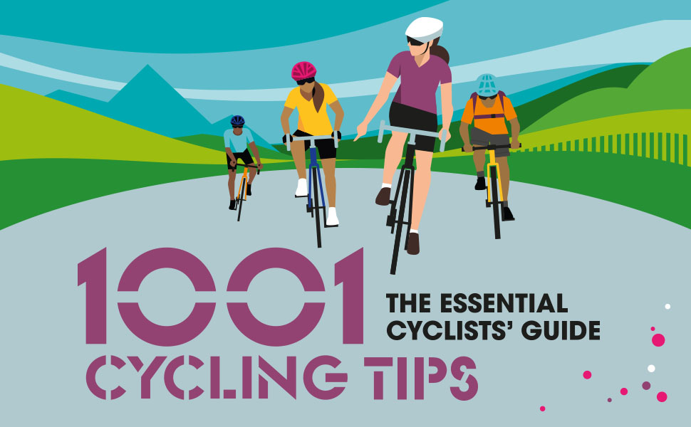
Recently, Vertebrate Publishing released a new book by Hannah Reynolds – 1001 Cycling Tips – alongside the 1001 Running Tips by Robbie Britton.
In the book, Hannah breaks down The Life Cyclitific* into sections: Basics, Maintenance, Cycling Life, Disciplines and so on. Within each are little sub-sections covering the absolute essentials you need to know or will no doubt be wondering ‘why the heck is that a thing?’: Sitting comfortably, shaving, cafes and, of course, Strava.
Me (centre) flashing the customary hang-ten at my first mountain bike race, taken prior to the race when my body and (some) dignity were still in one piece
Hannah herself is a mean cyclist and excellent writer, having been an editor at Cycling Weekly and edited Cycling Active. She alludes to her impressive palmarés in tip 237:
“Invariably, the time you need to fix something will be when you’re tired or it’s cold, raining or getting dark, so practise repairs in the comfort of your own home until you can do them fast. When I was training for a 24-hour solo mountain bike race, I’d set my alarm for 2.00 a.m. to fix a puncture or repair a chain before going back to sleep. It gave me the confidence to know I could do these things when sleep deprived.”
Given I can only just about pick up a puppy’s crap with a degree of dexterity at two in the morning, I doff my cap to Hannah for her commitment to the cause.
Recent forays into multi-day cycling
For those who are a little more seasoned to cycling, there may be a sniff at the idea of being given 1001 tips for cycling, but the whole book is peppered with excellent nuggets of information and bike life hacks. I particularly enjoy the use of the bike itself as an emergency storage space for bank notes and parts. There’s also a handy guide on how to transport your bike around and tips on nutrition.
Some may also be intrigued by the new wave of gravel cycling and bikepacking, both of which are thoroughly explained in this book, helping you pack better and enjoy yourself.
So, if you have someone in your life who is starting to get serious about cycling (or you are fed up with them watching the GCN YouTube** channel on your smart TV) I really would recommend 1001 Cycling Tips.
Hannah’s style is non-judgemental, humorous and honest, giving her own personal accounts of when things didn’t quite go to plan.
There’s literally a tip in there for everything. Though, “Just follow the turtle!” doesn’t appear in there.
*In case my readers are not listeners of BBC Radio 4, this is a joke about the programme The Life Scientific. If you are a listener of Radio 4, I am sure you laughed – heartily.
**Starting out as a cyclist (and even now, 6 years later), I found GCN utterly invaluable as a resource. Though it can be a bit ‘cyclist’ at times (think Strava KOMs and leg-shaving), it is a great place to learn and understand the ins and outs of cycling.
October trailed is damp fingers on into early November, the slow march to winter seemingly halted by a band of warm, wet weather.
Crisp and bright days seemed but an imagination, as I stared out the office window across the aptly named ‘Auld Grey Town’ of Kendal.
Thankfully, as I refreshed the MetOffice website for what felt like the umpteenth time that week, I spotted a break in the weather approaching – a little ball of sun amongst the grey clouds.
I decided to take the gamble and trust the forecast, and booked a day-and-a-half off.
Then came the task of deciding where to go. Part of me considered staying close to home and testing out my new bike on some familiar roads with a cheeky overnight stop. Though, my Lakes and Dales Loop didn’t feel long enough ago, and I wanted to go somewhere I wouldn’t normally. I also wanted to stay in a bothy, having not done so since mid-winter of 2019.
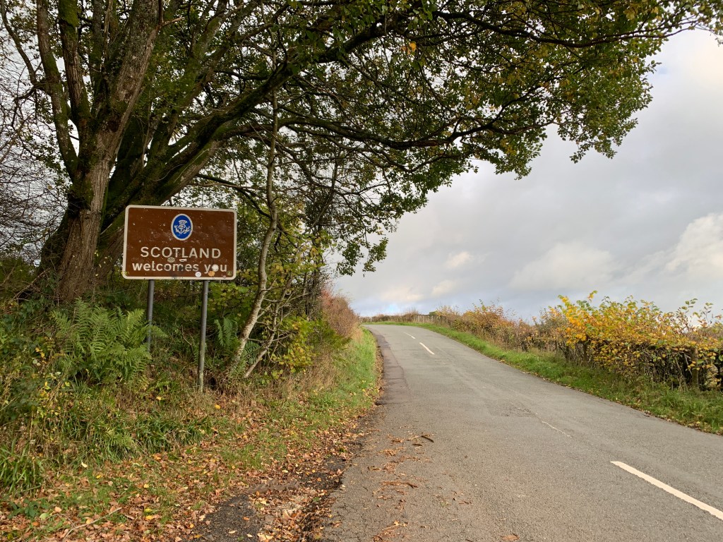
The Scottish Borders is a massively untapped place for me. Despite living in Scotland for the best part of 25 years, I have spent little time there bar a few trips to Innerleithen, primarily to visit No.1 Cafe (and friends, I suppose).
The Borders is a place rich in history. It was a contested and violent place, home to the Border Reivers and fought over by factions on either side of the border, making this place the ‘Debatable Lands’. Robert the Bruce’s family hail from here, with Annandale rich in his trial for the Scottish crown.
After a lot of umming and ahing, I settled on a 200km bikepacking route to explore this place that was just a short train journey away. I booked a £9 return from Oxenholme to Carlisle, leaving my laptop at midday and stepping out onto a chilly platform at 1pm.
The forecast was right: It was lovely. Steam billowed from the trains and my nose as I steeled myself for the trial that is getting out of Carlisle, reminded of this purgatory from my Journey for Wildness.
Once through the chaos of lanes, light, trucks and zero bike lanes, I had one last artificial challenge to overcome, which was a short section of the A7 to Longtown.
The first of many border crossings
In the daylight, it isn’t too bad, and given it was before any kind of rush hour I had little problems. As we shall see, though, that was not repeated on the return journey.
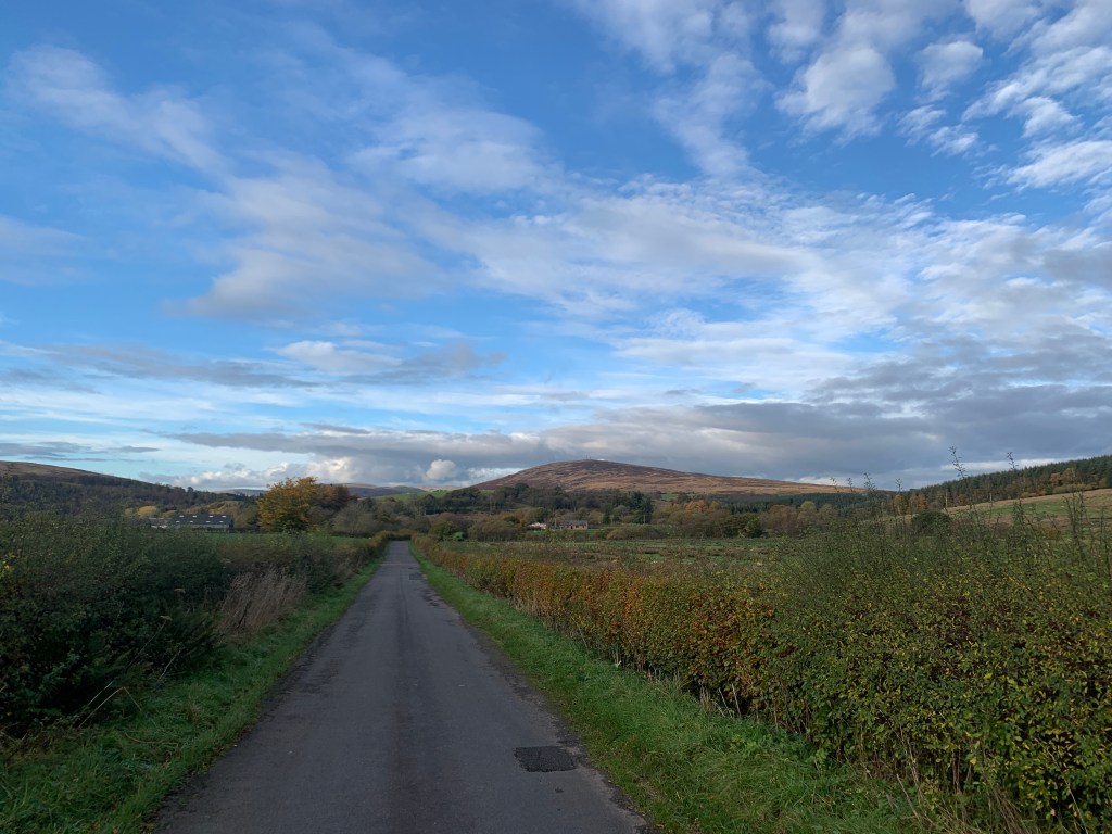
Once into Longtown, I turned off onto the back country lanes, leaving behind the high pylons and industrial skyline of Carlisle. It being early November, the air was clear and the sun low on the horizon, casting oranges across orange leaves.
My first checkpoint was Langholm, where I was to meet up with my colleague Kevin, who also spearheaded the campaign for the Langholm Community Buyout. Crossing the border for the first time of the trip, I followed the undulating roads to the textile town.
My first sign I was near Langholm was the tall monument and mast that sits on Whita Hill above the town. The moor itself is a brooding beast, its peated slopes dark compared with the other nearby bumps.
Whita Hill dead ahead
I had to be careful not to become too distracted, though. The lanes are narrow and often have tractors trundling down them. The autumn leaves, gorgeous in the trees, were a lethal obstacle on some of the tight bends, with a few butt-clenching moments as I zoomed round a bend with leaf litter scattered on the tarmac.
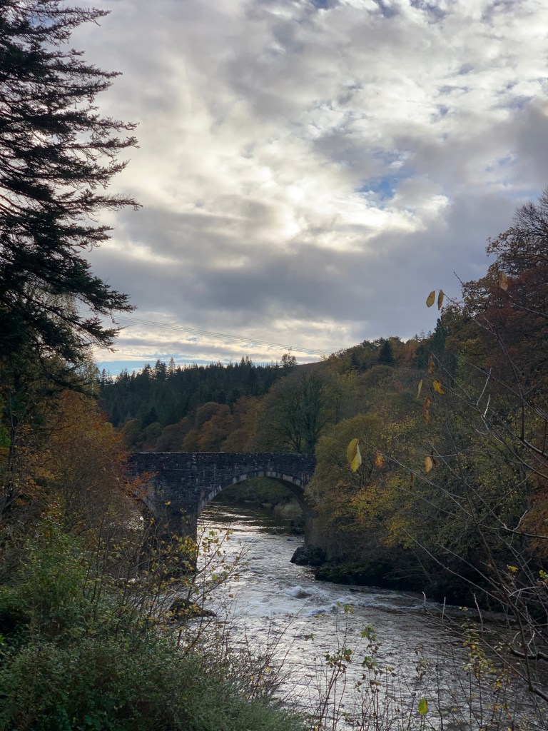
I passed the lovely arched bridge that spans the River Esk before the Muckle Toon, and set about locating the Langholm Initiative offices. Over a cup of tea, Kevin Cumming told me the story of this seemingly modest town.
You know Edinburgh Woollen Mill? That was once Langholm Woollen Mill. But the town’s textile lineage did not end there: several high-profile brands continue to make use of the town’s expertise in clothes-making.
Langholm is also the home of the Armstrongs and none other than Neil Armstrong of lunar fame was the first freeman and Burgess of the burgh. Poet and writer Hugh MacDiarmid is another son of the town, while Scottish engineer Thomas Telford hails from nearby Glendinning.
Kevin indicated to the map spread out on the large table, with a portion in red. This was the area the Langholm community had recently purchased from the Duke of Buccleuch. He produced a second map, showing the area the community wishes to purchase to extend the potential ecological restoration and economic boon for its people and nature.
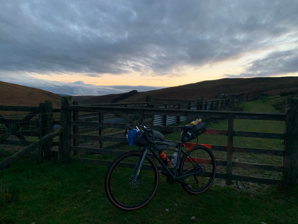
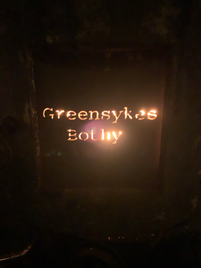
After a natter with the Langholm Initiative team and a brew, I hopped back on the bike in search of my accommodation for the night. The Greensykes Bothy has sadly gained a bit of a reputation locally for trouble. According to the Mountain Bothies Association website, police now visit the area to make sure the residents aren’t harassed by visiting hooligans.
As I followed the River Esk, I passed through the town of Bentpath before crossing a bridge to head up the glen to Jamestown and Glendinning. The sun had now lowered behind a forested hill behind me, and I made my way up a single-track road with sheep as my main company.
The road comes to an end at Glendinning. It is incredible that here, this tiny cluster of houses, was the birthplace of one of Scotland’s most influential engineers – maybe even Britain’s! I read the little notice dedicated to Thomas Telford, who designed roads across Scotland and who is well-known for his engineering of the transformational Caledonian Canal.
This is where most park their cars for the bothy. I can see how it must be a problem, with people’s homes right next to it. The road becomes a gravel-cum-grassy track, which steepens at points to climb higher above the glen. The sun was well and truly down now, as I made my way along with my bike lights showing the way.
For a while I was unsure I’d ever find the bothy. After a few miles, though, I spotted a slate roofed building by the river – home for the night!
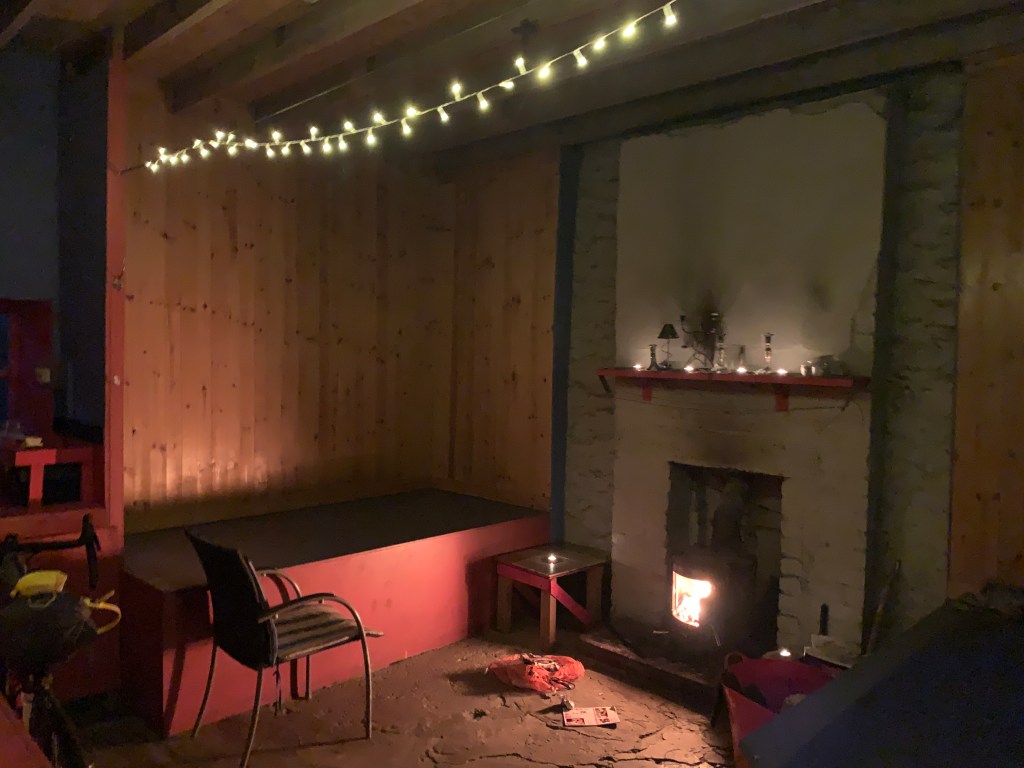
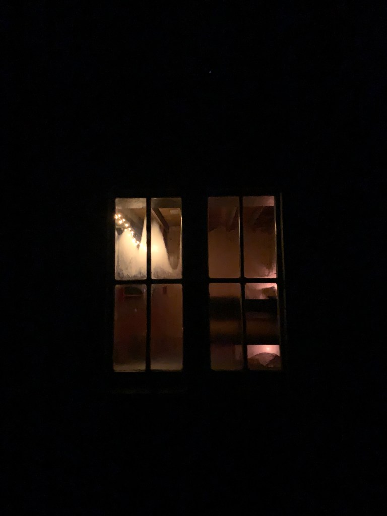
I had been worried about sleeping in a cold, dark bothy tonight, but, I needn’t have worried. As I entered, a warm air touched my face and, after looking around, I found some fairy lights strung above the main living room. It was incredibly well maintained, and I imagine pretty well insulated.
With food in my belly, a fire going and candles lit, I settled down to a full five hours of reading Andrew Painting’s Regeneration: The Rescue of a Wild Land.I had the bothy completely to myself, which seemed rare given the entries in the book.
I often say, if it wasn’t for the calls of nature in the middle of the night, I would never get to experience the stunning night sky in our wilder places. I left the bothy half awake and stared awestruck at the clear sky above. It was utterly baltic and utterly beautiful in equal measure. The whole sky was awash with stars. It was a real treat.
I slept like a log. Though I had only covered 60km in the first day, the whole business of getting there had left me exhausted. That, and reading for an entire evening does get you ready for a good sleep, I find.
Leaving the bothy at 7am, I set off on one of my longest days spent off-road. My aim was to reach the Roman and Reivers Route (RRR) that connects Eskdalemuir to Hawick. Once I reached that, I felt pretty sure it’d be a clear ride to Hawick.
I am not a fan of plantations. I think my childhood has left me scarred, with what feels like days of my life spent wandering around them half-lost most of the time. They do, however, contain possibly my favourite bird: the jay.
Jays are known as forest-makers, with the story going that they drop acorns and create the oak woodlands in which they are often found. The Woodland Trust calls them a “highly intelligent loudmouth” (people who know me can make their own conclusions as to why I have an affinity with jays) but their lightning blue colour makes up for their squawking jay-jay call.
After an hour or so riding on some superb gravel roads, I reach the RRR and turned to follow it. My hopes that it’d be dead simple from here faded almost instantly. The “superb gravel” gave way to a slightly muddy fire road, which became a quad bike trail, which became a quad bike trail with encroaching pine trees, which became a path, which finally become…nothing.
At the top of the grassy slog!
After persisting until the end, I got off and pushed through the grass and up to a clearing. Huffing and puffing after shoving a bike laden with kit up the hill, I made the last effort up to Craik Cross Hill, an old watch tower.
The weather was very lazy that morning. The sun wasn’t quite penetrating the clouds, but the clouds weren’t making much effort to conceal it. The gravel roads returned as soon as I started to descend, all the way down to the town of Craik itself.
The sun came out to greet me at Roberton
By now it was 9.30am and I had covered just over 30km, which wasn’t too bad considering the terrain. I was back on tarmac, skimming through the shallow glen to Roberton and then on to Hawick.
Home of the ‘Hawick Gill’ and the tradition of Common Riding, Hawick is another town with its roots in textiles, particularly cashmere from what I remembered. It was also the spot I decided to take a pitstop, pulling up at the Damascus Drum for a (huge) bowl of soup and a toastie.
It was a challenge to leave the warmth of that Middle Eastern-inspired cafe. Outside, the air was frigid, and I even wore my down jacket for the short cycle through the streets. Instantly, it was off again, though, for out of Hawick is a superbly steep hill that acts as purgatory for the unwitting cafe goer who stuffs their face at its foot.
Once I heaved my elevenses, bike and myself up the hill, I got a cracking view over Hawick, which sits in a basin, nestled among the hills, with the River Teviot passing through it.
The next checkpoint was the Kielder Forest, a place I’d heard much about but never visited. To get there, I cycled through the tiny village of Bonchester Bridge, and under some truly stunning trees. With all of its autumn leaves, I really felt like this part of the country was trying to rival Pitlochry and Dunkeld for its marvellous woods.
The rain came as I descended down through the Wauchope Forest on a fast, curving road into a clough on the B6357. I made a hairpin left, following a snaking road towards Kielder.
Whilst sat in the Damascus Drum, the waitress said, “Aw! I love Kielder Forest.” I have heard many say that, with it becoming a popular spot for runners and gravel cyclists. Not that I wish to pass judgement on such a fleeting visit, but I was left a little unsure as to its high praise.
For all its massive sign saying ‘Welcome to Kielder Village’, all I had to do was blink and the village was gone. In just under a minute I had breezed through the eerily quiet, forgotten-looking place. Despite it displaying the fuel prices, the petrol station looked oddly abandoned, too.
As I continued on along roads that felt akin to those found in great Canadian forests, I saw hardly anyone or anything. I felt slightly uncomfortable on the wide road, lined with ominous, gloomy pines. Perhaps the place livens up a bit towards the other end of the forest?
Back across the border
I confess, I think my dim view on Kielder is partly down to: 1) A disappointment at the lack of cafes in the area and a sudden desire for a cheese sandwich; 2) What happened next.
I turned off the road onto NCN route 10, which runs through the forest before playing hopscotch along the Scotland-England border. I noticed a couple of signs with small writing on them at the side of the path, but continued on. I was hungry, stopping once or twice to scoff the other two-thirds of my malt loaf.
After following the trail alongside the Lewis Burn for 5km, I came to a junction with a large arrow indicating ‘DIVERSION’. Wonderful – my nightmares of plantations had been realised. A sign in small lettering explained the path ahead was shut Monday to Friday for forestry work.
It handily showed a little OS map, with a short description of the diversion: “Follow the Bloody Bush trail until it turns right to the descent track. Go left and continue around…”
‘Fine’, I thought. ‘I will give you the benefit of the doubt and follow your instructions.’
After over an hour of seemingly never-ending plantation, drizzly rain, dead-ends, downhill mountain bike tracks and zero diversion signage, I gave up on Forestry England’s lacklustre attempt to divert me around the works and returned to the junction. I ploughed through the ‘No Entry’ signage along a mud-choked track, passing stacks of timber and very little in the way of personnel or vehicles.
After 2km of thick, tyre-sucking mud, I was through the works and back on the trail. I felt I had given the diversion my best shot, but given the one diversion sign was the only one to be found, and that every road I followed ended up going nowhere, I felt vindicated in my decision and had no issues.
Post-diversion: That was fun!?
I enjoyed a thrilling singletrack trail down to the Kershope Burn to begin my border-hopping trail to Kershope Bridge. This section was great – slightly downhill on excellent gravel, with occasional broadleaf woodland breaking up the regiments of Sitka spruce trees.
I’d lost a chunk of time and energy roaming around Kielder Forest, so my plans for an extended ride back to Carlisle didn’t seem so appealing. Once I reached Kershope Bridge, I amended my route to return to the roads I had followed the previous day. The sun was back out, but was only just making the effort to cast soft light across the fields.
The quiet lanes and expansive views were mesmerising in the fading daylight. I caught myself gazing sometimes at the extending shadows of the trees that bordered the fields, as the landscape turned bronze.
I had made one other error in planning: I didn’t bring a spare light. Soon, dark was rapidly coming and I had a nasty stretch along the A7 still to go with a dying bike light. I ended up in Longtown at nigh-on 5pm, taking a few minutes to jump into the Spar for that much-needed cheese sandwich and packet of crisps.
I braced myself for the next section. I put on my leg warmers with their reflective POC writing on them and psyched myself up for a tempo effort along the road. After 5km of barreling along in semi-darkness, I managed to hop back off onto the quieter lanes for a break, before returning to the fray just 10 minutes later.
At least there was a pavement this time, so the sketchy situation was made a little less dangerous!
As luck would have it, Carlisle was quiet, awaiting the oncoming of commuters from the M6. My train was not until 7pm, so I had around 90 minutes to relax and – importantly – eat!
As I rounded the bend before the train station, a Nando’s appeared. I find it amusing that, when out for longer endeavours, the brain’s inhibitions seem thrown out the window. Instantly, without hesitation, I set the bike against the railing, grabbed a table, and ordered a chicken burger with fries and a bottomless fro-yo cup. No questions asked.
Since my Journey for Wildness, my conception of distance has altered. Then, I had spent seven days riding usually over 100km each day. As I sat looking at my trace from the day, I had clocked nearly 100 miles, but that didn’t seem as absurd to me as it would have pre-J4W.
With a belly full of food, I hopped on the bike to wheel it the 50m or so into the station. Pulling on all my layers, preparing to sit on the chilly platform for half an hour, I pulled out the Kindle and started reading Regeneration.
Tomorrow, I would be back to the office, but I had managed to capture a full 36 hours to myself, cycled over 200km, slept in a bothy, enjoyed nature and discovered a new place. That’s not bad for 36 hours.
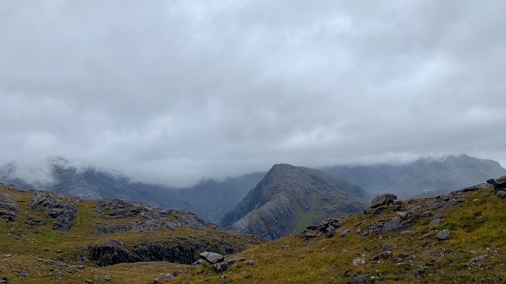
I sat in my car as the percussion band of rain drummed against the windows.
Flakes of pain au chocolat were scattered on my lap – the evidence of a feeble attempt to rally morale ahead of an inevitably dreary run on the Isle of Skye.
Through the blobs of rain on the windscreen, I could spy the aptly named ‘Misty Isle’ ahead of me, its peaks – true to form – wrapping themselves in a cloak of dark mist. It looked like an impenetrable fortress, which could surely be sieged with the help of another half a pastry and a banana. Right?
Drawing into the long layby at Kilmarie, along the long lonely road to Elgol, the rain had relented to a soft mizzle. ‘This isn’t so bad’, I said to myself, as I weighed up whether I’d need a jacket to start. I kept it in my bag, along with my waterproof trousers and a mountain of food.
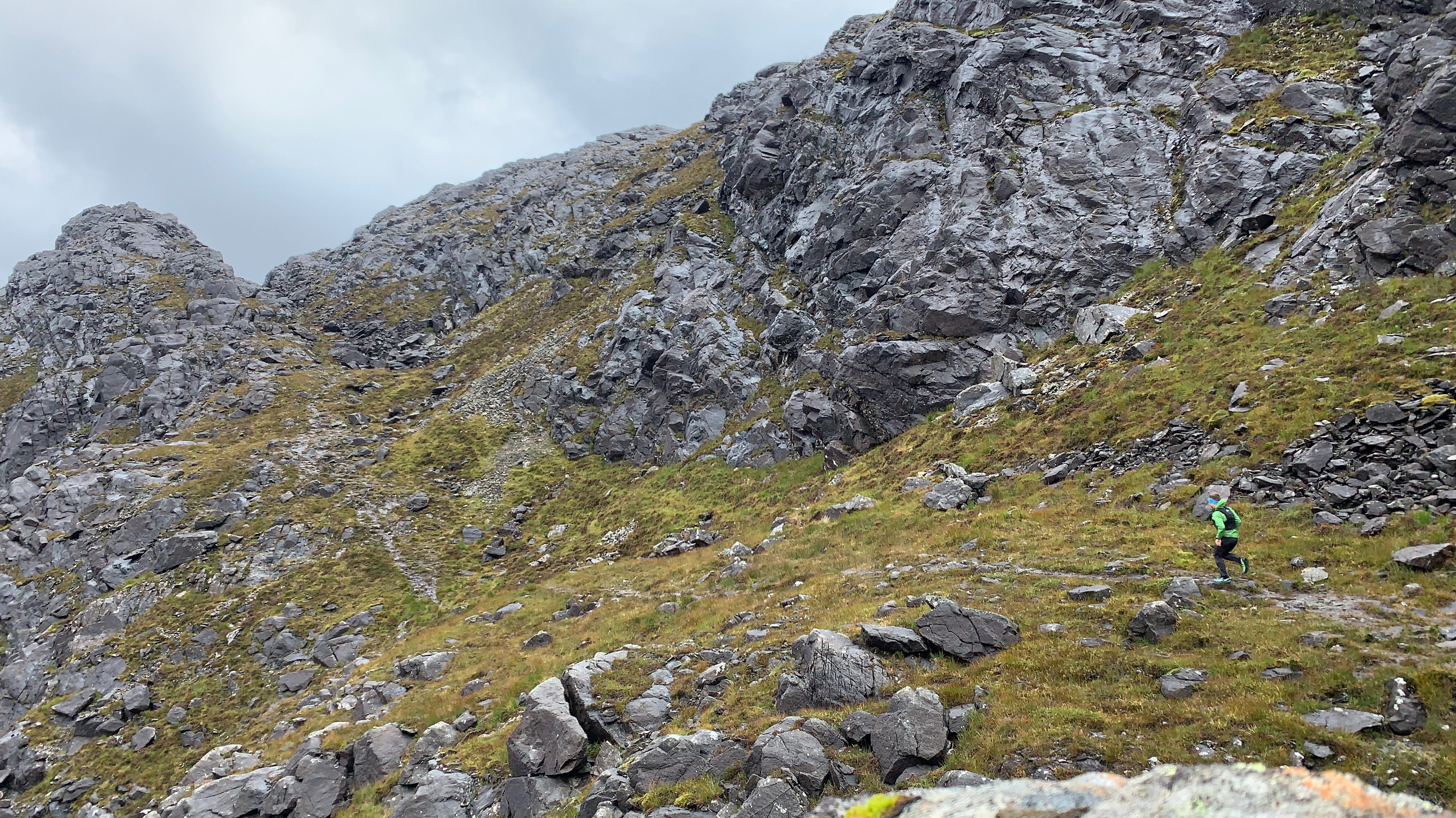
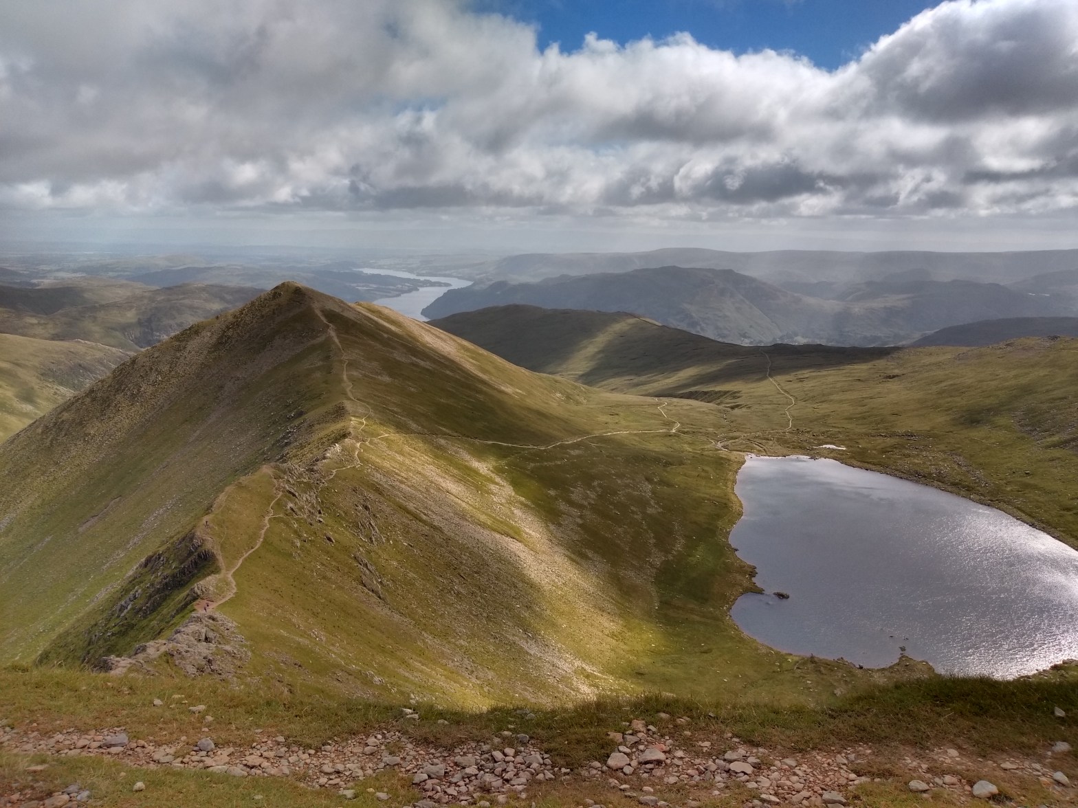
My objective was to climb Sgùrr na Stri, a diminutive peak that doesn’t even break above 500m, and stands above Camasunary Bay. For a few years I had found myself sat aghast at images from its summit of Loch Coruisk and the fanged Black Cuillin range. My hopes of such a view seemed pathetically small today, but I figured I would give it a shot.
As I trotted up the long vehicle track that slowly rises above Kilmarie, I got increasingly good views of island’s dragging finger of Slèite.
Despite being in the unique opportunity to be enjoying this landscape almost completely alone, something inside of me felt glum: I went over my potential shortcut opportunities, and constantly peered at the sky, willing it to give me a reason to turn around.
The path flattened after a couple kilometres before it descended. That was when I got my first glimpse of Camasunary Bay. Camasunary – or Camas Fhionnairigh – means ‘Bay of the White Shieling’. Many years ago, a small township resided here. It is fascinating how today we think in roads, tracks and paths, whereas these people would have relied mostly on the sea to connect them to the outside world.
Standing guardian above Camasunary, its conical figure firmly in the clouds, was Sgùrr na Stri. How far did it really ascend beyond those clouds? It was hard to tell.
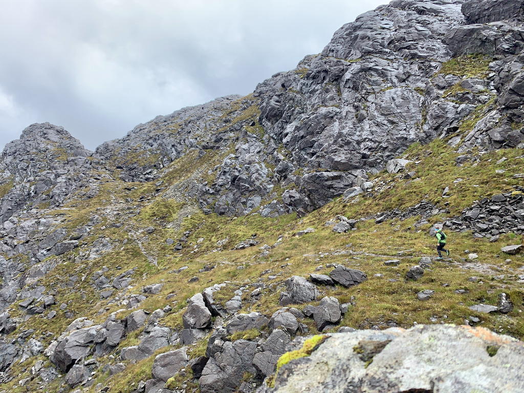
I dropped down on the zigzag track, overtaking a young woman near the bottom, Lauren, who was on day three of her hike along the Skye Trail. Soon after, I spotted two other backpack-laden figures, who must be sharing in her endeavour.
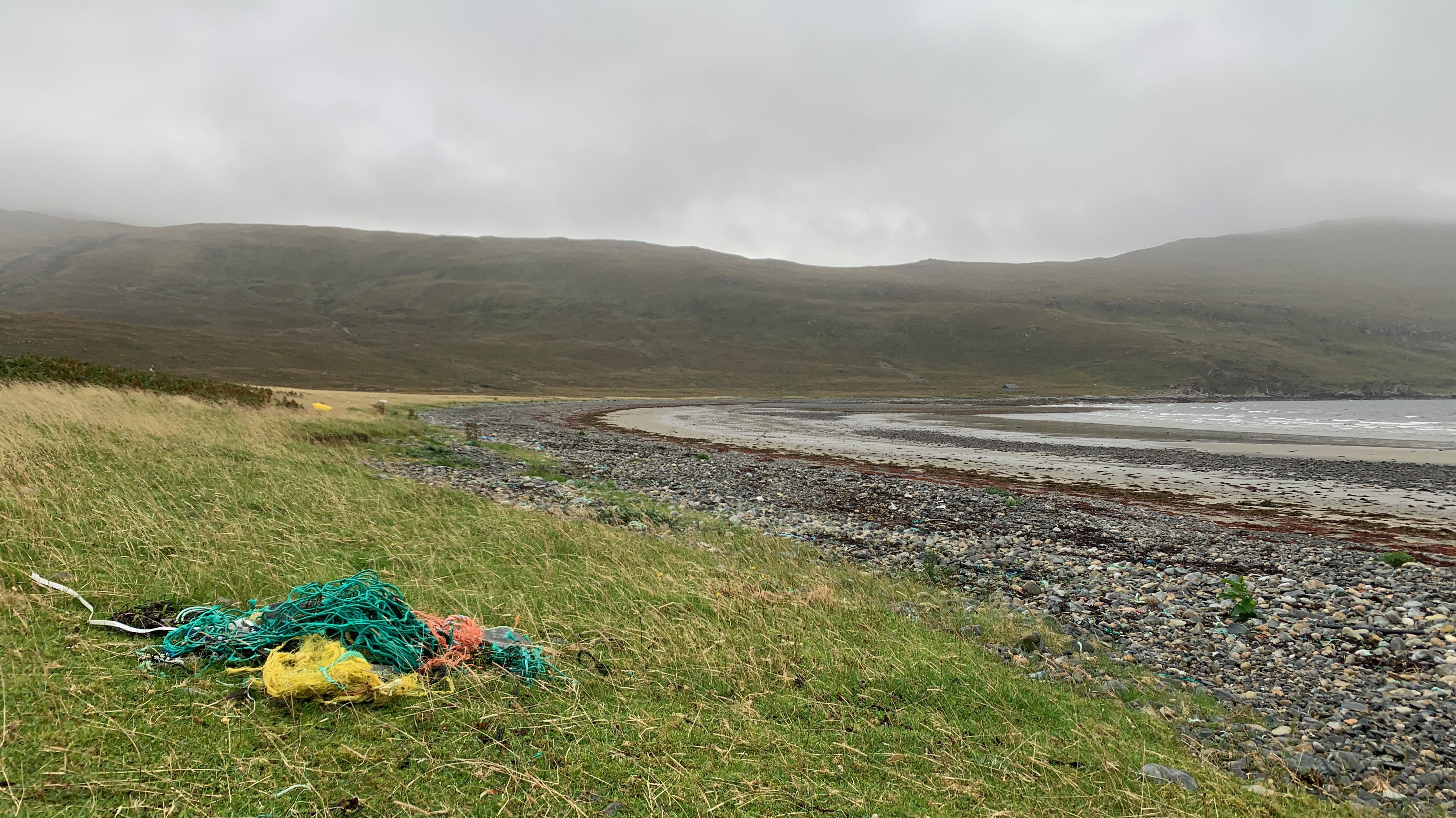
Pulling my gaze away from the mist-clad mountain, I looked at my feet. I had always known beach cleans were a regular activity at Camasunary, but I had never quite appreciated the scale of the problem. Currents and wind draw a profusion of marine litter to this seemingly wild corner of the world.
Much of it is industrial waste – ropes, metals, boxes and all manner of plastic detritus – and it is strewn across the bay and seeps inland up the rivers. In a corner of the beach, stacks of litter had been gathered by volunteers attempting to push back the never-ending tide sullying their beach.
I reached the Abhainn Camas Fhionnairigh, where I surrendered to the inevitability of wet feet and ploughed through the river, which wasn’t so high as to prove a problem. Following the track up-river past millions of scraps of litter, I began to curve uphill.
The rain was gathering strength, however. As I climbed, the world around me became increasingly obscured. The maw of the corrie ahead snarled at me through a thick curtain of clag and rain, while the wind pushed me into its jaws.
I found a large rock and tucked behind it. I took a moment to gather myself, and considered my situation: I knew where I was; I had a map; I’d brought extra layers and food in case of an emergency; I wasn’t hungry (thanks Co-Op) or too cold; and I had the years of experience to know what to do if things got worse.
All of a sudden, I had an adventure on my hands. Meanwhile, the wind had blown the black dog that had been on my back clean off. Taking the moment into my grasp and making independent decisions had given me a confidence in my ability and a clarity of mind I had not found in a long time.
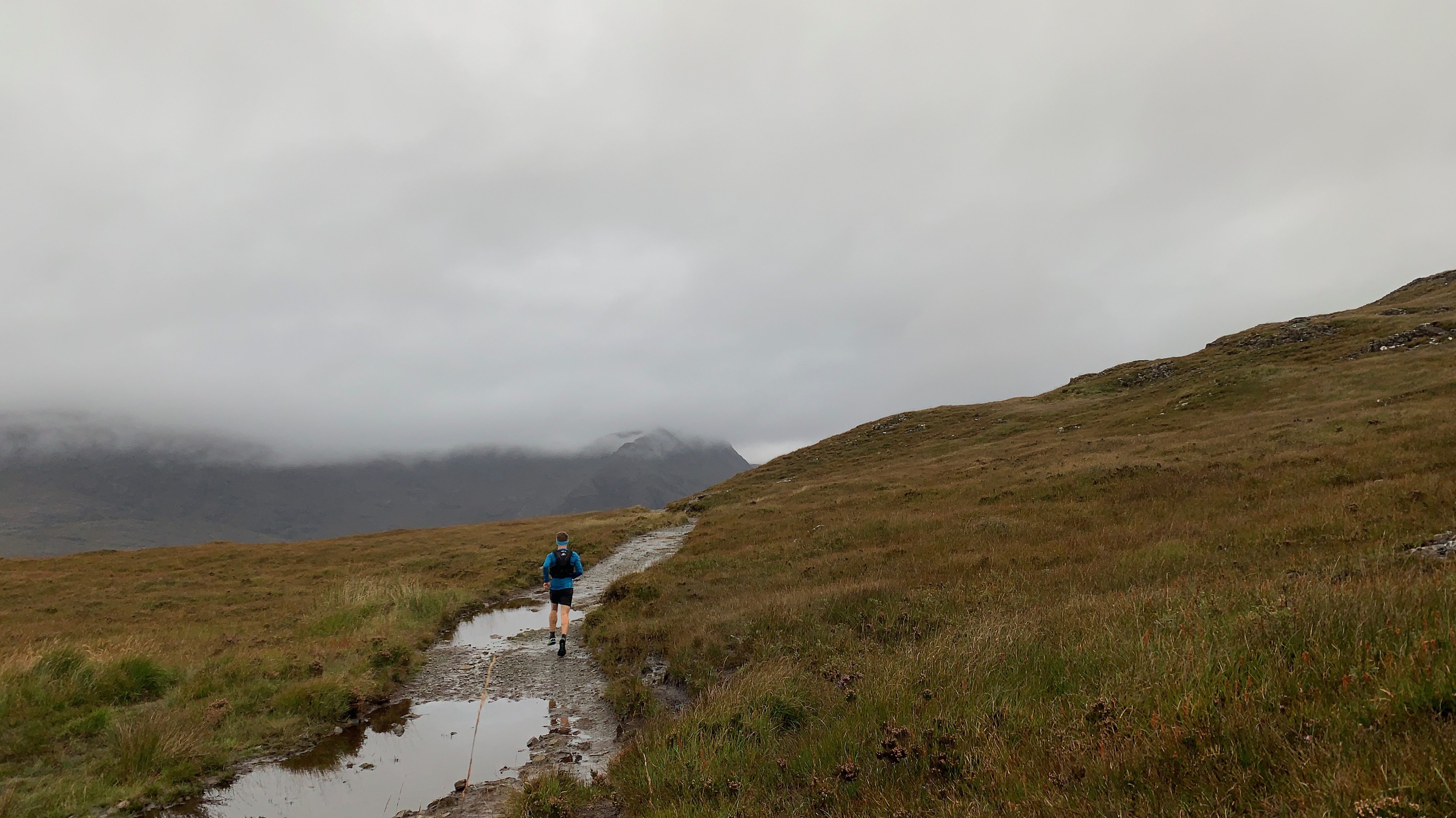
I donned my jacket and waterproofs and continued on, smiling like a fool as the rain washed over me and I watched several deer disappear into the veil that had consumed the rest of the world. The path struck directly uphill, following a burn.
As I continued to climb, so too did the weather improve. Looking to my left, I could see the prominent knoll that lies near the summit steadily clearing. The world around me began to come back into focus.
My heart was racing. Surely, there wasn’t a chance I would get a clear summit, was there?!
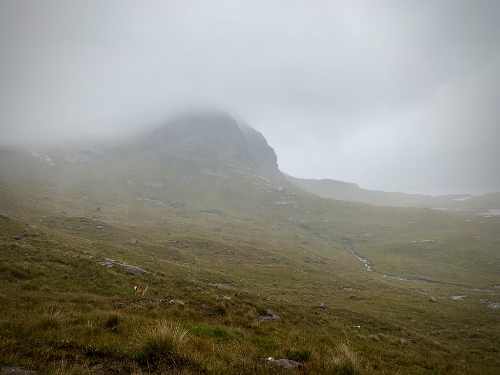
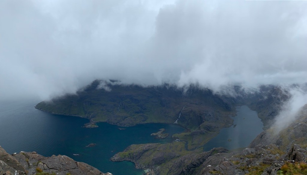
The path levelled off and I stumbled across the main path to the summit. Two people were below me in a seemingly futile struggle against the ground as their boots slipped and slid on the sodden turf. I turned to continue uphill, marvelling at the glistening grey rock of the mountain. Blà Bheinn – once shrouded in mist – was also emerging from its hiding, while the tops of Ruadh Stac and Marsco were already clear to see.
I made the final effort to the summit, and simultaneously entered into a great battle of nature: Cloud was hurling itself at the summit but was being fired upwards against the mountain’s slopes. I sat there for a time, watching this push and shove as the loch below me danced in and out of sight.
Then, after a few minutes of watching the sea of cloud washing over the summit, it stopped. Without the cloud, the strong wind became invisible and revealed the view I had hoped for.
Sgùrr na Stri is the best guarded mountain I have ever come across. As I looked out across the Cuillin Hills (as much as I could see of them), I laughed at the idea of Sgùrr na Stri being a baby dragon surrounded by its formidable family, so imposing do its neighbouring peaks look. I must have spent a good 20 minutes wandering around on the summit, looking down to the steel-blue loch below and around to those incredible hills.
The geological jungle was once part of a series of magma chambers, with the Black Cuillin formed of gabbro and basalt, while the Red Cuillin’s colour is thanks to its granite.
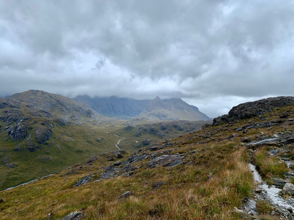
Reluctantly, I left my island in the clouds, descending on the water-slide descent that would take me to Glen Sligachan. There is a fantastic path down into the glen, which took me to my turnaround point. As I turned to head back to Camasunary, I came across a couple eating sandwiches next to a bloated river.
Sean and Christina were also on day three of their Skye Trail, and had seen me on my way through Camasunary. Despite us all looking like drowned rats, all three of us were so content with our lot that it didn’t seem to matter!
I bid them good luck and continue on to enter the fray of yet another front of torrential rain.
Back at the van, I peeled off layers that had suctioned themselves together. With the A/C wheezing in its attempt to expel the humidity I had just brought in, I drove the van along the road back to Broadford, where a bowl of soup and a coffee awaited my arrival.
This route, along with many more, will be published in my upcoming book Running Adventures in Scotland, published by Vertebrate Publishing in May 2022.
A few weeks ago, top-of-his-game ultra-cum-fell runner Kim Collison slid into my Instagram DMs: “Afternoon Ross. I’m planning a crack at the 24 hour Munro’s record. 😬 It’s a beast of a route. Don’t happen to be free 3/4th July if weather is kind?”
For the past few years, Kim has slowly been gaining prominence in the fell running community as a guy who, when he puts his mind to it, can conquer pretty much anything – somehow with a unshakeable grin on his face, hence the name “Smiley Assassin”.
The winter Bob Graham record, the Paddy Buckley record, the Lakeland 24hr record – the man loves running in really big, lumpy circles these days, having developed a name for himself in the ultra trail running scene representing GB.
A week or so later, Ally Beavan (pint-puller, Broken-writer and dot-watcher extraordinaire) and myself were jogging around the Cairngorms, surveying the route Kim was to take on 3 July, discussing other potential add-ons and Kim’s chances of getting the record.
You can read the full account of this wild adventure at Fast Running.
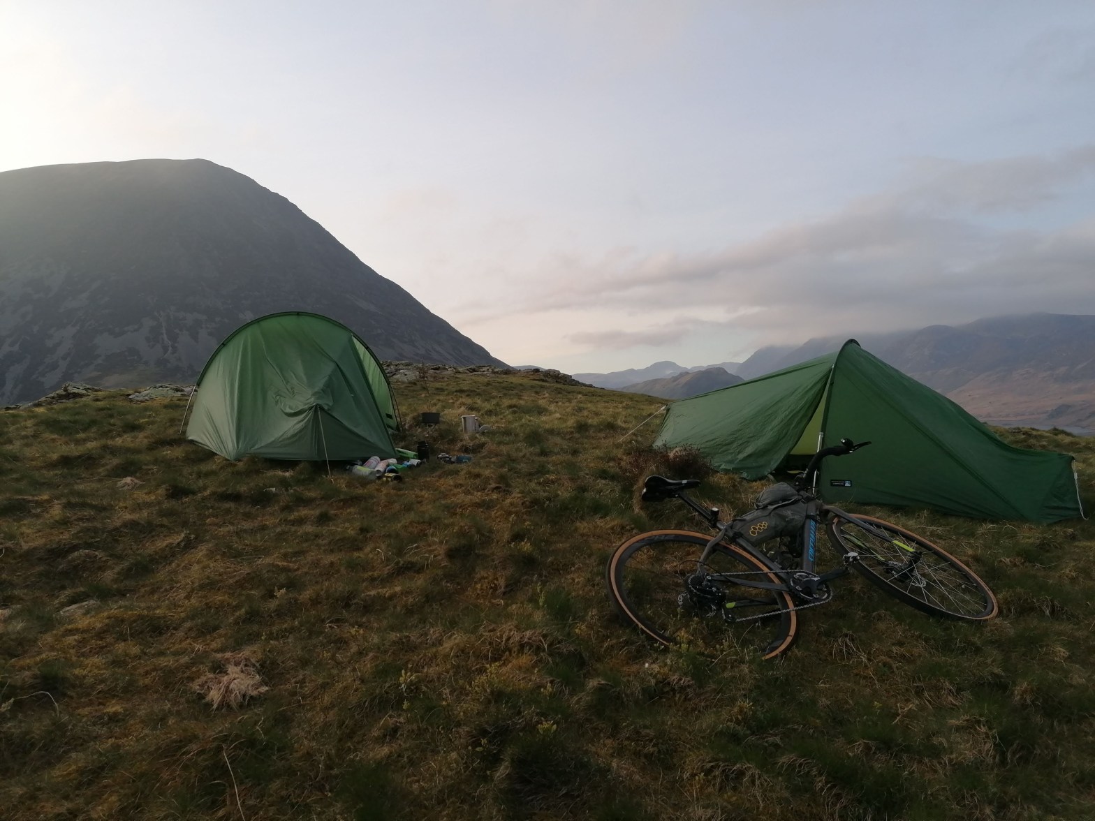
It was 5am, and I was curled in a ball at the bottom of my tent as the first cuckoo of the year called like a natural alarm clock.
We’d pitched the tents on top of a small hill nestled in a quiet corner of the western Lake District. In retrospect, it was much more sloped than it looked at 8pm after riding 200km when you don’t really care where you are pitching a tent.
Yellowish light was glowing around my down-filled cocoon as the first light seeped through the walls of the tent. I attempted to drag myself back to the top of the tent, fighting the pull of gravity, the slipperiness of my sleeping bag against the roll mat, and my tired legs.
After 45 minutes of staring into space and listening to the world waking up, I unzipped the tent and squeezed myself through the door. Hamstrings pinged and my back creaked as I brought myself into a standing position.
Immediately, that didn’t matter anymore: Grey dawn light creeped through a sleepy valley, Crummock Water dark and moody. In the distance, the great domed head of Great Gable stood out against a Turner painting sky.
Lewis emerged after a short while and we knocked together a brew and ate some breakfast, watching as the beam of sunlight continued to grow behind Grasmoor.
Soon, it was warming our backs and drying the dew from our tents and my bike. Holding a cup of coffee, Lewis said: “I need to do this more often.”
In planning my epic Pedal for Wildness adventure in support of the John Muir Trust, I had pencilled a practice weekend away to test my bike setup and, crucially, see how my legs felt with two big days (at least) back-to-back.
During my training rides, I often passed a little blue cycle network sign that read ‘L&D Loop’. It took me a little while to look into it but, when I did, I knew it was exactly what I needed to do ahead of my trip.
Circumnavigating the Lake District (and some), the 300km route links together a large number of old, quiet farm roads (read: steep, narrow, twisting and rough), climbing (according to Komoot at least) around 4400m of ascent.
At first, I was considering doing three 100km days but, realising this would mean only six or seven hours of riding at a time of year with 14 hours of daylight, I cut that down to two.
I had been thinking of camping at the 100-mile mark but was convinced to push on to Loweswater after my mate Lewis insisted Scale Hill would make an excellent camp and that he’d join me there.
Ballocks. That means a 200km first day. Well, I guess it’s better to know how I get on with that now than wait until 8 May!
Despite a host of bike mechanical problems in the weeks leading up to it, the conditions for the ride could not have been more spectacular: No rain, a slight breeze and warm-but-not-scorching temperatures would make for an all-round pleasant experience (though, maybe not a realistic test ahead of an eight-day trip through Scotland!).
Saturday morning was a grey and still day. I had budgeted for around 12 hours of riding, estimating an average speed of around 19kph and accounting for a couple of stops. Thus, I didn’t need to rush out the door, with sunset not being until just after 8pm (and, even then, it was still light until around 10pm).
I packed as though I was heading off on my big trip, only leaving out a couple of extra bike maintenance pieces like chain links and chain lube. I didn’t weight it before heading off, but the bike probably weighed around 16kg.
And so, after a customary amount of faffing, I set of 20 minutes late on my little adventure, heading south to join the official route just outside of Sedgwick.
Naturally, the night before I had watched a new bikepacking film from GCN+, featuring a set of interviews from the likes of Mark Beaumont and Jenny Graham. Mark said something that really chimed with me: You start to see the road like a rollercoaster. It’s about being a smooth and efficient cyclist.
Having earned myself the enviable title of Ross Bonkagain during my university cycling days, I figured I’d take a leaf out of his book for this one. Though, on previous trips like this, I hadn’t really had issues with bonking, as if my body knew that today wasn’t for playing games like that on me!
The route immediately started surprising me. I almost missed a few of the waymarkers as they pointed up lanes I had barely noticed before. As I left the South Lakes behind, I trundled up a gravelly lane at the foot of Farleton Fell, crossing over a gorgeous bridge smattered with purple and blue flowers.
I looked east after Hutton Roof and saw the Yorkshire Dales bulging on the horizon, yellow in the emerging sunshine. It wasn’t long before I was at the foot of them, climbing steeeeeeply out of Kirkby Lonsdale and into the stunning valley of Barbondale.
Part of my Pedal for Wildness is exploring the best and less-good wild places of Scotland (and the very north of England). Barbondale is a dramatic valley, with sweeping slopes either side of the road in a classic V shape. Yet, I could see in the crags remnants of a forgotten woodland, as small trees and flora clung on in areas inaccessible for grazing mouths.
As I dropped into Dentdale, I thought how the ‘shifting baseline’ syndrome we often talk about is so true. To the untrained eye, the trees in the crags and the solitary ones standing old and cracked on the hillside look very out of place and almost accidental. The connection isn’t made that the reason they stand alone is that saplings are quickly cobbled by livestock and deer, leaving the land bare.
Dent to Sedbergh is an exhausting affair. Instead of the quick road, the route follows the oft-submerged tracks along the river, which takes twice as long. After several gravel roads and a few gates, I emerged into Sedbergh and met my friend Rich and his partner Steph, who would join me for a while.
We followed the M6 northwards, now in classic farming country with rollercoaster roads and confused/lost-looking drivers. Rich told me of his wild vision of encasing this stretch of the M6 in a tunnel and rewilding the top of it to create a wildlife corridor from the Howgills to “the other Borrowdale”.
It may sound mad, but it’s thinking like that which scares people, and we need more ideas like those to tackle the biodiversity and climate crises.
It wasn’t until we were just outside Orton that I checked my watch for my distance: 70km down! This was great! We stopped in Orton for a cuppa and grabbed a sandwich from the Post Office. I really need to bring more savoury stuff with me on these rides…
Freshly fuelled, we rolled out of Orton and out towards Tarn Moor and Little Ashby Fell. Here was the sign we were now heading to the Pennines – a great big plateau rose in front of us, with a single-track road winding its way up to the top.
Once at the summit (around 320m) we could see the Pennines ahead and looked back to the Howgills to the south through a shimmering haze of heat. Rich and Steph turned that way, heading back to Sedbergh as I continued towards Appleby-in-Westmorland.
The roads changed from small and winding to wide and rolling, with fast descents and long straights. It meant the stretch to Penrith went by quickly and I ticked by 100km without much fuss (bar trying to send a voice message to my girlfriend just as a big hill appeared and I couldn’t change gear!).
It’s easy to get confused in Penrith; this is the ‘official’ start of the route, but there were no obvious signs guiding me out of the town. Eventually, I found it, and ended up on a ridiculously rough track out of town and back into the countryside.
I knew I had to go around the back of the Skiddaw massif but boy! It looked miiiiiiles away! Weirdly, as I found out as the ride went on, nothing is really as far as it seems and, before I knew it, I was at Mungrisdale.
While the car park at Mungrisdale was busy, the back of Skiddaw was quiet…except for the sky. Above me, around 10 paragliders peppered the sky with bright coloured parachutes, drifting above a winding road and a group of wild ponies. There were a few vans at the side of the road, occupants sat with their feet hanging out the doors, watching the paragliders and enjoying the afternoon sunshine.
Since Sedbergh, I’d been a little behind schedule but I was now ahead of it, trundling through Caldbeck and onto the amazing Roman road over Aughertree Fell.
By now, it was the furthest I had ridden on a bike. I was past 100 miles (160km) and feeling a little woozy on my way past Over Water, more from the constant sun than anything fuel related.
As I passed Binsey, though, I heard one of my favourite sounds: The unmistakable call of lapwings. I love lapwings. Their call is almost unearthly, sounding more like a Pokémon than a bird. They were making their courtship dance, swooping and diving in the fields. It was a wonderful sight.
I made it to Cockermouth after over 10 hours of cycling. I was dying for some proper food so made a detour to the Sainsbury’s for a pot of pasta – a pot of pasta that didn’t even come with a fork, so I resorted to downing it like a smoothie.
Disaster struck soon after. As I ate a cinnamon swirl, the centre part – the best part – dropped to the ground as I stood next to the bin. Though I am an advocate of the 10-second rule, I feel the area around a dustbin is a 10-nanosecond rule.
It was time for the final ride down into Loweswater on another road that, on the map, looked straightforward, but in reality took ages to get down.
It was just after 7pm when I arrived, so sooner than expected and delighted at having done my first 200km+ ride. I waited for a short while for Lewis to appear. Once he did, I put on my down jacket and began pushing the bike uphill, carrying it over roots and onto the open fell.
We sat up for a while, me devouring the flapjack and crisps Lewis’s mum had provided, drank a couple beers and settled down to sleep under a clear sky and a shining white moon.
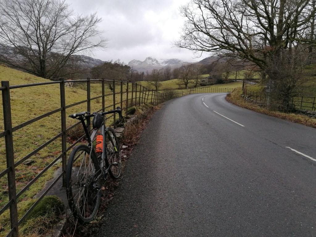
Never tell yourself it’s ‘just a short ride home’. Albeit day two was half the length of day one, I hadn’t taken full stock of just how lumpy and winding the roads would be. After much dawdling before leaving camp, I left Lewis to continue on to Ennerdale Bridge and follow the coast south.
I felt great – energetic, even. The 200km of the previous day were present but not enough to cause me too much bother. The climbs were steady to start, with a big ramp out from Ennerdale Bridge to Calder Bridge.
It had turned into another gloriously sunny day but with an easterly wind blowing in my face to make things cooler and (lucky me) more challenging! In my head I was waiting to go over Ulpha Fell but, as I turned the corner out of Eskdale Green, I saw a sign that read ‘Birker Fell’.
‘Huh?’ I thought. I looked at my watch. ‘There isn’t a climb on the route profile’.
There was; it was just so steep that my condensed route profile couldn’t show it. ‘It’s fine’, I said. ‘Just get over this bit. It doesn’t seem to be long’.
Oh, how wrong I was! The first 400m steep section is just a little warm-up before the 4km-long slog to the high point of 260m above sea level. As I ascended, the landscape opened on my left to reveal a vast emptiness until the fanged summits of Sca Fell and its neighbours met the sky.
Mercifully, a large banner appeared ahead: The Crosby Snack Shed and Cake Cupboard… 1/2 mile ahead. The banner was adorned with images if cakes and sandwiches. My goodness did I pedal for that 1/2 mile!
Full of a bacon roll and coffee, I made the leisurely descent into the Duddon Valley. Soon, my heart sank again as I saw a road snaking up the other side of the valley, knowing it was highly likely that was where I was going.
Sure enough, the brute that is the Kiln Bank Cross road (averaging 9.7%) was on my path. I confess to getting off to push!
I started to lose track of the miles. I knew I was getting somewhat close to Newby Bridge, but I just never seemed to get there. The roads snaked up and down and round and over and through gates and on rough roads and it never seemed to end.
It became almost hypnotic. My legs felt fine, but the sun and the undulating ground was starting to make me seasick. I just kept chomping on food, knowing that was my best way out of here.
After what felt like eternity, I was back on roads I knew, riding through Spark Bridge and finally into Newby Bridge. From there, I just had a couple short climbs until I was at the coast. Then I would have ice-cream. Yes, ice-cream!!!
I sat on the ground next to the ice-cream hatch in Grange-over-Sands, happily devouring a salted caramel cone and watching the tourists glancing at this odd-looking cyclist on the ground. As the saying goes: If you don’t need to stand, sit; if you don’t need to sit, lie down; if you don’t need to lie down, go to sleep.
I followed the sand flats for a time before turning inland and following flat roads to Levens. The climb out of Levens is always nasty, particularly with a laden bike and leadened legs.
It wasn’t long, though, before I was back on the short road back into Kendal from Natland, turning into my street with 330km and over 5000m ascent in my legs.
If you’re a beginner bikepacker looking for a first foray into this funny world, the Lakes and Dales Loop is a phenomenal route. I’d recommend at least 32mm tyres, though, as a number of the sections are rough. While it’s all on tarmac, Lake District tarmac is loosely defined. Literally.
The route was an excellent warm-up ahead of my Pedal for Wildness in two weeks. If you’d like to support me, you can find my JustGiving page here and can read more about it here and here.
Now, just to rest, eat and stay upright before 8 May!
It seems, at last, like there is a glimmer of hope on the horizon. The recent announcement from the Scottish government indicates that the 26 April will be the day people can move freely around the Scottish mainland.
Finally, I can tell you about a mad idea I have had with some assurance that it will actually happen in the next couple of months.
I had been planning to run the Bob Graham Round this May. However, with injury hamstringing any running I had planned for the early part of the year, I returned to the bike.
As you may have read in my previous blog, it has been a joy to get back on two wheels. I am very fortunate to turn the pedals from my front door and immediately have access to the Lake District National Park.
As a cyclist, the lockdown has been a literal breath of fresh air. With so few cars on the road, forays over Kirkstone Pass and Dunmail Raise have been nothing short of…not terrifying.
I would never consider going over Dunmail in normal times, but the quiet roads and (occasional) sunshine have opened up the roads of the Lake District like never before.
I have loved cycling since my undergraduate, spinning frantically behind my University of Stirling Cycling club friends as we formed a chaingang on the way home from an epic day in the Trossachs.
After succumbing to the notion I might not be able to do the Bob Graham for a little while, I wondered what I could invest my time in. What would get me out the door when it was wet and windy?
In 2020, I was part of the team at the John Muir Trust looking to get their Journey for Wildness off the ground. Unfortunately, as we all know, that couldn’t happen.
You’d think getting half-frozen in a bivvy bag in a bush just off the West Highland Way might have made my relationship with bikepacking a little…frosty. Yet it seems that, with time, such memories thaw, and a warm fuzzy feeling takes over and the imagination runs with it. And it wasn’t really that bad.
The plan
So, that is what I will be doing! I will be riding a rather satisfying 1001km (according to Komoot) from Kendal and visit each of the Trust’s properties in support of Journey for Wildness.
They are: Glenridding Common (Helvellyn), Glenlude (a small woodland in the Scottish Borders), Schiehallion, Ben Nevis, Li and Coire Dhorrcail (Knoydart), Skye, Quinag and Sandwood Bay.
I am not taking the fastest lines. Instead, I am taking the scenic roads and gravel tracks. I will be mostly bivvying out, occasionally sleeping in friends’ gardens if only to catch up with them (and maybe make use of their shower!).
If you are around and want to join me, it’d be great to have the company.
The why
In doing so, I am wanting to highlight the value of our wild places. Though I am going to be in the saddle for over eight hours every day, I am hoping to do some filming and photography of my trip, showing the good, the bad and the ugly of some of our ‘wilder’ palces.
While I am creaking over the handlebars, you can support me by supporting the Trust’s work. My donation page is now LIVE. You can go there and begin supporting me. For your entertainment, I have linked my Strava to it, so you can see what I am up to in training.
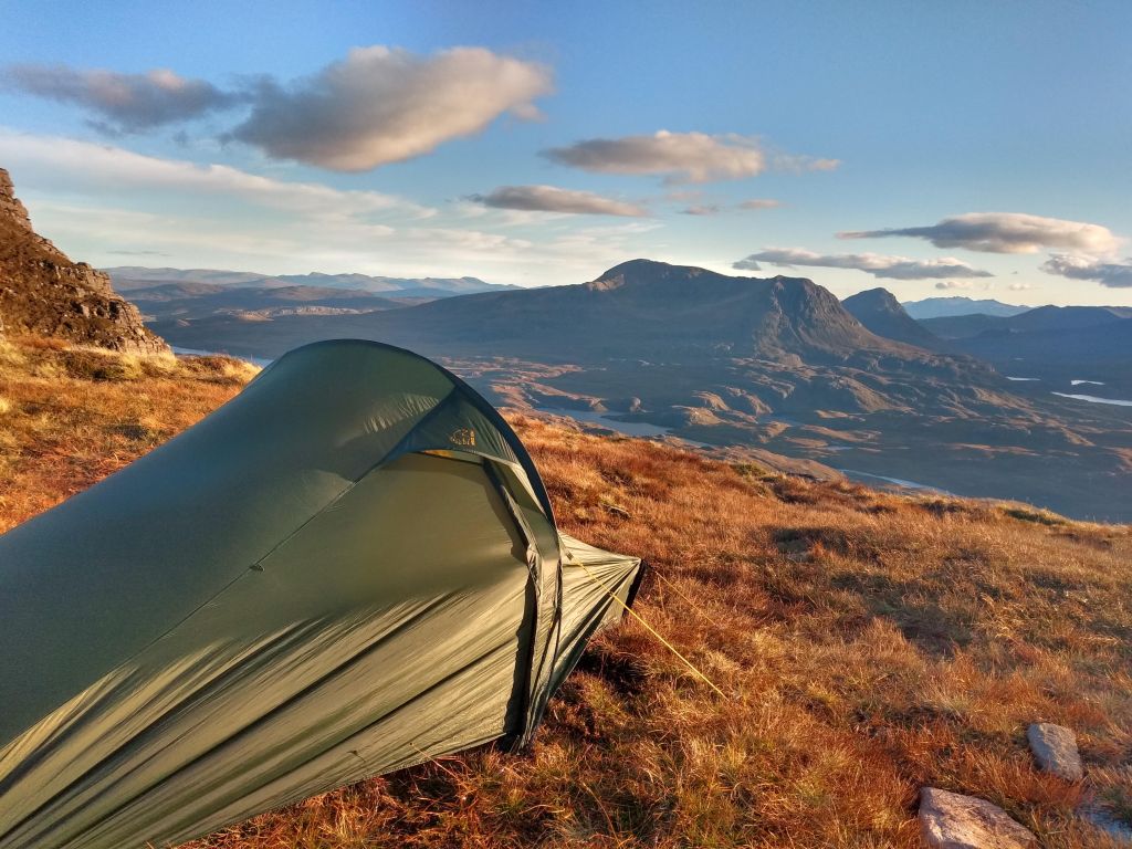
Mist on Quinag
When?
When am I doing this? Go day is 8 May. With any luck, I will be on the shores of Sandwood Bay within my 10 day target, before needing to work out how to get home.
And that is my hope. I am hoping to make this trip is environmentally-impact-free as possible. I won’t be getting any support by vehicles and aiming to use as much sustainable packaging as possible (I am going to eat a lot).
I am very excited to be swinging my leg over the bike on this, my longest adventure yet. With any luck, this is a sign of other exciting adventures by foot or by bike in the future.
Now to map out where all the coffee stops are on the route…
Supporters…
Big thanks to the lovely people at Outdoor Provisions for sending me some tasty snacks for the ride! Their bars come in super cool compostable packaging and made from real ingredients, helping the Pedal for Wildness to remain environmentally friendly.
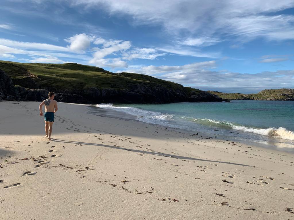
I tried to resist the cold clawing hand of the Atlantic Ocean but, despite my efforts, the constant expanding and contracting of the sea washed the definitively baltic water over my body.
I shouldn’t have been surprised. However, standing on the beach – tucked away in a crease in the land around the corner from Achmelvich Bay – you would have thought you were in the Mediterranean. The sun shone brightly, turning the sea an emerald blue, the champagne foam rushing along packed sand.
Scotland or the Mediterranean?
I remember, as a youngster, spending hours on this beach on a family holiday, digging a hole in the sand with my brother so deep you couldn’t see our heads if you stood a short distance away.
After a few minutes of being softly bumped around by the incessant breathing of the tide, I acclimatised, and spent a full 10 minutes swimming in the shallow waters. Bo joined me, eventually, and after another few splashes around we got out, only for my core temperature to drop through my feet into the warm sand.
It was still early on that September day. No one else was on the beach, so we hopped about changing into fresh clothes, simultaneously trying to warm ourselves up. This was the first proper wash we’d had in a couple days, having made our way from Kintail, to Torridon, up to Ullapool and now in Assynt.
Yesterday we had arrived at the foot of Quinag at midday, watching the moody clouds roll over its buttresses and the rain come down. At some point, something changed, so we got out the car in our full waterproofs and headed up Spidean Coinich.
The slabs up its sloping back had turned into a river, but the rain was easing slightly and there appeared to be an infinitesimal atmospheric shift in the air.
The final steep climb to the top seemed to call my name. I pushed on hard, answering the call. I hadn’t noticed the rain had stopped, but as I reached the summit I was greeted by a landscape that was lifting itself out of the sea of cloud like an old ship.
Descending Spidean Coinich
The remaining clouds rolled off the sides of the steep-sided ridges, and the low ceiling lifted slightly to reveal the Atlantic beyond. A few hours later and we were back at the car, cooking up dinner and ready for sleep.
I woke up in the middle of the night and found myself in a very eerie world; a strange place where I appeared to be living inside the static of a television. The mist reflected the small amount of light that exists at that time. I sensed, just ahead of me, a stag on the opposite side of the road. I cannot tell if I imagined it, but I could have sworn he was just 30 metres from me before turning to walk into the gloom.
Back on the beach, in fresh clothes and enjoying our new-found cleanliness, we headed back to the car.
There’s a point along this headland where you can look east and see the impressive Assynt hills in their glory. Where the sea meets the land, the peaks of Suilven, Canisp, Cul Mor and Cul Beag stand like stranded ships, left when the tide receded. It’s no surprise the Vikings thought this was where their gods practised mountain-building.
We drove back to Lochinver, searching for a pie. Naturally, the Lochinver Larder delivered. I am almost surprised their slogan isn’t “If it can be in a pie, we’ve got it”, so wide is their range; everything from your traditional fillings to deliciously spiced vegetarian and vegan options.
Though today was far brighter than last night might suggest, there was a fair breeze picking up and talk of a storm from Spain the following morning. As we stood in the queue to order our pies, our eyes were drawn to a large picture of the area’s most iconic mountain on the wall: Suilven.
Shaped like a great whale, for a long time I’d had a dream of camping in the saddle between Suilven’s two tops. That was our aim for the day: Head out from Glencanisp Lodge, up the long track to the foot of the mountain, summit, camp, head out the next morning before the storm.
It felt rather strange hanging around all day waiting to go for a run. Normally you’re out the door early and back for lunch, but today it was the complete reverse. I have never really done much run-camping, primarily for this reason. It’s seemed odd to spend a day twiddling your thumbs awaiting the afternoon to set off.
Despite the impatience, being sat in the garden of the Lochinver Larder, overlooking the sea as the breeze whipped the bushes around us, it was hard to not be glad to be sat there.
It was around 4pm when we arrived at the car park, just down the road from Glencanisp Lodge. The afternoon sun was bright and warm, but we had packed as if for winter, knowing the wind was only set to increase. It wasn’t long before we were rolling up the bottoms of our tights to let out some heat, though.
Suilven on the right, Canisp on the left
Suilven was a constant presence as we ran along the track into Glen Canisp. The track is wide and rolling, following the babbling river Abhainn na Clach Airigh. Every so often it would stall, pooling into lochans, before rushing on again in dramatic waterfalls.
I amused myself at the idea of the conventionally conical peak of Canisp sat grudgingly alongside its elegant neighbour, shooting dirty looks across it as awestruck walkers, photographers and film crews gaze at Suilven’s unique figure.
Just beyond Lochan Buidhe, we left the main track and headed south. Looking up, the path looked atrociously steep. In the saddle between Caisteal Liath and Meall Meadhonach, silhouetted against the sky, I could see the crest of the enormous dry stone wall that drapes over Suilven’s flanks.
This wall is what has become known as a Famine Wall. During the mid-19th century, the landowners forced many from their homes to make way for livestock. Some emigrated for a better life, but those who stayed suffered a potato famine, that decimated their food source and left thousands starving.
Many ‘offered’ their services to the landowners, building roads and walls in exchange for food. These became known as Destitution Roads and Famine Walls.
As we toiled up Suilven’s steep side, the wall’s existence becomes ever-more unfathomable. To have carried these stones from the surrounding area to (most likely) mark a boundary line is beyond imagination.
To our left, the long shadow of Suilven cast itself on the slopes of Canisp, while Loch na Gainimh stretched to the horizon. Suilven must be the only mountain which is just as identifiable by the shape of its shadow as by the real thing.
As we huffed our way up, two figures approached from above. One of whom was Lee Craigie, adventure cyclist, currently Active Nation Commissioner for Sustrans and all-round cool woman.
She and her friend had kayaked across from Ledmore, deflated their boats, strapped them to their backs, hiked over Suilven and were walking out to a car parked down at Glencanisp Lodge. Like I said: All-round cool woman.
Guess the mountain…
Just before we summited Bealach Mor we came across a rather oddly-shaped stone perched precariously over the edge. It looked like a rather uncomfortable looking throne – straight-backed and, obviously, hard as stone. We danced around sitting in it, worried the ground would disappear beneath us!
Finally, we reached the summit. Until now, we had been sheltered from the wind, but now it hit us and, along with it, a dazzling afternoon sun. Immediately my lips started to chap, the cold wind and sun sucking any and all moisture from them.
We pitched the tent – alone save for the odd stag roar. To the north we could see the hoof-like shape of Quinag’s three peaks where we had been yesterday. The thin outer of the tent thrummed in the wind. We unravelled the guy ropes, nervous our lightweight home would become a parachute in the night.
Leaving the tent and praying it didn’t take off, we donned our waterproof trousers, down jacket and extra layers and headed to the summit of Caisteal Liath.
The surrounding landscape is what I can only describe as wilderness. While it is a degraded landscape, the peatlands, lochans that are splattered across the landscape, and the seeming vast emptiness is almost without comparison and captures the imagination.
As we reached the summit, we squinted against the gale and sun, working on our natural weather-beaten look that you can’t get in a bottle. Cheeks sufficiently rosied, we headed back into the bealach, relieved to find the tent where we left it.
Some time in the wee hours, I extracted myself from my sleeping bag. As I crawled out the tent, a bright light dazzled me, and I tumbled out the tent. Feeling like a fugitive under the spotlight of a searching helicopter, I squinted into the sky as the world around me swirled in the wind.
It was no helicopter (obviously); it was a stunningly bright full moon, lighting up the world like a silver sun. I looked around, the hills not necessarily visible with the moonlight but standing out against their dark shadows. The sky was awash with stars but most were dulled by the exuberant glow of our closest satellite.
I have no idea what time it was when we woke up. All I know was the alarm clock sounded a lot like a bellowing stag. Stumbling out the tent we found a different world to the one I had found the previous night: Grey and mild.
We hastily ate some porridge and a granola bar before packing up the tent and jogging down the hillside. As we ran back along the ATV track, we could see the weather front closing in from the south and west, the coast slowly becoming obscured as a veil of rain enveloped the mainland.
Looking back up to the head of Suilven, we watched as the great whale entered the wash of the approaching storm. We trotted through the lodge and back to the car, swapping into some dry clothes and leaving just before 9am.
Back in Lochinver, we trooped into the An Cala Cafe, ordered two breakfasts and drank coffee, looking outside as a Spanish storm drenched the streets. We held warm mugs in our hand and smiled at a night well-spent. Chapped lips protesting.
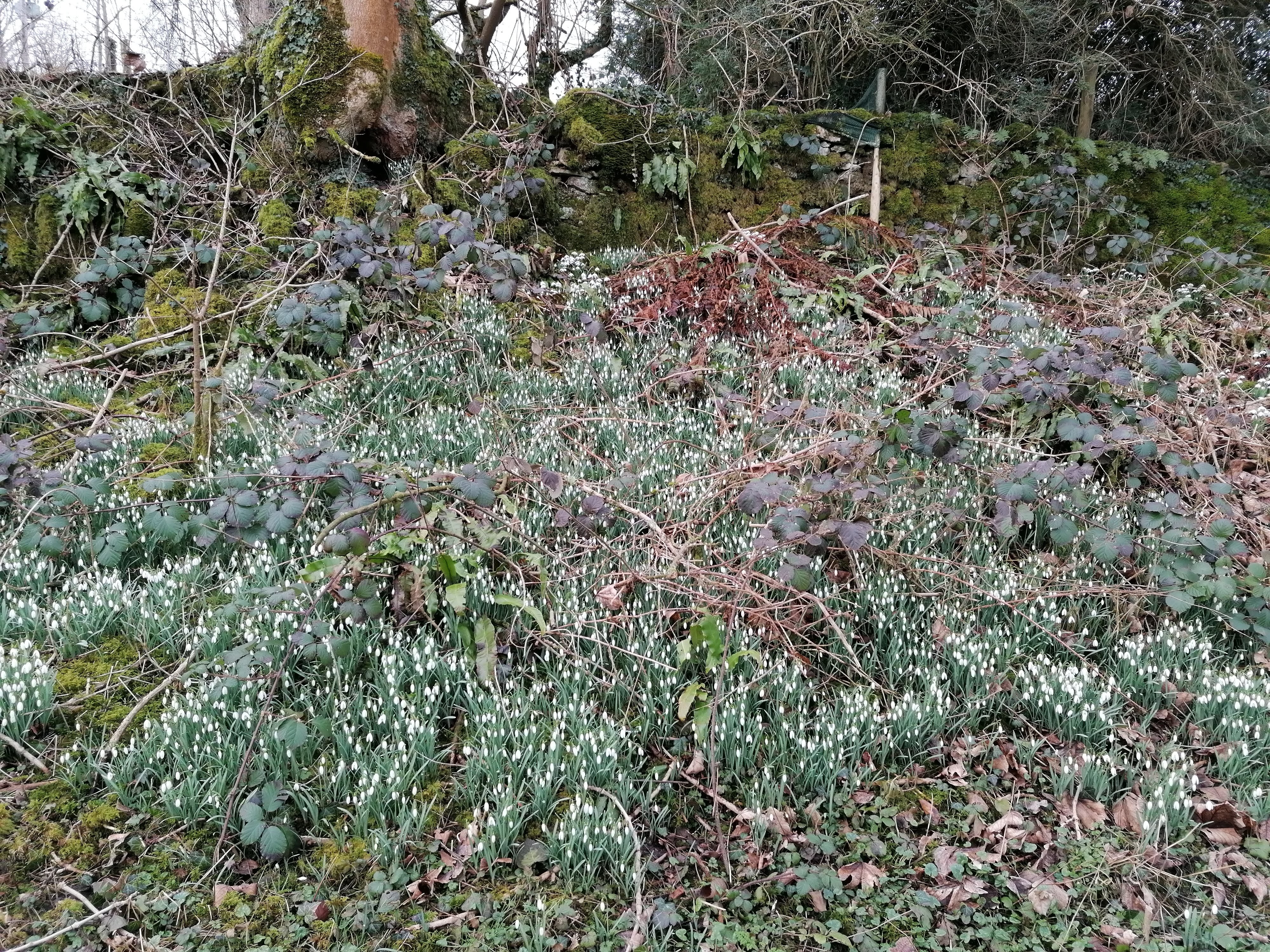
What’s the collective noun for a group of snowdrops?
I found myself asking the question as I pumped on my pedals on a climb by Sizergh Castle in the South of the Lake District, on my way to Levens.
I stopped for a few minutes to admire a sea of white on the roadside, amusing myself with a variety of names for them, but for some reason “a garrison” or “a regiment” seemed to be the most fitting.
Snowdrops have this helmet-like flower to them and cluster in groups, looking like a very tiny army. My mother submitted the best one, though: A drift.
February has really started to feel like spring. This is an odd thing to say; normally I wouldn’t be saying ‘spring’ until late March, but then I know the further south you go the earlier the seasons change.
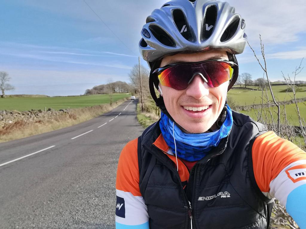
Throughout the month, I have been riding my bike a lot, following the quiet lanes around my home in Kendal. My favourite local loop heads west out of Kendal towards the tiny cluster of houses and pub that define themselves as ‘Crook’.
Just as you pass the Sun Inn, you head quite steeply uphill. On Strava – the authority on random place names – this climb is simply called ‘Sun Inn Hill’. If I could rename it, I would call it ‘Daffodil Brae’: On either side of the road, the thick shoots hold the promise of the tiny orbs of yellow that will burst forth at the first touch of the spring sunshine.
From the Daffodil Brae, the road slowly ascends, passing the St Catherine Church which, confusingly, is open every Sunday except the fifth Sunday. I am unsure if this is a rolling fifth Sunday or suggesting that – should such a thing ever occur – any month with five Sundays is just exhausting.
Gradually, the Coniston Fells appear over the hill, but are soon obscured by the leafless trees. Once I reach Windermere golf course, the road tips down in an exhilarating downhill towards the lake. I head north, seeing more daffodil shoots waiting to bloom, as the road follows the lake.
Sometimes I pass Millerground and spy the friendly sign propped out by Fellside Coffee, joyfully advertising its plant-based coffees and baking, all of which made with passion which comes out in how good they taste.
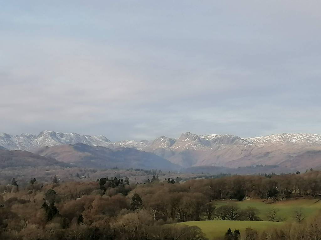
Leaving the tree tunnel behind, I start to climb again. As I pass Windermere School, I always look left and never fail to be struck with awe as the Langdales burst forth on the horizon.
Until recently, the freezing temperatures and snow had turned the fells a glittering white. Loft Crag and Pike o’ Stickle looked more like the Matterhorn than a 700m high Wainwright.
Back on the road and the climbing is coming in punches, relentlessly heading upwards as I take a few sharp turns towards Dubbs Road. For much of 2021 so far, this road has been thick with ice, forcing wobbling cyclists into the dirt on the edges of the road.
Thankfully, I have been riding my Specialized Diverge for much of the winter, the 32mm cross tyres making little sections like this a lot of fun. I always look right here as the trees part, looking over the very Lake Districty fields; nature bordered by straight dry stone walls – evidence of our increased appetite for efficiency.
It’s easy to forget the largely treeless landscape when you are on the roads, so often are they bordered by a long line of them. Yet, often they are here as this is their last refuge, just on the other side of the wall from nibbling teeth.
Dropping down towards Ings, the cold air bites, the easterly wind that has so often characterised this last month bringing cold North Sea air to the UK. It makes the straight stretch to Staveley brutally hard, lips drying out in the cold wind.
Resisting a stop at More? Bakery is the greatest challenge on the ride. Often, if work calls, I wrench my head away from the junction but, when time allows, its easy to be drawn in by its devilishly good baking. Sometimes, the whole of Staveley is rich with the warm smells of roasting coffee wafting from Mr Duffin’s.
The final stretch to home passes through Bowston and Burneside initially rolling but becoming flat, allowing an easy pedal back through to Kendal before a final kicker over the brae to get back into town. There’s always one, isn’t there!?
It’s now 21 February. Somehow. Time slips through our fingers like water, even though normality seems to have halted. Many outdoorsy types are dreaming of adventures further from home. An incredible winter now a lost opportunity for the skiers among us.
For me, I haven’t ran anywhere near as much as usual. Injury continues to drum away in my foot, but we are on the right track now. Meanwhile, I have taken to the bike, finding a new love for it and the roads around me – like the one I have just written about.
Instead of making myself upset at lost opportunities – fells not ran, summits not touched, goals not achieved – I have turned back to the bike, exciting myself with new challenges once lockdown eases. As I write this, I am spreadeagled on the couch after an 80km ride through South Lakeland.
More than anything, I am excited for spring and the increasingly longer days. The curtain is slowly being pulled back and soon (hopefully very soon) we will move into the light again.
I went for a walk in our local woods this morning. The cold, crisp air that carried us through a somewhat alpine-like Christmas and New Year has been washed back by Storm Christoph.
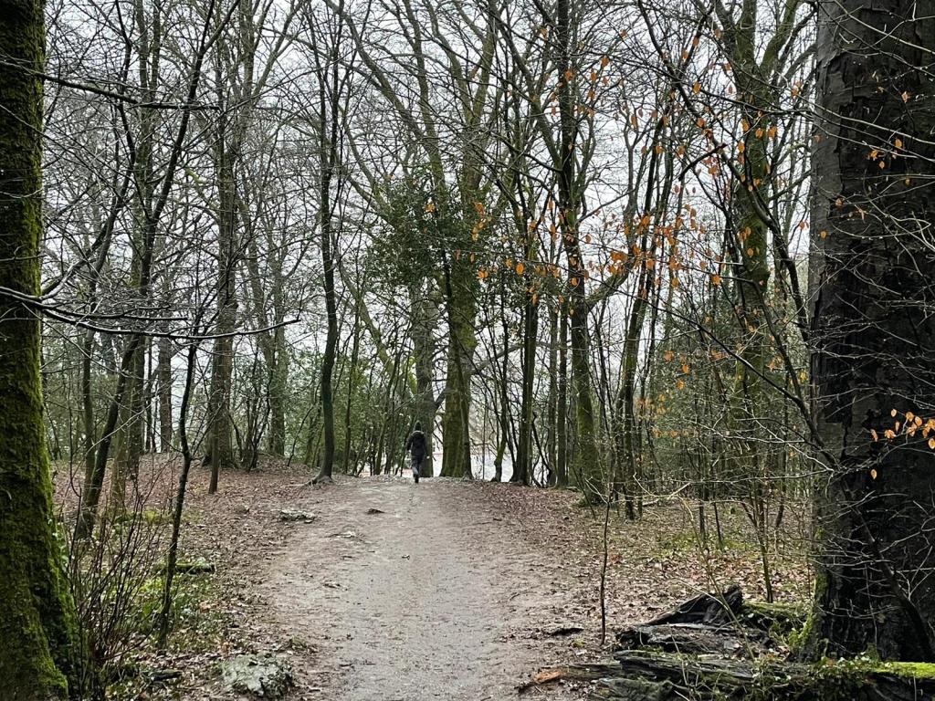
Clear skies and hard ground has given way to a grey blanket and mud. As the rain beaded down from the canopy of trees above, we made our way up through the Serpentine Woods.
I run there a lot, often in the dark, my world reduced to the circumference of my headtorch beam, over rotting leaves and scurrying animals. Once out in the open fell, the steam from my breath rises in front of me, obscuring my vision to a dazzling white mist.
As we trudged our way up through the forest, it was as though I was seeing it for the first time. The mind likes to take shortcuts. I have found this equally amusing and frustrating in my endeavour to learn Dutch. I now anticipate the sentences and phrases Duolingo will throw at me to such a degree I imagine them into completely different sentences.
This is often because I am in a rush, taking for granted what I think I have learned.
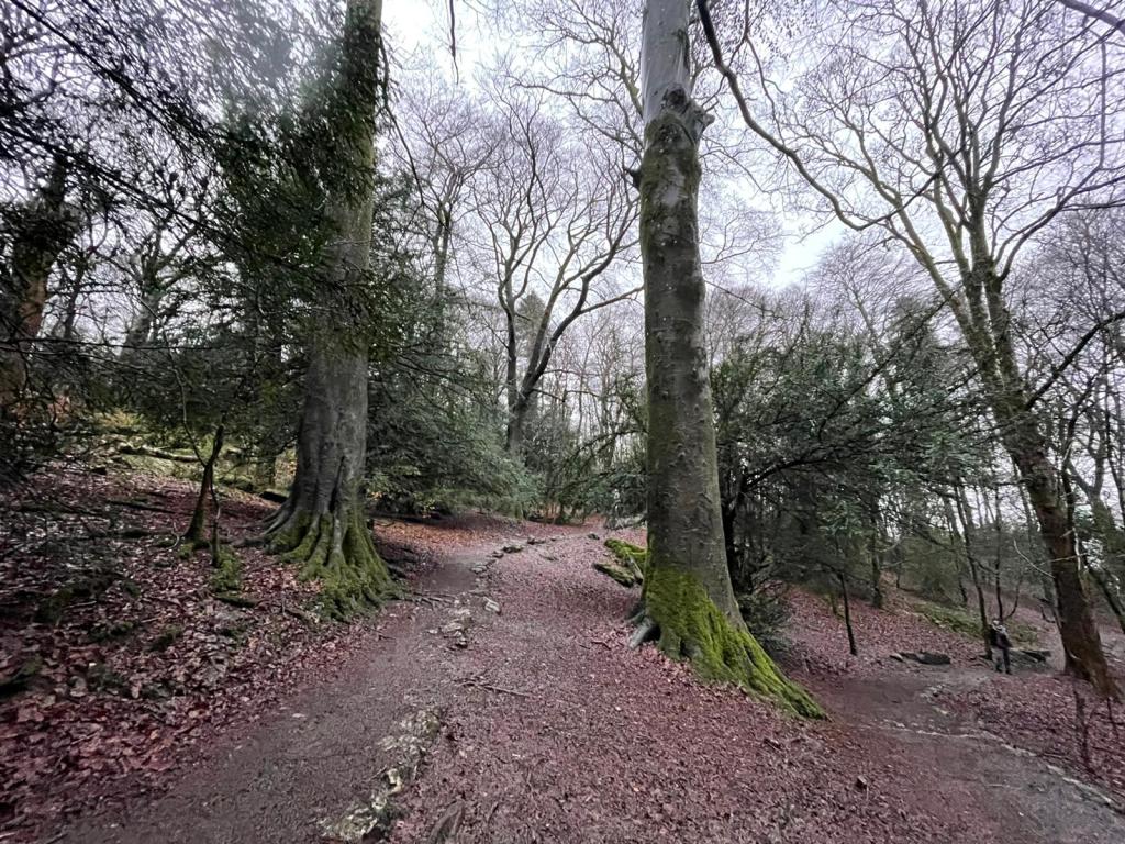
The same goes for Serpentine Woods. I have taken to more walking lately, my running seeming to be continually impeded by tendon and ligament issues in my glass ankles and nerve pain in my shin (yay).
I noticed a clearing for the first time, before suddenly spotting a whole new trail I had never noticed before. All of a sudden, the woods grew, turning from this one narrow trail I follow onto the fell into a maze of interlinking passages.
Everywhere, kids (or maybe adults!) had built little dens on any low hanging branches they could find, leaning sticks against them to create wooden tepees.
Given I work for an environmental charity dedicated to getting people outside, I have read a lot of the blogs and articles about rediscovering our back gardens.
I felt now, walking further up this boggy trail, I must have been only half reading them, in the same way I was half reading my Duolingo and the woods around me. It was as though I had changed lenses, putting in a big wide angle in front of my eyes, picking up various things I had never noticed.
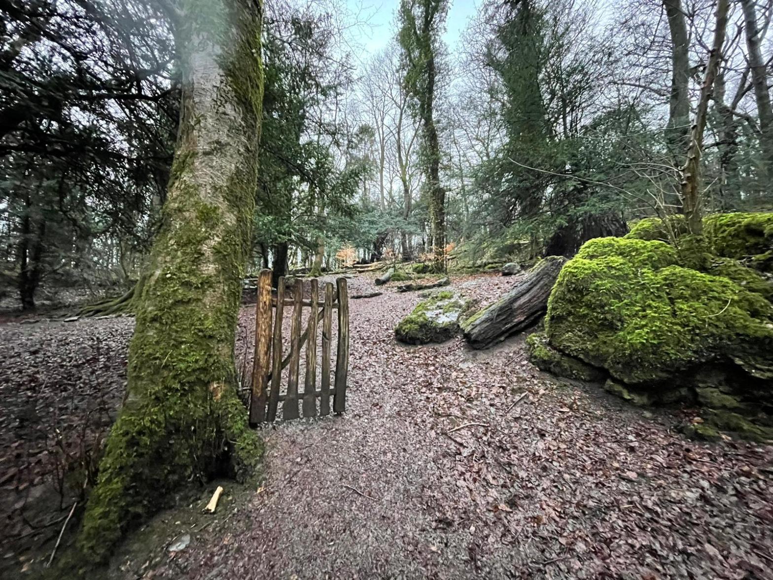
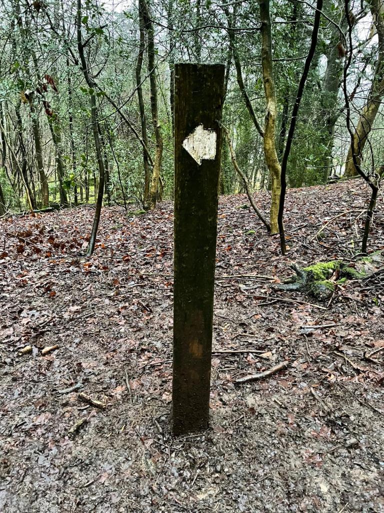
Serpentine Woods is a quirky place anyway. There are sculptures of ladybirds, acorns and a stag’s head dotted around the woods. Every so often you come across a post with a white arrow on it. These seem to lead nowhere in particular, often pointing in the opposite direction of the previous post.
I’ve seen chaffinches, robins, treecreepers and nuthatches in this wood, flitting over the heads and under the noses of the various dog walkers out in the morning.
I also noticed a rather strangely positioned gate, attached to a tree on one side and nothing on the other.
The gate barred nothing; it was opportunity. This wood is for you to explore.
Writing, for me, has always been that opportunity. That chance to explore myself, places, people and ideas. Some may be unable to identify with this, but I also feel the need to share that writing.
I haven’t updated this blog since the West Highland Way. Since then, that blog has been re-written and printed in the latest Trail Runner Magazine. I also have a piece lined up for the next Fellrunner.
Yet, they feel quite safe. We ran the WHW in August, and my Fellrunner piece is an interview about a friend’s life in the fells. This blog is a little different: It is a personal acount.
I felt myself stimied, though. Coronavirus may have brought the best out in some, but certainly the worst in others. Everyone everywhere has an opinion on everything.
This has left me slightly hesitant to write. There was now a gate in my way that I couldn’t get around. Would adventure stories be seen as irresponsible, encouraging exploration? Would advice blogs be met with armchair experts launching into me saying I was an idiot?
I put this out on Twitter. A lot of people replied saying, “No. We need a release now more than ever. Write.” While I cannot promise daily prose, I can perhaps promise a more frequent posting schedule.
It also so happens I have started reading Running Free by Richard Askwith. Lately, it seems everything I do requires some greater purpose. For a while, my partner has asked me, “Why do you feel the need to push yourself?”
This is coming from someone who ran from Albania to Greece last year, but did so at what one might call ‘adventure pace’. Meanwhile, I sit here with a dodgy tendon, fretting that I won’t achieve that challenge I have set for myself.
Reading Running Free, though, I realise there is a need to Live Free. Do what brings you happiness. Care less about the expectations of others and enjoy it a bit more. Slow down. Some of my best training of late (both emotionally and physically) has been when I didn’t have a goal, and I just plugged away at a consistent level, which is far better than the rollercoaster of highs and lows.
So my takeaway from the past few weeks: Run free, write free, live free.
Take a look at this blog, and what you will find are high altitude adventures. Since I was a kid, hills have been the focus of my attention, with the open air of giddying heights always captivating me.
Runs not measured in kilometres or miles, but in metres or feet.
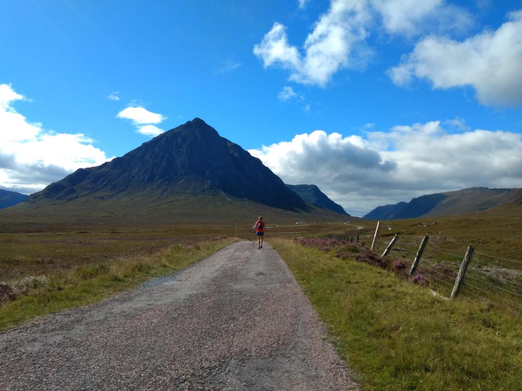
I remember at the end of many walks in the hills coming down to the chip shop in Tyndrum and watching a group of hobbling walkers tottering their way into town, laden with enormous rucksacks featuring tents and roll mats bursting from their compartments. In classic Scottish fashion, it would likely be raining or they would be under siege from midges.
“Ouch”, one of us would say. “Some poor sods on the West Highland Way.”
I had done parts of the West Highland Way over the years, as either a short run or a link between the start and end of a hillwalk. I knew of the race for years, but that was for ultra runners – trail runners, even. Yikes!
Somehow, though, I met a girl from the Netherlands who likes doing long-distance running over lots of different terrain, and I started looking behind the crushed contour lines on the map and instead peering at the twisting paths and trails that snake around them.
I couldn’t help being reminded, too, of Nan Shepherd’s maxim that a summit is not the only way to experience a mountain. Sometimes going round, through and beneath them is just as powerful an experience.
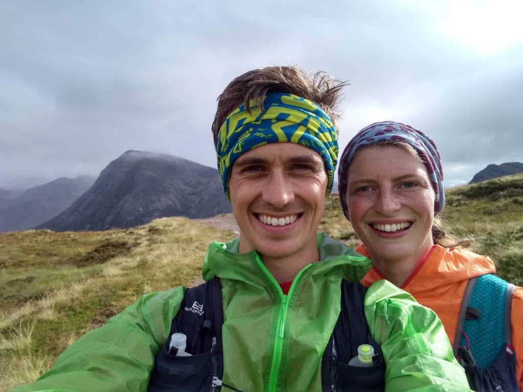
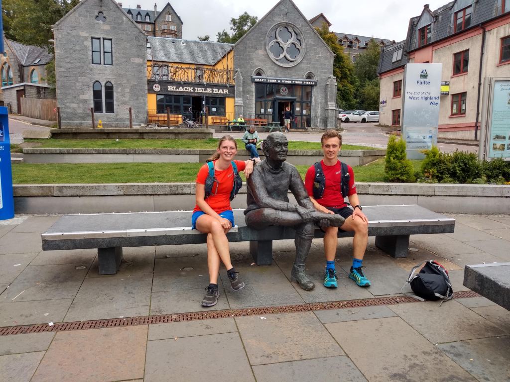
And so it was I suggested to Bo a three-and-a-bit-day holiday running the West Highland Way, the 150km trail from Milngavie (Mill-guy) to Fort William.
Before the run
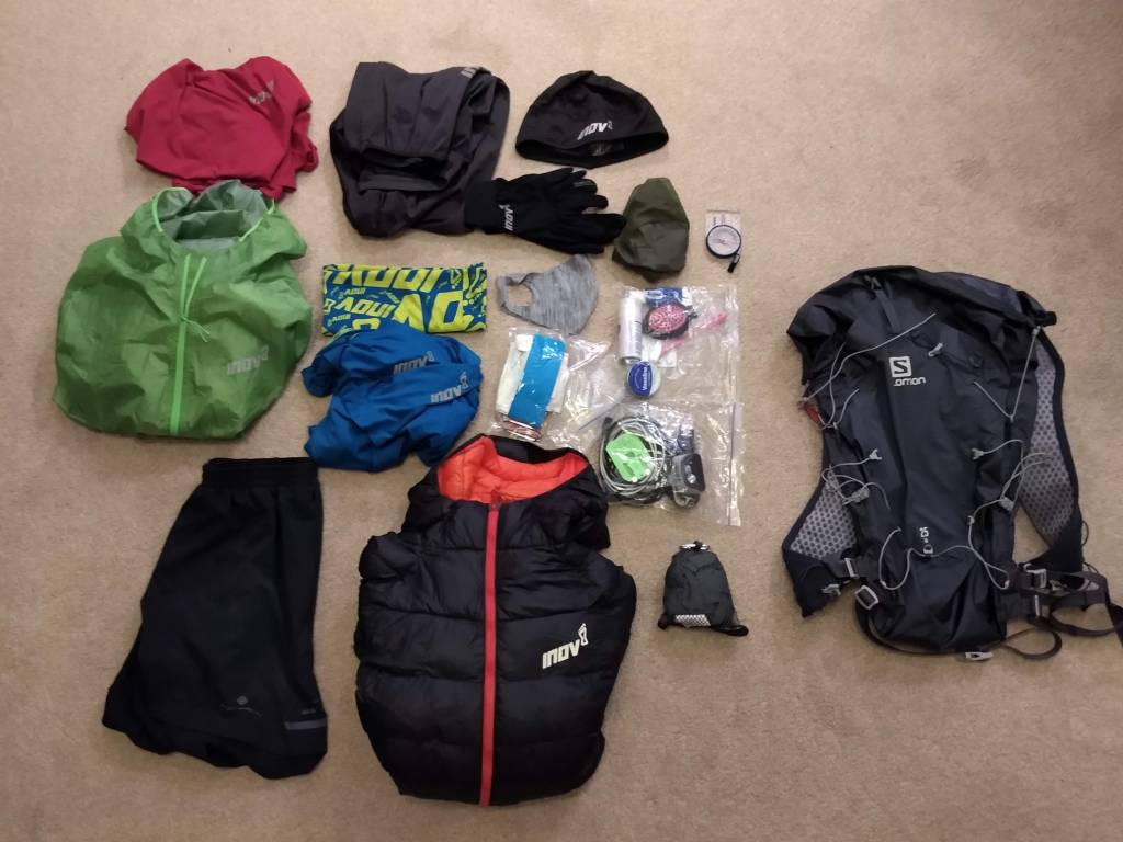
We decided we wanted to go light on this trip, opting to spend a little extra on hostels, bunkhouses or B&Bs instead of carrying camping kit. Despite being a fell-runner, I wasn’t quite used to the ‘travelling light’ that comes with multi-day running.
Bo laughed at my meek question: “So, how many socks are you taking?” “Two. One for running, one for the evening.”
Right. I will take out my extra pair then. In the end, I took slightly more than some would if keeping it minimal, taking two long sleeves as I would likely wear one running most days.
The pre-run kit photo
I posted my kit photo the night before and proceeded to not think on it again. The next day, however, I checked my phone and nearly choked on my cheese and ham toastie in Balmaha. The thing had nearly 100 likes with a few amusing queries:
“Not nearly enough midge nets or spray”
“How can I keep track of you?”
“No food?”
In an age where dot-watching and FKTs (records) are every fell and ultra runners equivalent to a football derby, I found it interesting this post blew up in the way it did, with some appearing to believe I was off to break Rob Sinclair’s ridiculously fast record for the Way (13:41.08), which I obviously was not.
For the rest curious as to where the midge nets and food are, I can assure you I took them! For a full list of all my gear, head to the bottom of the page (not including food).
I completed the Lairig Ghru marathon a couple of years ago, which was the last time I ran 42km on trails (the Abraham’s Tea Round obviously being more, but for some reason that was easier!). Since then, though having not ran the distance, I have done a number of days of 6+ hours, so that did not bother me much.
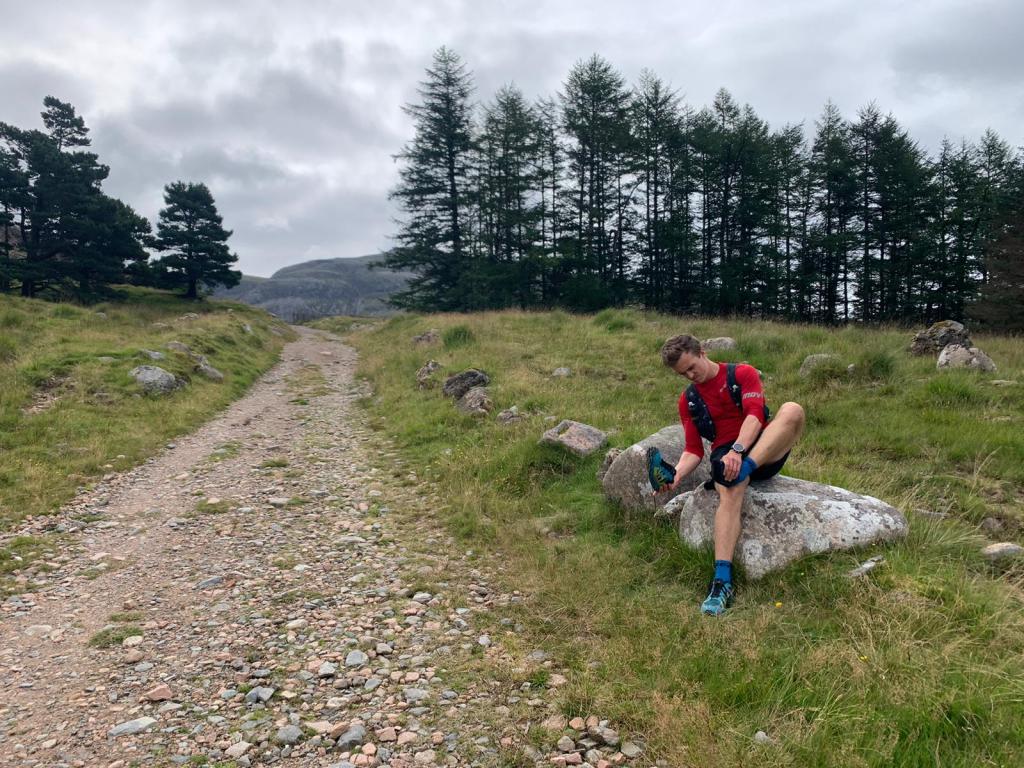
What did make me nervous was, ironically, the terrain. The Lairig Ghru butchered my feet. My Inov-8 Roclite 290s forged a blister the size of my big toe in my arch. Naturally, I decided to rigorously test the shoes I would wear on the West Highland Way to ensure they did not rub…
…by running 10km total in them before leaving. Despite that, I was quietly confident Inov-8’s new TerraUltra G270 would see me through, and that a more leisurely approach to the challenge would prevent too much difficulty.
Still, I felt trepidation. Flatter than any run I would normally do, I was interested to see how I would get on with the repetitive motions of a rolling trail.
Day 1 – Milngavie to Rowardennan
Distance – 43.2km // Elevation – 951m
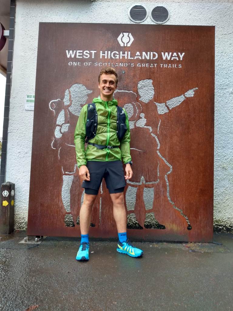
We hopped off the train at Glasgow Queen Street, changing to the lower line out to Milngavie. The weather could only be described as “driech”, but we felt confident in the promising forecast for the following days.
It was strange knowing that, from here on, we had only the kit on our backs and the shoes on our feet for the next few days. As we took off our masks on a rain-soaked platform, we followed the signs for ‘West Highland Way’.
We passed two women who had just finished their walk who, when asked how it had been, replied with a cagey: “Yeah. Yeah, it was good.”
It was quite strange walking to the archway to start the run. Having spent some time in Glasgow, where the West Highland Way was our go-to trail, here we were actually running the thing.
After a few quick photographs, press of the watch button and a joking sprint start, we were off. Off for a big adventure.
Trotting through Mugdock Park, we encountered a number of giant levitating packs which – as we came closer – we found to have people actually carrying them, so hidden were they under a mountain of luggage. I couldn’t help but be grateful for our lighter bags.
Passing below a mist-cloaked Dumgoyne after 9km, we came across our first West Highland Way quirky support board: A mad wee Scots poem outside a tiny ponies enclosure encouraging walkers into the Beech Tree Inn.
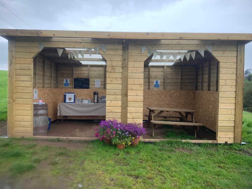
As our day went on, we passed more honesty boxes, pop-up cafes, fun message boards and artwork all encouraging Wayers (for want of a better word) to pop in for a brew or a snack. Some were fairly substantial, like one outside Drymen which featured a wooden shelter, tea kettle, cool box, snacks and a picnic bench!
What was clear was that here was a trail that pulled people and communities together in many ways, and that the infrastructure around this one trail was a sign of how community, tourism and infrastructure come together.
The aim on this adventure was to just keep the food coming. I’ve been trying to be more conscious of the plastic packaging of my bars, so had a stash of Outdoor Provisions bars with me, along with the usual array of flapjacks and malt loaf.
We’d set ourselves up to stop in Drymen for lunch. In the back of my mind, I knew most people stopped there, so had the expectation that the route passes through the town. Following the signs to the right, we carried on through a beautiful hedged path before popping out on the road.
Soon I turned to Bo and said: “I think we’ve missed the town. Do you want to turn around?” We mused for a moment and decided it felt weird to turn back on ourselves now.
Within an hour or so, we were wondering if that had been the right decision! The push from Drymen to Balmaha isn’t easy and, as we climbed through the forest to the iconic Conic Hill, we were missing the taste of a good sandwich and a coffee.
Conic Hill is built up as this ominous trickster of a climb, catching out the unwary traveller. As fell runners, we took it with a pinch of salt. However, after a nice flat stretch above the tree line, I looked left and thought: ‘Crap. We go up there!?’ For some reason, the back of Conic Hill looked more like Ben Lomond with its hood of cloud upon its head.
Head in the clouds
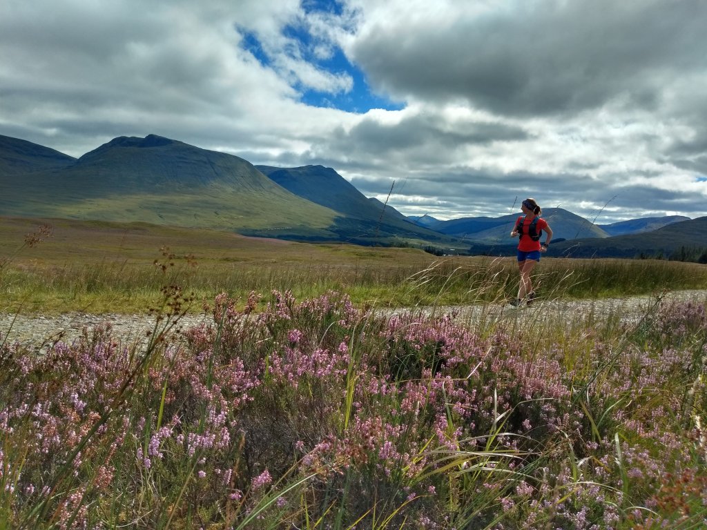
We kept the intensity low, taking time to admire the sea of purple heather upon the hillsides to the north. The Way skirts beneath the 361m summit of Conic Hill, but this meant we could keep just below the cloud to peek out towards the body of Loch Lomond that lay below, peppered with its many islands.
As we descended, it became clear to me why Mountain Rescue is so often called here. Dozens of people were slogging up the heavily eroded path, most in leisurewear, with one group of guys passing us saying, “F**k me, man! A’m swea’in’!” as if it was a novel concept.
It’s great to see them all up there, but with the numbers, the erosion causes greater hazards, with twisted ankles and falls not uncommon as people descend on protesting legs.
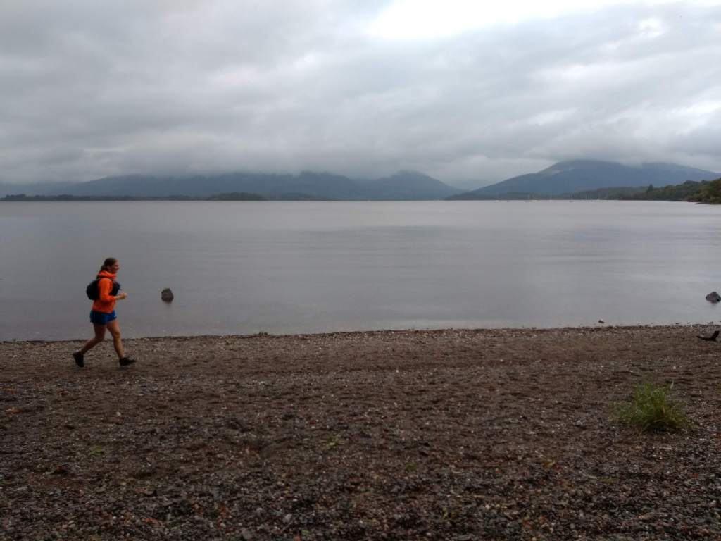
Eventually, after a long 30km push, we made it to Balmaha and the St Mocha Coffee House and Ice-cream Parlour. As is typical for British tourists, the ice-cream was going out the door at a similar rate as the coffee despite the now-pouring rain.
We plonked ourselves into a warm corner of the cafe and devoured a cheese and ham sandwich as the rain came down heavier outside. Hilariously, the ceiling of the cafe has two fake skylights featuring blue skies and sunshine. After some time lost in space, I caught sight of these and snapped my neck as I turned to look outside, only to see droplets bouncing off the pavements.
Slowly regaining our strength, I downed my last cup of tea and we headed out into the rain. We only had to be in the deluge for a short time as we entered the trees to take us to Rowardennan.
On the bonnie banks
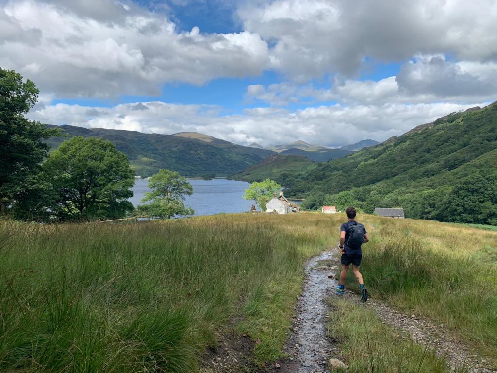
People always talk about Conic Hill, but no one mentioned the innumerable 10m steep pitches that riddle the path to Rowardennan. Up, down, up, down – the 10km to the end of the day never seemed to end! Yet, it is a beautiful run for dinner – the idea I was chasing down my tea was a definite motivator.
Soon, Ben Lomond sprouted from between the trees and we made the final few miles to the Rowardennan Hotel. We’d be staying just up the road at the Rowardennan Hostel, but – ask yourself – what’s most important here: Getting showered or eating food?
The Clansman Bar was very quiet, with only a few similarly drenched travellers drying shoes by the fire. We hopped on the recovery train with a steak pie and a burger, eventually hauling ourselves from our chairs to hobble to the hostel.
Set on the shore of Loch Lomond, Rowardennan Lodge is a grand building. Due to Covid-19, we had a room of four to ourselves, with a private washroom – result! We washed our clothes in the sink, ate a flapjack for dessert and hit the sack.
Multi-day running level-up.
Day 2 – Rowardennan to Tyndrum
Distance – 42km // Elevation – 1125m
We left the Rowardennan Hostel on a sunny morning, the ripples of Loch Lomond winking at us with a fresh northerly breeze.
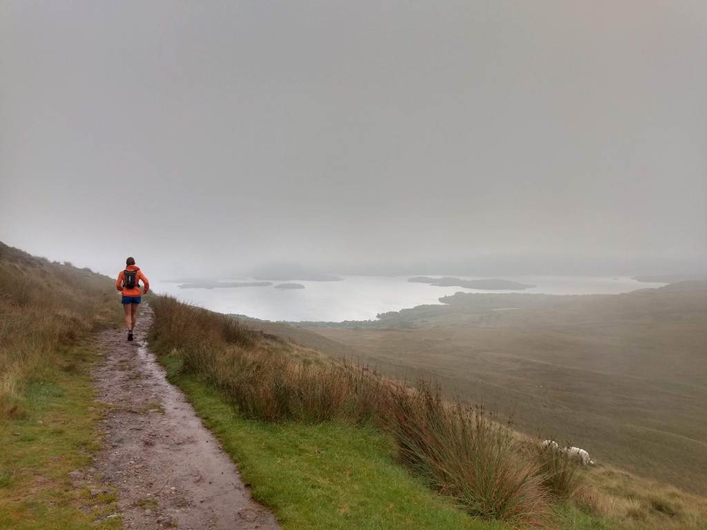
Shaking loose our stiff legs, we headed off towards Inversnaid. Thankfully, the chill wind kept the midges at bay, though every so often we would pass some poor souls packing up tents whilst under siege from the winged teeth. We thanked them for their sacrifice and quickly shot by.
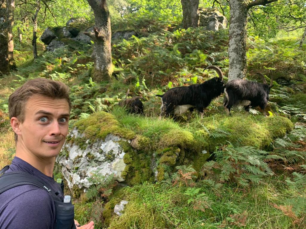
The WalkHighlands website mentions one might see goats after Inversnaid and, lo and behold, as if on cue, they appeared! Huge wild goats, with a smell that followed them over 500m beyond!
Due to the stories I had heard of the ‘rough’ section between Inversnaid and Inverannan, I had in my head some epic boulder field. Despite there being no boulder field, the roots and narrow single-track can make for some slow going. I cannot imagine what it would be like with a 50L rucksack!
By the time we left Inverannan, we were a bit pooped. We knew this would be the long day, with no opportunity for a mid-run coffee stop. Yikes! Aches and pains presented themselves in strange manner, but once we reached the wide gravel track above the A82 to Tyndrum, those began to subside.
Approaching Doune Bothy
It was an incredible thing to look back at this point to Ben Lomond. It looked so very, very far away, and we had done it all on foot. That was quite a feeling.
The path down (which is more down, up, down, up) through the forest transports you to a pine forest in North America. Reaching the Herive Burn, an autumnal sun broke the canopy illuminating millions of glowing spores like fireflies.
By the time we were through the Strathfillan Wigwams, we were pretty goosed, opting to sing along to the soundtrack from Moulin Rouge to gee us up!
Eventually, with shuffling feet, we arrived in Tyndrum. As we hobbled to the Real Food Cafe, I looked at a few people sat drinking outside the Tyndrum Inn and watching us go by. I laughed at how my role had reversed from sympathetic onlooker to John Wayne-esque West Highland Wayer.
Day 3 – Tyndrum to Kinlochleven
Distance – 45km // Elevation – 1048m
Here we are. The long day, but also the most runnable, and our first steps into the proper Highlands. Looking at the route profile, it’s amusing to see the flats replaced with climbs as we steadily enter the higher plains.
It was colder now, as we headed straight into the cold northerly wind. Despite having felt very tender the night before, that morning we felt far better than the previous.
The volcano-like shapes of Beinn Odhar and Beinn Dorain loomed over us as we made short work (well, “short” by my new expectations) of the road to Bridge of Orchy.
As it seemed any other sane Wayer does, we popped into the Orchy Hotel for scones, eventually kicking ourselves out the cosy pub and up the climb to Mam Carraigh. From there, we had a stunning view to my two favourite Munros: Stob Ghabhar and Stob a’Choire Odhar, the car park for which was absolutely rammed when we arrived. Evidence we were now in a Bank Holiday weekend!
Until now, my body had been behaving itself remarkably well. However, as we toddled along Telford’s Parliamentary road to Glencoe, the arch of my left foot began to twinge with pain. Loosening my laces, I marched on, able to largely ignore it under the azure sky as the mountains grew around us like we were in an enormous pop-up picture book.
Telford is best known for his design of the Caledonian Canal, but he was also tasked with the improvement of many old military and drover’s roads in the Highlands during the 19th century. The A82 was now far from us, and we had a wonderful sense of space as we entered Glencoe.
We made a pitstop at King’s House, giving me a chance to remove my shoes and us both to get psyched for the last push to Kinlochleven, aided by a hot chocolate.
By now it was a truly gorgeous day, Bhuachaille Etive Mor’s famous face was in shadow in a glen flooded with sunlight. However, my foot was not all sunshine and rainbows. I have to thank Bo for letting me almost tear up with the pain and for strapping my foot. I stuck an ibuprofen down me just as we started the ascent of the Devil’s Staircase.
Only in Scotland could you go from Bahamas-like sunshine to rain in 20 minutes. Strangely, as we climbed in the drizzle, the pain in my foot dissipated – maybe it was the painkiller, maybe it had stretched out a bit. Either way, after a speedy ascent of the Staircase (it isn’t as bad as people say) we began trotting down towards Kinlochleven on the long zigzag track, with stunning views over the Mamores.
It was only in the trees where the wind was scarce that we encountered our first midges. They forced us to quicken our pace all the way into town, where we quickly made a beeline to the Getaway Inn.
We drank a shandy and toasted to our final marathon day. All we had now was a cool half marathon and we’d be in Fort William.
Day 3 – Kinlochleven to Fort William
Distance – 25km // Elevation – 632m
The midges swarmed around our heads as we waved goodbye to our B&B hosts and shuffled our way out of Kinlochleven and up the steep climb to the foot of the Mamores. I thought back to that incredible day almost a year ago on the Ring of Steall Skyrace, which took us up on this path on another bright and sunny day.
We left the swarms behind us as we cracked the tree line, jogging through the towering peaks, passing many others on their final day of walking.
Some foot grumbling
My foot wasn’t causing as much issue, but still caused a few frustrated sit downs and another painkiller or two. Eventually, the path turned back on itself and we climbed to a point that gave an excellent view towards Ben Nevis – a sign we were nearly there!
The path lolloped up and down all the way to the forest, before finally nose-diving down towards the road. About two-thirds of the way down, a small brown animal streaked towards us: My mum (not the brown animal) and their dog Meg (the brown animal) were waiting for us, giving a little boost for the final 5k.
Once we left them, our pace picked up a little, and after a few rounds of playing Kokomo obnoxiously loudly on my phone, we hit the road on the final stretch into town. Glen Nevis was packed, with cars perched precariously on verges and pavements – evidence of the strain on rural areas post-lockdown.
We were both quite sore, so we walked the last little uphill into town before making a vow to jog all the way to the finish.
Finally, 150km later, we were jogging up the high street of Fort William. We flopped down on the bench either side of the “Man with sore feet”, eventually getting to our feet and shuffling into the Black Isle Bar.
Some final thoughts…
Running the West Highland Way was something very different for me, and very special. I got to experience a different side of running in Scotland, and a new appreciation for the hills and places I hold so dear.
You will also be amazed by how far your legs can carry you. This trip left me excited for more long distance challenges. Forget about racing, this stuff is just bloody good fun!