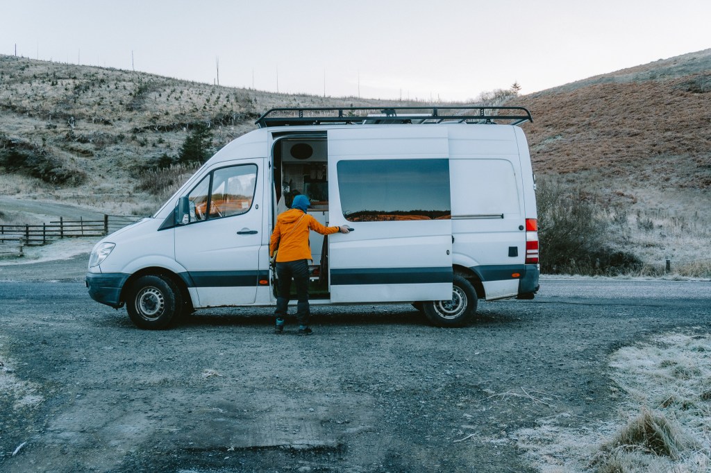
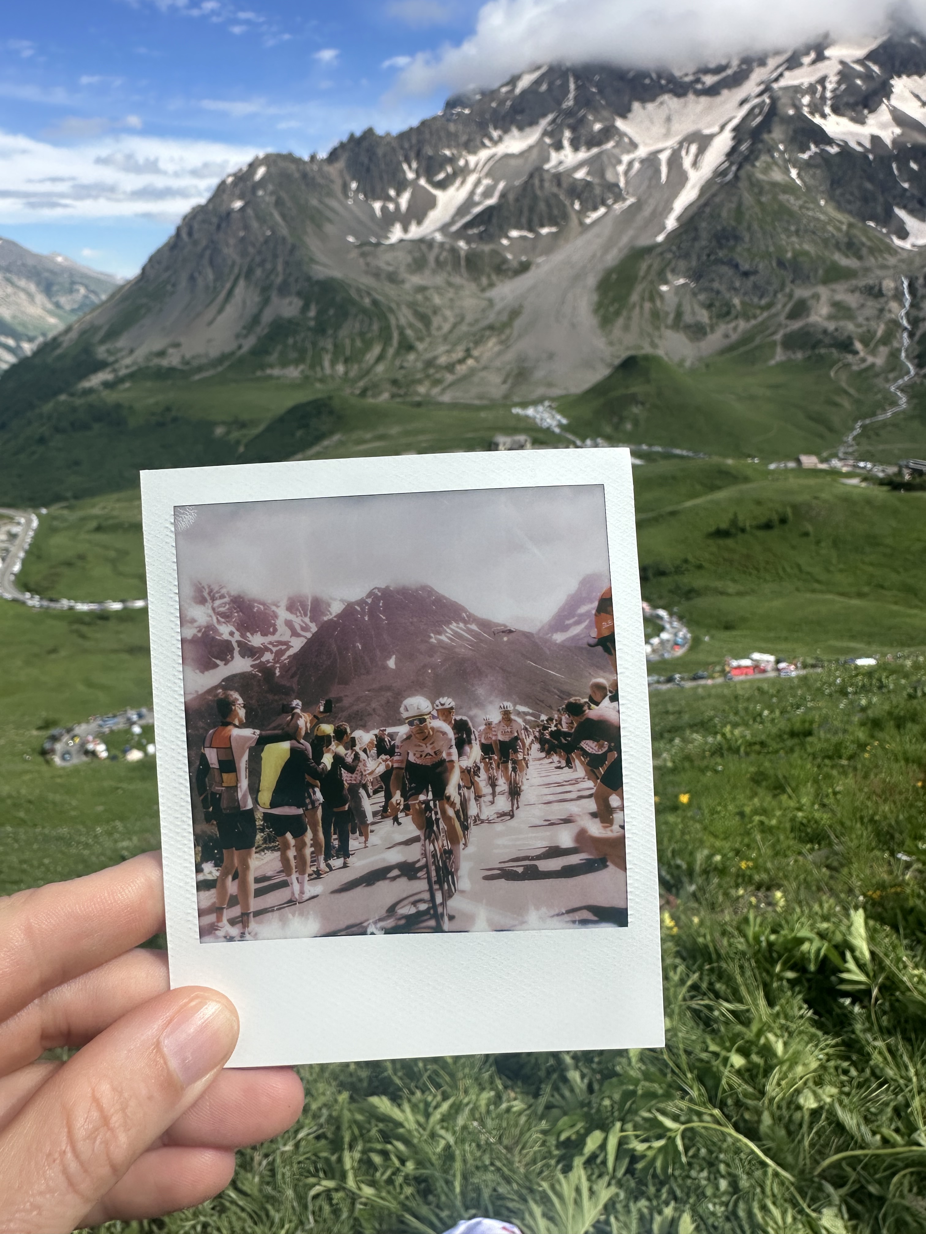
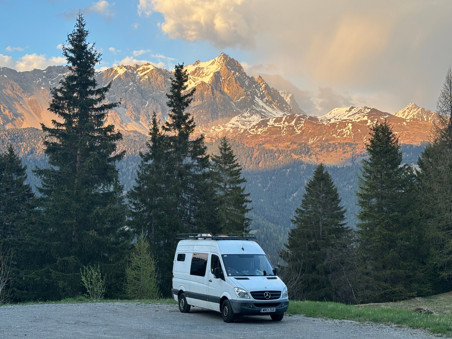
Getting married and one year of Running Adventures Scotland

*Deep breath*

Well! I felt it was time for a short personal update, as I realise my blog has been a little quiet over the past couple of months. 2023 has been a busy and wonderful year so far, and I wanted to share a quick run-through of highlights of the last six months.

Getting married!

I am over the moon to say that, on 22 April, my fiancée Bodil and I officially tied the knot on a glorious spring day in Perthshire, Scotland. As anyone who has been married will know, planning a wedding is the kind of thing that can eat away at a lot of your free time.

Any free evening that was available was given over to planning the day or let our brains rest from planning the day. That meant that most of my spare brain power was not directed towards things like rossrunswild.com, but I hope that the habit will continue to settle back in.

I can hardly complain, though. The day was as perfect as you could imagine. What I do enjoy were the compliments people gave saying, ‘You can tell this in your wedding. You have spent time/money/energy on the stuff that really matters.’ That, as someone who does enjoy a project plan, gave me immense satisfaction.

Comrie Croft is a truly beautiful location and, if you are planning a wedding or even looking for somewhere to visit, I really do recommend it. We had the whole place to ourselves all weekend for our friends and family to just hang-out. It was a fairly DIY affair, but the staff were incredible and made the whole thing a lot less stressful.

We also had the most fantastic celebrant – Gillian Robertson. As someone for whom words are somewhat livelihood-cum-hobby, it was so interesting working with someone else to tell your own story. You don’t really notice how your brain is wired until you are encountered with that, and you find yourself tweaking little words and stories to make them reflect your character – your ‘brand’ even!

Gillian was everything I wanted in a celebrant: kind, patient, funny, and well-versed in some Scottish wedding traditions. We had both a hand-fasting and a quaich ceremony, both of which we added some special twists to. For the former, our mothers laid my family’s traditional tartan over our hands and a Delft blue fabric to represent Bo’s Dutch heritage. The whisky in the quaich was poured by my dad, the whisky for which was Glenturret – just a few miles down the road.

Sustainability and localness was really important for us, in as much as we could control and give energy to: we dried foraged petals for over a year in our loft, mostly from our own garden and any other flowers came from the market garden next to the venue; my mum amassed an incredible range of second-hand, upcycled and handmade decorations, and anything else was borrowed from the venue; our photographer was local, our caterer was from St Andrews (who, while being a hog roast, made so much BBQ jackfruit and were also well-priced and easy to work with that we accepted some guilt for the meat-orientation of the dinner); we only asked for very specific gifts and money towards our honeymoon to avoid needless waste (one of our friends even offset 10T of carbon for us, which while not perfect, it is something; Bo’s dress was even made from vintage fabrics!

One can fall down a rabbit hole with these things, and I think we could have done more, but the reality is that weddings are never going to be absolutely net-zero and you can always do more. Plus, when someone is well-priced and easy to work with, you work with them, despite reservations.

Of course, the whole event was topped off with us riding into dinner on a tandem, a Best Man speech by my brother for the ages, and a fine Scottish ceilidh. After a short mini-moon in Argyll afterwards, we have since been back to the grindstone and enjoying our first month of married life together.

Running Adventures Scotland turns one!

To think that, a year ago, I became a published guidebook author is BONKERS. I still look at copies of Running Adventures Scotland on the bookshelves of shops and pinch myself that it is actually my book on the shelf!

What I am most touched by is the people who have got in touch with me after buying the book to share their stories of following the routes therein. I even have people basing entire holidays off it, which is exactly what I wanted to happen.

The genuine appreciation and positivity for this book has been truly wonderful, and I am still incredibly proud of what I achieved with it.

Photography

I stated in my blog at the start of this year that I would endeavour to take more photographs. Since then, I have been going to college to attend a night class for several months, as well as even getting my first photographs in print in a local newspaper.

Most of my photography is landscape-based, and occasionally try to bring aspects of street photography into my shots. I have always had a good eye for a photo, and I am now getting around the technicality of a camera quite well, but I am working to get my shots up to that next level.

As part of college, I will now be working on a project, so I am in the midst of trying to think what that might be. At the same time, I am keeping my eye out on other photographers to keep some inspiration coming in, and thinking of specific things to try and capture to challenge me. Being close to/in the Lake District make landscape photography a natural fit, but there are lots of genres out there I am keen to dabble in!

You can see some of my work over on my new photography page, or on my new instagram @sgurrmorphotography.

Looking ahead…

Next weekend I am heading to the Isle of Jura for the first time to take part in the Jura Fell Race! While slightly daunted at the challenge, I am just looking forward to an incredible adventure and the chance to finally put a new long race under my belt! My palmares is sorely lacking recent examples of long racing!

In July, I am excited to say I will be heading back to the Transcontinental Race as the Race Reporter for the second year. Last year’s race was probably one of the most eye-opening and valuable experiences I have had in my professional life recently; that challenge of writing every day, coming up with fresh ideas, late nights, sunrises, bad coffee and incredible landscapes.

There will be more, I am certain. For now, though, I have to cook dinner (married life, eh!). Until the next one!…

Nature’s backstage pass

I rolled over and looked at my watch: ’05:10′.

My alarm was not due to ring for another 20 minutes, but the the creeping morning light was already causing the inside of my tent to glow. Turning to look at my canine companion, Togo, I saw him sat bolt upright and staring at the door, barely batting an eyelid as I moved. I wondered how long he’d been sat like that. He isn’t the best at relaxing in a new environment!

I groggily opened the doors and allowed him to jump out and explore our ‘estate’ for the night. Lingmell is an unobtrusive summit, overshadowed by the hulking figure of Scafell Pike and its sabre-toothed neighbour Sca Fell (as an aside, I do find this contrast amusing, with the latter a far more satisfying-looking contender for England’s highest peak). Still, it has a number of crags and outcrops that make it very worthy of a visit. Yesterday afternoon, we hiked in from Seathwaite, enjoying a stunning display of light, shadow and colour as the sun crept across the sky, throwing reliefs of the mountains across their neighbouring peaks.

Rivers and pools shone near-perfect reflections of the landscape back at us; natural mirrors repeating the wonders above. The climax to this was close to the summit of Lingmell, where we looked across to Great Gable over a natural infinity pool, perfectly reflecting the sky and a passing plane. The waning sun cast shadows across Great Gable’s many crags, it’s scree slopes standing out like stubble on a weather-worn face.

Despite the warm forecast, the night was brisk, so I had carried in a few extra layers (even a liner, which I certainly did not need). As the new day dawned and I clambered out the tent, I was glad for the spare layers: it was bitingly cold, with a fresh breeze.

The morning looked as expected: Pastel blue sky, golden glow. Perfect. Moving around the tent, I walked towards the edge of the fell, where it drops precipitously down to Piers Gill – and had my breath taken away.

Nowhere in the forecast had I seen any hint of a cloud inversion. But there it was, stretched out in front of me, extending the view to an infinite horizon to…how far could that be? Layer after layer of mountains rippled across the low cloud, the dawn light magnifying their granduer.

Inversions are jaw-droppingly beautiful. Though, I have to wonder, why? What is it that makes them special for me?

As I busied myself with taking photos and standing agog in every which way I looked, I pondered on that question for a time. For me, temperature inversions are like a backstage pass to your favourite band’s gig: You have been offered this incredible unique vantage on something you already love, but that sense of privilege and unique insight heightens the magic.

Standing there, above the cloud, with not a soul in sight, I had been given a backstage pass to one of the most wondrous places. While the world lay sleepily in a mist-clad valley, with dew hanging from every blade and leaf, and those awake remarking how drab a day it was, I was atop a mountain with a view people can scarcely imagine being just above their heads.

Inversions, as odd as it sounds, bring me closer to the landscape I am in. It becomes a companion of sorts. It and I are above these clouds together, silent and still, soaking up those first rays of sunshine and the views across their fellow mountains.

My only thought was how nice it would have been to hear more. These landscapes are quieter now, save for the occasional bleat of sheep or the chirping of a skylark. I always wonder how much more life could be in them if we allowed nature to take a greater hold of its landscape.

After a coffee overlooking the sea of clouds, I felt the first real breath of warmth at 06.30. After just 30 minutes, it was warm enough to shed the down jacket; an hour after that, I’d be down to a base layer.

Togo and I made our way down the fell towards Wasdale, packing away the tent and descending into the cloud which filled the valley. By the end of the day, we’d have walked 25km and ascended nearly 2000m. As the day wore on, the heat would climb and, while my legs felt fine for most of those 25km, my body was struggling to adapt to a temperature it had forgotten after a winter spent outside.

Despite that, though, we had an incredible day. It is hard not to when it starts like that.

The Last Homely House: Bothy weekend at Lairig Leacach

Lairig Leacach bothy lies nestled amongst the slopes of Stob Ban in the Grey Corries, surrounded by the towering peaks that form the eastern Munros of Lochaber.

Following our Ben Alder bothy trip last winter, my friend Tom and I settled on Lairig Leacach as our next excursion; Tom having ambitions to run Ramsay’s Round some time in the future, and I keen to finally climb Stob Ban, the last of my Munros to summit in the area.

We drew in to the deserted farm track at Inverroy, with the inky black sky above scattered with stars and a luminescent moon. After ten minutes of walking, we stowed our headtorches away, eyes adjusting to make use of the plentiful light cast by our celestial guide.

As we climbed beyond the wall of forestry, higher and higher up the track, the snow-flecked mountains came closer, their size accentuated by the silver glower of the moon. “I feel like I am in Afghanistan or something”, said Tom, an ex-paratrooper. I could see what he meant: there was a clarity in the air that one could imagine experiencing only at high-altitudes, with mountains ethereally outlined against a black sky.

Lairig Leacach is a small bothy, and I admit to having trepidation in choosing this as our base for the weekend. I am very susceptible to two things: Cold and hunger, and usually they come together. I have not yet managed to shake the mild anxiety I get when walking to a bothy and finding it to be full and either having to walk on or camp outside. Given the temperature was below zero that night, I was crossing my fingers for a quiet bothy.

Rationally, I know that early March is hardly ‘peak bothy season’, and usually you can squeeze a roll mat in, but a cold sleep is something I dread after a few instances.

As we rounded a corner, a sloping roof came into sight. Knocking on the door, we entered and found an empty bothy – home for the weekend. Small and simple, with an open fire and a fairly sizeable bunk bed, it was the perfect spot for our weekend of adventures.

With beds ‘reserved’, we set about making dinner, watching as a pair of headtorches approached on the path. The pair – one from Fort William the other from Ullapool and both in their early twenties – were soon joined by one more. His name was also Tom, and boy could he talk the ears off a brass monkey! Regardless, all three were superb company on a cold night.


Snow swirled around the bothy, the grey clouds hanging heavy over the hills. Where was the blue sky that had been forecasted? We retreated back into our stone-walled sanctuary, in no rush to get out the door too early.

Tom and I ate breakfast as our companions dozed in their bunks, watching the flurries fly by the window. Suddenly, a ray of golden light struck the blurry glass. With coffee in hand, we went outside; the snow had abruptly ceased and a band of light was streaming into the valley.

Grabbing our extra layers and my camera, we marched through the heather to a vantage point above to see Stob Ban aglow with the early morning sun, sparkling with a fresh dusting of snow. We drank it all in as the clouds that had smothered the lower tops began to lift and the land awoke. It was as though a dinner cloche had been placed over us through the night and was slowly being lifted off.

After taking photos and and enjoying being in the fortunate position to experience that moment, we dropped back to the bothy to prepare for the day’s outing.


With us both having slightly separate aims for the trip, we decided we would run together to Loch Treig before splitting up: Tom heading east towards Corrour and the eastern edge of Ramsay’s Round; I west along the Abhainn Rath to scout out the Tranter Round line to Stob Ban.

The first section to Loch Treig started on a path but slowly turned into an indistinct trod, often through damp ground. With 7km under our belts, we arrived at Creaguaineach Lodge, seemingly an old stalkers lodge at the edge of Loch Treig. Behind it stood a company of Scots Pines, packed close together on a small hillock.

Sitting down on one of their fallen brethren, we dried out damp socks and addressed a blister, marvelling at the mini ecosystem that was thriving in this stand of pines. Stonechats and chaffinches flitted from branch to branch, with early season insects slowly awakening from their winter hibernation. With the sun streaming through the gnarled branches above, it was hard not to stay there all day.

With an effort, we picked ourselves up and parted ways. Following the Abhainn Rath this way was such an incredible insight into the life of this river. From its mouth at Loch Treig to its head at the edge of Glen Nevis is around 8km of gentle ground.

As I followed against its current, it became a companion of sorts, swinging away every so often, only to come back with fresh delight. In the early stages, I was captivated by the frothing cauldrons and foaming waterfalls, inspiring thoughts of summer afternoon dips after a long day in the hills; later, they are replaced with meandering stony bends and slower currents.

Following the great river, I eventually came across Staoineag bothy – a gingerbread house-like building teetering above the Abhainn Rath, sat in the shadows of a looming mountain and a small huddle of trees. After a quick look around, it was back on the trail, winding my way towards my third bothy of the day – Meanach.

As I ran, I was following in the footsteps of Ramsay Round hopefuls. This section is a love-or-hate one, with some enjoying the break from the endless ups and downs, whilst others are drained by the monotony and constant effort of a near-flat ground. As I hopped over stream after stream, I could image, on tired legs, cursing every little jump and sucking of energy, knowing I was only (at best) halfway there.

Rounding a corner, I spotted Meanach bothy ahead. The sky was clear and blue save for a few fluffy tendrils, with the sun hinting that spring was finally here. This was the weather we had been promised.

Where Staoineag is a bothy hemmed in by its surroundings; Meanach sits in an absence of surroundings. Flat boggy ground extends around it, with the Abhainn Rath a solid 50-meters away. The hills stand clear of it, leaving it isolated in a heathy emptiness. I can imagine in summer the bog asphodel carpeting the ground with yellow, but brown was the only colour available that day.

After reading the log book and finding a frenzied entry from someone warning against entering the supposedly-haunted Luibeilt ruins on the opposite side of the river. Had the sun not been streaming over the pages, their words might have sent a chill down my spine: “There is nothing you want to find there. This weekend will haunt me forever. DO NOT GO IN.”

Choosing to eat my lunch from the safety of this side of the river, I watched as a walker slowly made his way towards the ruins opposite. I resisted the urge to mischievously make a shrieking sound as he approached it with caution. After finishing my sandwich and idly watching the walker walk around the ruins (I do think he was actually there…) I set off in search of my line up Stob Ban.

My route contained only 920m ascent – most of which was this final stretch. I left the Abhainn Rath behind, heading north up Meall a’ Bhuirich, a typically concave shaped slope which got steeper and steeper with every step. After a gruelling knees to chest march up to 700m, a started to contour around the side, ankles pitched at 45-degrees to maintain traction on the slope.

Nearly 40-minutes later, I finally reached a terrain that was runnable, with Stob Ban’s conical summit ahead of me. The gradient to the 977m peak was so inviting, but with legs full of lactic acid I had little hope of running much of it. Instead, I drank in more of my surroundings, chuckling as I watched a covey of ptarmigans waddle their way across the hillside in their white plummage.

Finally reaching the summit, I could see our bothy home in the glen below, and gazed up towards the ridge of the Grey Corries snaking their way towards the west. Part of me was tempted to go onto Stob Coire Claurigh, but after the gruelling climb to Stob Ban I felt the legs weren’t there.

Descending steeply back towards Lairig Leacach, I could see some people milling around outside the bothy. Jogging towards it, I found two couples enjoying their lunch in the sunshine, the bothy acting like a gravitational force drawing people towards it.


As I changed and prepared for an afternoon of taking pictures and waiting for Tom, more people passed by the bothy. Bothies have this kind of draw to them. I was reminded of the Last Homely House in The Lord of the Rings; Rivendell, a refuge for travellers going to and from the wilds of the Misty Mountains. Here, people could find warmth, shelter, company, a seat, and general intrigue at the interior of the bothy.

Two chaps from the Isle of Skye showed up, both classic sea-dogs who worked on the boat yards. Sitting at the table, they set about making hot chocolate, pulling a half-drank bottle of Jim Beam, a wad of tobacco and a packet of Rizlas from their bags.

We started chatting and were soon joined by a young couple who pulled out a French press and some food. Sitting there in the afternoon sun, the five of us talked and shared a drink; an amusing mash-up of people all brought together by the bothy.

Once the chaps from Skye left, the couple – Niall and Heather, who were staying the night – and I got chatting about our day. “What have you been doing?” they asked.

I told them, adding, “My friend Tom is off running the eastern Munros over Corrour and Loch Treig. He should be back around 6pm.” Their eyes widened in horror as they looked at each other, then at me.

“Wait. No. Is he quite a tall guy?”

“Yep.”

“Runner?”

“Yep”, I said, now curious.

“Oh god!” they said, laughing and glowing red with embarrassment. “He saw us stark naked at the side of Loch Treig doing press ups earlier!”

This information was just as baffling and hilarious to me as it is to you. “Wait, what?” I asked.

They explained: “Well, we went skinny dipping in the loch and, to warm up after, did some push ups on the shore. We did not expect anyone to be coming around the corner!”

We laughed for a while at that, until the penny dropped: “Wait! Is he coming back here tonight?”

“Yup!” I said, barely able to contain myself. They both burst out laughing and held their heads in their hands. “Oh, well! This will be fun!” It was a very entertaining reunion when Tom did show up around four hours later.


After a hearty dinner and a solid 10-hour sleep, Tom and I made our way back to the car. It was an easy walk downhill, leaving our friends to walk back to Corrour (obviously hoping for no more trailside faux pas!).

The cloud was thick with a steady mizzle, but with a weekend of adventure and a cooked breakfast in Spean Bridge ahead, it could do little to dampen our spirits.

With great camping comes great responsibility

On 25 February, it will be 20 years since the Land Reform (Scotland) Act came into force, a seminal moment whereby Scotland became a country at the forefront of access rights in the world.

It is, therefore, ironic the decision to clamp down on people’s right to camp in Dartmoor National Park has come now, at a time when understanding and valuing wild places has never been more important.

I do not want to get too much into the weeds of the matter. My understanding is the Darwall family – represented by hedge fund manager Alexander Darwall – pushed forward a claim that the right to ‘open-air recreation’ in the National Park did not extend to camping, and so people now require the permission of the landowner to camp (as per everywhere else in England)1.

Unsurprisingly, Alexander Darwall’s 4000-acres of land consist primarily of pheasant and deer shooting, and so the intrusion of people into these areas puts his business interests at risk.

Credit: Lewis Taylor

Due to the setting of precedent (as far as I understand) the fact Darwall has won this case means the same will apply across the entire National Park, except (perhaps) those areas actually owned by the National Park Authority themselves.

As in any good democracy, everyone should have the right to challenge everyone else, even in court. But this High Court ruling highlights two key problems we have in the UK: 1) That our National Parks are toothless bureaucratic bodies; 2) We have a gross preference towards short-term over long-term solutions.

Giving National Parks some teeth

On the first point, it baffles me that a National Park standing against someone who owns an estate within that National Park…can lose. How can that possibly be the case?

Contrary to popular belief, National Parks own a fraction of the land designated as ‘the National Park’. The rest is owned by a multitude of other bodies, public and private, all with their own vested interests. While National Parks are government-funded bodies charged with the “conserving the natural beauty” of the area and “promoting opportunities for their enjoyment”, it is clear from this High Court ruling their power is extremely limited.

Purple is land owned by Dartmoor NPA. Source: OSMaps and Dartmoor NPA

For decades, National Park Authorities have had their protections chipped away by development schemes, and their ability to implement natural restoration projects is something I am yet to see evidence of, especially in the Lake District and Peak District. Any regeneration schemes are by separate charities, occasionally supported by the Park via funding or staff.

In addition, National Parks have seen and will continue to see huge cuts in their budgets, with England’s set to see significant reductions in funding over the next three years on top of the 40% real term cuts over the last decade.

Without going down a rabbit hole of National Park reform, it’s clear there is a strong need for our National Park system to be reviewed.

Removing barriers

What matters more, to me, is more a philosophical issue. We have a gross tendency towards short-term solutions, not just as a country but as a species. This decision by the High Court is just one of them.

I grew up in Scotland, and so had the massive good fortune of exploring under the Right to Roam2. Since its inception in 2003, the Land Reform (Scotland) Act has not been all sunshine and rainbows. The enforcement of camping permits in Loch Lomond and Trossachs National Park – while positive in some ways (see my closing thoughts) – is one to keep an eye on lest similar plans roll out across the country.

Because what all this is working against – the signage, the court proceedings, plus all the little aggravations we never hear about – is the ‘dirty camper’. We saw lots of problematic camping after lockdown in 2021, mostly from people who rarely visited our wild places because they’d be elsewhere.

The quick fix is to implement actions against them, not for them. More barriers to stop people camping where they are a nuisance, creating an ‘us-and-them’ complex. Indeed, one of the reasons for the High Court battle was due to poor camping behaviour. I am not idealistic, though; I won’t sit here and say, in letting people camp, they (see, even I do it) will behave themselves. I regularly see evidence they don’t.

Yet, hardly anyone focuses on is ‘why?’: why do some people behave badly when camping? If I asked you to picture the kind of people to leave litter and burned out tents at the side of Windermere, I am fairly sure I can guess who you imagine.

Growing up with the values of the Right to Roam, positive experiences in the outdoors, and the support of family and friends to give me those positive experiences, I would never dream of trashing the landscape. Why are others not the same? I believe it’s down to a lack of awareness and appreciation for the outdoors from a young age, and a corresponding lack of support from their immediate community.

I am not one to say that camping is somehow a transcendental experience; in fact, sometimes it is a bit shit and faffy. However, for me it is important to have that right and be given the opportunity to explore further in these places and enjoy a night outside. And besides, it’s the principle that in banning camping we are on a slippery slope to eroding the access rights which (in England) are already so tenuous.

We need to review not just our access rights (in England, especially), but also our education system to give those experiences early on. We have a cultural problem, an alienation of people from nature at a time when we need people to care about nature more than ever. If we work our way to the root cause of bad behaviour in the outdoors, it cannot be boiled down to simply “Some people are arse holes”. There is a deeper cause, and I believe it to be a cultural one.

So, let’s change the narrative. Let’s move away from a system of fences and signage to one where people feel empowered to go camping and do so responsibly, because I really do believe that great experiences breed responsibility. I even think that permitted areas could aid people in getting that first step towards wild camping, so long as the right to camp freely elsewhere is not impinged.

This is no short-term fix. To get this right, we need to be ready for the long-haul. But I believe we need to do this to better our health, improve the quality of our wild places, and improve relations between landowners and land users.

I am interested to hear your thoughts. I never pretend to be an expert, and always want to learn more. If you have other suggestions, leave a comment.


  1. Edit as per 17 January 2023: I strongly recommend you reading Emily Woodhouse’s blog on the matter. As a Dartmoor resident and one with an intimate knowledge of the place, her analysis is second to none.
  2. There is a move to change this to ‘Right of Responsible Access’ which I fear – as does Calum of parkswatchscotland – is a sign of kowtowing to landowners who dislike the policy. However, it is vital that with that right comes a responsibility to adhere to the various Outdoor Access Codes in the UK.

Reflecting on 2022

Writing annual reflections is always difficult. How do you summarise a 365-day period into a succinct story with a compelling narrative? How do you capture the highs and inevitable lows and general tedium that goes into a year of life?

I am sitting in my soon-to-be-father-in-law’s kitchen, watching the rain smear the window as the Oude Kerk of Delft leans precariously over the nearby canal, chiming out the bells of Christmas Day. I have had time to reflect on the year that’s gone, thanks to the happy timing of catching the flu in the run-up to Christmas.

It has, at times, been a year of false starts, with a few injuries and illnesses meaning my initial running goals for the year had to be re-evaluated to, essentially, as much as I could do. Mentally, things have been hard at times, too, sometimes down to those false starts. But that’s the roll of the dice sometimes, and having no goal on which I was really failing means the consequences are minor.

On the GTJ

While running might have been on the back burner this year, I still have had some amazing adventures, both on foot and by bike. Some of them have been written about on this blog, like the GTJ and the Hebridean Way. Regardless of how many kilometres were ran or cycled overall, those that were will be remembered incredibly fondly. I saw stunning landscapes and wildlife, and spent them with dear friends.

Meanwhile, I had some jaw-droppingly cool opportunities which I could never have imagined at the start of the year.

If anything, this year has been a real self-affirming year, where people have put faith in my abilities and valued them, too. The publication of Running Adventures Scotland in May was the end result of an 18-month project that took up much of 2021 for me, and a life goal I did not expect to achieve so soon.

Chatting about my book at Skyline Scotland

The wonderful people at Vertebrate Publishing (especially Commissioning Editor Kirsty Reade, Editor Helen Parry and marketeer Rae Helm) did an amazing job of turning the words I gave them into a truly stunning book, and I am indebted for the faith they put in me.

I think it is easy for me to say “It’s only a guidebook/ it’s quite formulaic/ it’s fairly straightforward”, but this is a gross understatement (as my fiancee likes to regularly point out). The whole project took up most of my evenings in the latter part of 2021 – writing up routes, researching new ones – but because it was such a pleasure, it hardly felt like work.

I am immensely proud to see my book in a bookshop, and I double-take when I see someone I don’t even know and haven’t asked to walk around with the book casually strolling around with it under their arm (this actually happened several times at Kendal Mountain Festival, which was surreal).

It’s a joke between authors that people ask you “How’s the book going?!” The answer I want to give: It doesn’t matter. As Jane says in Jane The Virgin “I’m a published freaking author!” The boring answer is “Pretty well”. We have sold over 1000 copies, which is bonkers to think. The feedback I have had has been wonderful, and I can only hope people use it to explore the beautiful country of Scotland in a joyous way.

Quite possibly my favourite review

After the general madness that comes after a book’s publication, I did not have long before the next thing came knocking. I have not written a blog about my experience on the Transcontinental Race because it is almost too difficult to succinctly recount. But maybe it will emerge!

The Transcontinental (TCR) is a 4000km unsupported bikepacking race across Europe where riders plot their own route from start to end via a series of checkpoints. I was immensely honoured to be selected as the Race Reporter for the event, working alongside one of the most motivated, talented and funniest people I have ever worked with.

As we drove from Belgium to Bulgaria, I wrote daily stories from the Race, working alongside the podcast wizard Tom Probert to bring the literal highs and lows of one of the toughest bike races out there to our audience. It was a life-changing experience.

Travel has never been my forte, and I was so nervous as I waited on the platform in Oxeholme to begin my journey across Europe. It transpired to be one of the best experiences I could imagine, and I met so many fantastic people along the way.

It was followed soon after by the Trans Pyrenees Race, the sister to TCR, also run by Lost Dot. Instead of a linear route, TPR was an out-and-back across the Pyrenees in October, with riders climbing cols synonymous with the Vuelta a Espana and Tour de France. For almost a week, we criss-crossed these dramatic peaks, chasing riders, writing stories, recording podcasts and having bags of fun every step of the way.

The obvious people to thank are Anna Haslock, David Ayre and Andrew Phillips, who are the engine behind Lost Dot and gave me such a fantastic opportunity. Thanks also to my ‘colleagues’ Tom Probert and Iain Broome who produced a fantastic series of podcasts for each race, plus Stef Amato for coordinating us rabble-rousers. And thanks, of course, to photographers James Robertson, Charlotte Gamus, Liz Seabrook and Tomas Lopez plus all the CP photographers for producing such incredible images.

Most of all, thank you to the riders who shared their stories of the races, as well as all those who read and shared the reports

Finally, November saw me hosting two talks at the Kendal Mountain Festival. Having been to KMF several times, it had always been a hope of mine that, one day, I might present a few events.

I got a call from Paul Scully one day inviting me to host an event alongside Renee McGregor about her book More Fuel You. Not long after, he asked if I would also host a conversation with ultra-running legend Damian Hall about his book We Can’t Run Away From This. Wait for an opportunity and two come at once!

Myself and Renee McGregor (Credit: James Kirby)

I had done a little hosting before, but nothing at this scale. When the lights go up, you feel as though you are the only two people in the room, only dimly aware of the audience. Both writers have produced fascinating and important books which were a joy to research.

I have received some wonderful feedback on my work as host, and I thoroughly enjoyed it, and can only hope I get more opportunities next year.

If you had told me how this year would go back in January, I would not have believed you. I suppose that is what we should always remember. You can never predict the future, for better or worse, and for that I am glad.

Excited for the future with this one!

Next year, I embark on one of my biggest adventures yet (as cliche as it sounds). I have a wedding to plan for April with my incredible fiancee (who regularly features in this blog) and have exciting honeymoon plans in the works! More on that in due course.

A very minor adventure goal: I would like to finish the Wainwright’s this year. I am about 70% done with the 214 tops and, albeit totally arbitrary, I would like to visit the fells I don’t often go to in my local patch.

Also, I want 2023 to be a year of adventures. Not even big ones, but (as is the parlance) microadventures which get me thinking differently and spending more nights out of my own bed. It’s something Bo and I say a lot of the time, but it’s something I want to commit to.

I would like to write and photograph more in 2023. I know – it’s a classic one. Recently, however, I have become aware of my near-crippling awareness of what other’s think of what I am doing and basing what I do on how well I think I will do them. It’s stopped me pursuing a number of things, or pressing ‘publish’ on several blogs, or ‘send’ on several pitches to magazines. I am not someone who enjoys being bad at something, because it makes me feel exposed. But I need to challenge that fear and just crack on with things I am interested in.

Personally, I need to find more things that make me happy. For too long my happiness has been dictated to by sport. Whilst that is a good thing, and being fit and healthy is something we should all do, I need to be open to more things which bring me joy. At times in 2022, when I cannot run, I felt adrift, without an anchor to tether me. As I walk around depressed because of a fresh injury, I realise I am choosing to be unhappy, and should instead focus on things I can do and also bring me joy.

Now, it’s time to rest, reflect, reset, and go into 2023 with an open-mind and be excited for opportunities both known and unknown. Thank you to everyone who helped make this year incredibly memorable, and gave me many fantastic opportunities.

And, of course, thanks to you – the reader! This little blog has seen a year of droughts and floods, but I have enjoyed having you along for the ride.

All the best to you and your family and friends for 2023! Keep exploring.

Bikepacking the Hebridean Way – Extended Edition

12-minute read

The Outer Hebrides. They conjure images of crystal clear seas, white-gold beaches, wildlife, wild landscapes and even wilder weather!

The Hebridean Way – a 297km cycle route from the Isle of Vatersay to the Butt of Lewis – has long been on my watchlist for a bikepacking trip. Connecting 10 islands via a series of causeways and ferries, it combines the joy of cycling with the idiosyncrasies of island life, all while being car-free.

We cycled the Hebridean Way and a little extra in five days, combining cycling with public transport to create an unforgettable island adventure

Below I have put together a guide on how to get to the start of the Hebridean Way, planning your itinerary and a potential extra way home!

View the komoot collection here.

How to get to and from the Hebridean Way

Planning a trip to this far-flung corner of Scotland always meets the big first hurdle: How to get to the Outer Hebrides in the first place! Starting from Glasgow is the easiest place to kick-off your Hebridean adventure. Most people will be able to get a train to Glasgow (as we did) and take the stunningly scenic train journey to Oban. Plus, it’s easy to take a train from Inverness at the end back to Glasgow.

Busy train!

It is essential to book your bike on the Glasgow Queen Street to Oban and the Inverness to Glasgow trains. You can do this by booking via The Trainline.

The journey to Oban is truly beautiful, snaking along Loch Lomond before threading its way through Arrochar hills and finally to the west coast. Once you arrive in Oban, you will likely have some time to enjoy the harbour and the seafront, and I recommend checking out McCaig’s Folly that stands above the town, plus the superb Hinba Coffee Shop!

The ferry terminal is directly opposite the train, so you should have no issues in finding it. Bikes are fairly cheap on Calmac ferries. For the five-hour journey to Barra we paid around £30 each. The return ferry from Stornoway to Ullapool was around £20 each. You pay as a foot passenger and your bike is free.

Remember: You should book your ferry from Oban to Castlebay on Barra in advance, plus your return ferry from Stornoway to Ullapool. The ferries on the Hebrides themselves do not require booking and are very cheap for cyclists.

To get back to Inverness, we cycled from Ullapool (as I will explain), but there are buses that allow bikes as well as transfer companies.

Ferry arriving in Oban

Planning your Hebridean Way

How far you want to go each day is completely up to you, and will be dictated by whether you want to camp or stay in hotels and bunkhouses. Despite their recent fame as a tourist destination, the Hebrides are still remote at their heart, so plan ahead with your accommodation plans.

Beyond the usual booking.com and Airbnb, check out the Gatliff Hostels and other independent youth hostels on the islands.

We chose to camp two nights, hostel one night and bothy for the last night. This allowed us a nice mix of flexibility with camping plus the knowledge of a warm bed a couple nights!

When it comes to packing for the Hebridean Way, all I can say is pack for the worst and hope for the best! The Hebrides are the first landing point for weather rolling off the Atlantic Ocean so can be battered with heavy rain and gale-force winds. Still, they can be graced with surprisingly amazing weather, so best to pack for all seasons in a day!

A note on Sundays

The Outer Hebrides remain a staunchly religious area and you will struggle to find facilities open on a Sunday. Make sure you have a plan in place if your trip crosses a Sunday. Accommodation is still open, but pubs, shops and restaurants are extremely limited. Ferries also run on amended timetables, so make sure you double-check!

Our Hebridean Way

Reaching Glasgow at 8am, we caught the 8.21am train to Oban, which meant we had some spare time before our ferry left for the Isle of Barra at 1.30pm. Ironically, the day we spent the most time travelling on public transport would be the best weather we would see for the rest of the trip!

Starting in Barra meant we had the prevailing south-westerly wind to our backs, though that is not an exact science, as we would discover! Upon reaching Barra, we found a secluded campspot and enjoyed dinner looking across the Atlantic as the sun dropped below the horizon, ready for our first day of cycling tomorrow!

Day 1: Barra to Berneray (151km/630m)

The clear skies of the previous evening had been shrouded by a blanket of grey cloud. It was Sunday, and so the roads and villages were utterly silent as we made the short journey to Aird Mhor ferry terminal. Arriving at the terminal, a Golden Eagle flew over our heads, closer than I have ever seen one.

Despite the heavy winds, our 8.55am ferry was still expected, so we spent the 30 minutes sheltering from the gale in the Ardmhor Coffee store, chatting to fellow cyclists including a pair from the USA on a grand tour of Scotland.

After a choppy sailing, we landed on Eriskay and turned our backs to the wind, which pushed us onwards through the flat, exposed landscape of South Uist. That morning, we also crossed our first and probably longest causeway – a truly incredible feat of engineering to connect Eriskay with South Uist.

The eerie silence of that Sunday morning was punctuated only by the greetings of our fellow Hebridean Way cyclists, who we leapfrogged for much of the day as we stuck true to the squiggles of the Way while some of them cut them off on the main road. I do not regret this: the official Way takes you to the shore, affording impressive views over the ocean.

As the day rolled on, energy began to flag but we thankfully had the prospect of a hostel that night in Berneray. After a few heavy showers, the loss of one of my sandals from my saddle pack (tragedy) and a ferocious tailwind, we arrived in Berneray on North Uist.

We had originally intended to stay in the Berneray Gatliff Hostel, but this is a solid 20-minute ride from the ferry terminal, where we would catch a very early ferry to Harris the next morning. Instead, we stumbled across a ‘Vacancies’ sign pointing towards ‘John’s Bunkhouse‘, where we waited out the storm which blew in overnight.

Day 2: Berneray to Isle of Lewis (105km/1120m)

If there was one island I was most excited about on this trip, it was the Isle of Harris. Famed for being home to the glorious beaches of Luskentyre, Hushinish and North Tolsta, Harris is the hilliest island of the Hebrides.

As we watched the sun rise in the east, its early rays glinting on the sea where gannets dived for fish, we glanced west and saw the beautiful dawn juxtaposed by menacing clouds over the Atlantic. Another day in the Western Isles!

Dawn on Berneray

The rain swept in as we landed on Harris, so Bo, my fiancee, ducked into a waiting room while I grabbed us some breakfast rolls. Time was not so precious today: we had no ferries to catch and were planning to camp on Lewis that night. The wind, however, had changed from a south-westerly to a westerly, meaning some stiff crosswinds all day and a block headwind to finish.

With the rain dying off, we set off, stopping at the Talla na Mara visitor centre, base of the community-run West Harris Trust. Vast swathes of Harris are managed by community trusts who, like the West Harris Trust, are dedicated to the sustainable economic development of the island.

Grabbing chocolate from the visitor centre, we pedalled down towards Luskentyre as a fresh deluge rolled in off the sea. We would become accustomed to donning and shedding layers every 30 minutes or so on this trip. After having our hopes of a morning coffee and cake dashed by the ‘closed’ sign at Talla na Mara, we were thrilled to find a small blue box by the roadside en route to Luskentyre – The Cake Shed*.

Inside was a treasure trove of goodies; freshly-baked Biscoff biscuits, scones, brownies and all manner of treats. Popping our cash into the honesty box, we rolled down to the famous beach to sit down and enjoy our scones, marvelling at the emerald blue sea which crashed on the golden sands.

Once we eventually pulled ourselves away, we set course for Tarbert and the first of our Harris climbs. As we made our way over some steady gradients, the landscape unfurled ahead like a pop-up book, with mighty hills growing on the horizon. Harris contains no real ‘mountains’, but the meeting of land and sea makes these hills all the more striking.

In particular, as we left Tarbert, we climbed what I dubbed the Col du Mhorghain. This beautiful ascent swiftly took us high above the sea to Loch a’Mhorghain, a small lochan surrounded by hills. The views only continued to delight, with the panorma over Loch Seaforth potentially even more dramatic.

Sadly, our time of Harris came to an anti-climactic end as we crossed the invisible border to the Isle of Lewis and its exposed plains. The boundary has a long history, potentially stemming back to a split in the Clan Macleod, who presided over much of the Western Isles.

The final leg of the day saw me taking the head of our two-person peloton and sticking my nose into a brutal headwind as we hunted for our camp spot for the night. After 15km, we veered off the road and traipsed over rutted ground towards a loch, passing stands of cut peat to finally pitch our tent on a fairly marginal spot on the lochside.

A tad midge and a little soggy!

Day 3: Isle of Lewis to Knockdamph Bothy (75km/750m)

It was sad to leave the Outer Hebrides so soon. We knew this trip would only scratch the surface of this beautifully rugged archipelago, but it was a shame to leave after such a short visit.

Our first 50km saw us ride around the west coast of Lewis through Carloway before cutting inland towards Stornoway. This cut-through saw us miss the Butt of Lewis – the official finish of the Way – but was necessary for us to reach our 2pm ferry. Despite that, we were not being let off lightly. Our final 20km to Stornoway featured a tortuous drag of a climb over the aptly named Black Moor. This seemingly endless road undulated its way over barren, bleak moorland, with faster traffic than much of what we’d experienced until then.

Morning visit to the Callanish Standing Stones

After what felt like the umpteenth “Just one more summit to go” from me, we finally zoomed downhill into Stornoway with the Peat & Diesel song of the same name stuck in my head the whole way. With time to kill, we refuelled in The Hub Cafe adjoined to Bespoke Cycles, gorging ourselves on paninis and cake.

The terminal at Stornoway was a much more industrial affair than we had encountered so far, evidently the busier of the ferries we had travelled on. After tying our bikes up on the car deck, we sat and watched the sea roll by, soon followed by the Summer Isles and, eventually, the mainland.

Before we made our final voyage for the day, we hopped off the boat in Ullapool and made our way to the famous Seafood Shack. The Shack is one of the best restaurants in Ullapool – fresh seafood served from a van. This is not just any van, though. This van has comfortable outside seating with umbrellas overhead and a pop-up gin bar.

You’re right: we had some gin.

With full bellies, it was time for our final push into the unknown. When planning this route, I spotted a series of gravel tracks heading north-east out of Ullapool and eventually popping out close to Inverness. Given we had time and the ‘right’ bikes, I figured this would add a little more adventure to the trip.

It was not without trepidation, though. I had heard rumour of singletrack, hike-a-bike and rough roads…but it was worth a try. After passing the tarmac-cum-gravel road past a quarry, we joined some excellent gravel tracks to East Rhiddoroch Estate. The landscape around us became increasingly rugged and remote, with high hills disappearing into the thick cloud overhead. Meanwhile, rain chased us up the glen as our thoughts turned towards our bothy bedroom.

Following East Rhiddoroch there was a challenging section of steep, rough gravel which required some pushing. We were rewarded with a dramatic (if obscured) view over Loch an Daimh – the view which indicated we were close to Knockdamph Bothy. After what felt like eternity, we eventually made it to our shelter for the night, just before darkness descended.

Without coal or wood, we settled in for a cold night by an empty fire. Thankfully, the bothy was well-insulated, and with a few whiskies purchased in a Stornoway shop, we were cosy in our little home.

Day 4: Knockdamph to Inverness (108km/1090m)

The rain which had smeared the window all night continued in the morning. Rivers gushed and the tracks were waterlogged as we made our descent towards Schoolhouse Bothy.

Our unity as a pair was tested that morning. With a train time lodged in my mind, I was too focused on battering on down the relatively technical descents while Bo struggled to hold on, her hands beginning to hurt from the constant breaking and shaking on rough ground. In short, words were said and lessons learned this day!

It would prove to be one of the most challenging days. While not singletrack or hike-a-bike, our gravel bikes with their 40-43mm tyres and their riders were at their limits at times – goodness knows how we didn’t puncutre!

Our efforts were not in vain, thankfully. The Alladale Wilderness Reserve is famous in conservation circles for its edgy rewilding tactics, masterminded by owner Paul Lister. It’s website describes it as ‘the wild side of the Highlands’, and it’s clear why. Turning the corner off a farm track, we moved from a typical Scottish landscape into one abundant with trees and wild rivers. It was as though we had teleported to the Cairngorms.

Everywhere, Scots Pines groaned over the gravel track which led to the estate with every turn revealing another stunningly natural view. How has something so ‘natural’ become almost unnatural? There was a feeling of manufactured beauty about it, as though being in a safari. Despite it being an oasis for nature in a landscape dominated by excessive deer numbers and human development, Alladale was one of the most memorable places of this trip.

The gravel waxed and waned in its quality as we continued our journey south towards the main road, but we suddenly popped out of the Land Rover tracks onto a tarmac road to take us to the main A834.

With the wind on our backs, we breezed through towards Garve. After such a challenging morning on the gravel, we discussed whether to stay on the road or opt for the off-road via Strathpeffer. In the end, the gravel won, so we took a left over a marvellous little bridge to join the forestry tracks to Strathpeffer.

The final few hours were spent following the cycle network into Inverness, over the Kessock Bridge and into the town centre. There, we were greeted by the alluring sight of the Black Isle Bar and the promise of beer and pizzas within.

After 450km, those pizzas tasted divine. With fully bellies and hearts, we rolled into the train station with dessert under our arms and made the journey back south to where it began.


*Don’t worry about the opening times of the Cake Shed. We took a gamble and it was open. Depends on the baking schedule!

See the komoot collection here.

How to pack your tent for bikepacking

Bikepacking is all the rage just now, with people excited to explore the outdoors and nature on two wheels.

Most people will be familiar with bike touring (or cycle touring), but bikepacking has surged to prominence in recent years with the creation of specific bikepacking bags instead of traditional pannier bags and racks.

While bikepacking bags are lighter, able to be used on almost any bike and more aerodynamic, they do present a challenge of space, especially for bulkier items like tent, sleeping bag and your stove. Here’s how best to pack your sleeping system for bikepacking.

Do you need a tent?

This might sound mad, but often you might not need a tent. This depends on how you like to travel: Do you prefer lightweight or comfort? It also depends on the weather.

If you prefer to travel lightweight and forsake a little comfort, why not try a bivvy bag? Bivvy bags are lightweight bags that you, your sleeping bag and sleeping mat go inside. They are usually waterproof and provide a basic shelter you can put down anywhere without worrying about pitching a tent.

Bivvy bags are usually lighter and smaller than a tent, so make a great bikepacking companion. I use a North Face Assault for when I am on shorter trips, but I recommend checking out Alpkit’s range, too. They have a model called the Elan, which is a bivvy bag-tent crossover.

However, if it is a long trip or you are worried about getting wet and you don’t have options to stay indoors, you might want a tent to save you from the elements.

Think about packability

Choosing lightweight kit is helpful for any long-distance adventure – the less weight you carry, the less hard you have to work! However, it’s worth considering how packable your kit is first; essentially, how small can it be squashed down?

My Terra Nova pitched on the Isle of Skye

Tents with solid features, extra zips or doors will make them bulkier and take up more space in your pack. Similarly, long tent poles and pegs – which are not supposed to be bent – restrict your space.

Do your research and find tents where the design is fairly minimalist and the poles can be folded down into a smaller size. I have used a Nordisk Telemark 2.0 and a Terra Nova Laser Compact 1 when bikepacking. Neither of these are “freestanding” – this means they rely on tension from the pegs and guy ropes to stand up, but does mean they have no rigid structure making them lighter and more packable.

Split it out

It’s quite normal for tents to come in a bag containing the tent, poles and pegs. Poles and begs are solid, so they will hinder your attempts to squish the tent down.

I normally squash my tent into my saddle bag and will put my poles and pegs into my frame bag. This is because the frame bag is where I want stiffer, heavier items to protect them and lower my centre of gravity, so I also place tools, battery packs and toiletries in there.

If you are with a friend – even better! Share the load and that way you have more space to carry a stove and other items. On my recent trip in the Outer Hebrides, my partner and I shared the carrying of items to make things more comfortable for us both.

My setup for the Hebridean Way: Saddle bag with tent body, roll mat, down jacket, spare layers; frame bag with tent poles, pegs, tools, toiletries, batteries; front with sleeping bag, dinner, breakfast, extra bits.

Bigger bags

If you are struggling to fit things into your bikepacking bags, it might mean you need more space. Of course, pannier racks are great but they do require the right mounting points to be bolted on to.

If you need to carry tent, stove, sleeping bag, mat, that’s a lot to fit into a small set of bikepacking bags. I normally have a 9L saddle bag, but on my longer bikepacking trips I will swap to 12L. You will find a setup that works best for you. You might find a full frame bag is better than a half, or a different model of saddle pack is better for you.

It’s all trial and error.

The old setup with a larger saddle pack

A word on sleeping bags

Sleeping bags are like down jackets – they are fantastic at filling gaps. Once I have packed those items that are maybe a little more solid like sleeping mat, tent (often a cylinder, too) and stove, I have a lot of gaps inbetween them.

That’s where sleeping bags are great, especially if you have waterproof bikepacking bags as they mean you don’t need to keep your sleeping bag in a drybag.

I have a very cheap Vango summer sleeping bag and a winter Rab Ascent. While comfortable, the Ascent is not as packable as something like the Mythic, which has a better warmth-to-weight ratio – but it is far more expensive!


Good kit costs money, but hopefully you can find items second-hand or during sales which can help take the sting out of it. I hope you found this useful in learning how to pack your tent.

If you want to find out more about my adventures, follow me on Instagram. If you want more content about packing for a bikepacking trip, just drop me a message there or email me.

Have fun!

Fastpacking the Grande Traversée du Jura (GTJ)

Below is a full description of our experience on the GJT. To view the Komoot collection, click here.

The Grande Traversée du Jura (the GTJ or Jura Grand Traverse) is a 400km-long trail following the Jura Mountains that stretch along the border between France and Switzerland.

Europe is famous for its long-distance Grande Randonnée (GR) trails and, indeed, you could easily be drawn down several that run over and along these sub-alpine mountains.

When planning our trip to Jura, we were keen to remain on French soil, for the simple reason that things are not as expensive as in Switzerland. The Jura Ridgeway (or Jura Crest Trail) is a famous long-distance route, but remains solidly on Swiss soil, and so our eyes were drawn elsewhere.

We stumbled across the GTJ which – we realised later – is a family of routes. In fact, you can complete the GTJ is seven different ways, with paths designated for walking, cycling, snowshoeing, skiing and even horse riding.

The trail worked perfectly for us: We were staying with family in the Morvan, which meant the Jura Mountains were just a few hours away.

We had a slight logistical hurdle to overcome in deciding just which part of the trail we wanted to run.

Spanning from the northern tip of Switzerland’s border with France, the GTJ wiggles its way through forest and over lush rolling mountains to the southernmost point near Lac du Bourget (close to Annecy).

Originally, we had intended to get a train or bus back to the start. That, plus the fact we only had three days to do the trail meant we selected a 100km section between Pontarlier in the north and Morbier in the south.

Albeit we would be missing the highest point of the trail (Grand Cret at 1702m), we would still have nearly 3000m to ascend over our 100km route.

Day 1 – Pontarlier to Chez Liadet (42km, 1800m)

Pontarlier sits astride the Doubs River, which would be our companion for much of the day and to the source of which we would visit that day.

With an hour to go before we reached Pontarlier, we were already starting to feel the more alpine climate emerging around us, with thick forests carpeting the hillsides. I was incredibly excited: Though I had studied the map and plotted the route, I was still very unsure as to what would await us on this trail.

Without realising it, we had driven to a height of 900m above sea level already, before dropping into Pontarlier at 840m.

The GTJ map

Driving through Pontarlier, we made for Chateau de Joux, where we had spotted an aire on the map that we reckoned we could leave the car.

Chateau de Joux is an underrated chateau. Now a fort, it commands an enviable position above Cluse de Pontarlier perched right at the top of a rocky outcrop and, if it were in a more popular region, would likely be the most photographed chateau in all of France.

Had we not been focused on getting started on the trail (and had it not been closed for renovations) we may have stayed a while to look around; it felt almost rude to park here only to run away from this stunning building.

After a customary selfie in front of the GTJ route board, we followed the famous white-and-red stripes out of the car park and down the hillside through the heavily shaded forest. As a side note, if you happen to be looking for a trail to run in summer, this may well be a good option as the abundance of trees allows for a cool run throughout the heat of the day!

The day started with a couple of punchy little climbs followed by long, gradual descents on quiet roads towards Montperreux. This is where we had our first encounter with the French habit of everything being closed during the day.

We had hoped to stop in Malbuisson on the banks of Lac de Saint-Point, but we discovered both were shut and so we cut out the dog-leg down to the town and instead headed straight uphill towards Les Hopitaux Neufs.

It was no great chore. The forest tracks – wavering between tarmac and gravel – were hemmed in by a beautiful mixture of woodlands, with pines and broadleaves happily nestled together.

What we quickly came to realise was that, bar one other person, we were the only two people we had seen on the trail that day. In fact, everywhere we went, we seemed to be alone except for the omnipresent chimes of cow bells that wandered to us through the trees. This would become a theme for the whole trip, actually.

We emerged from the forest to the warmth of the day and could look down upon Les Hopitaux Viex and Neufs. Ahead, the rising bump of the Métabief ski slopes loomed – our biggest climb and highest point of the whole trail.

Hopitaux Neufs looked very much like somewhere you’d expect to see the Tour de Romandie peloton passing through, with a wide central road and quaint stone buildings either side of it. We wolfed down our pastries and baguettes, fuelling up before the long climb to Métabief.

The trail started on meandering trails, every now and then passing over the ski slopes and downhill mountain bike tracks that zigzag through the forests. It was also where we came across one of the most spectacular highlights of the GTJ: the wildflower meadows.

Jura is dairy cow country. Morbier, our final town of the trail, is famous for its Morbier cheese. Because of this, the dairy cows require a diverse range of food, and so Jura is bursting with these enormous wildflower meadows which the cows visit rotationally.

Morbier cheese is distinctive thanks to the black line running through the centre of it. Traditionally, when making comté cheese, the cheesemakers would leave the leftover curd overnight and cover it with a layer of ash to preserve it. The next morning, they would add a second layer to it, and so Morbier cheese was born.

These floral oases were straight from a Sound of Music scene. The sun shone down on the hundreds of flowers nodding lazily in the light breeze. As we climbed higher, the meadows gave way to the Alpine climate of the top slopes. Any time I looked at my feet, I could see Alpine Lady’s Mantle carpeting the ground.

We headed straight up the ski slope. No one was around, so we had the opportunity to enjoy the expanding vista of the French-Swiss border alone, savouring the mountain air and sun.

Eventually, we popped out at over 1400m. From the summit at the Métabief ski centre, we looked south over the famous limestone escarpment towards Mont d’Or, just 500m from the Swiss border.

The steep descent to the artificial lake is followed by a lazy climb to the escarpment, which provides some exquisite trail running – a sense of running in the sky as the earth disappears to one side of you. Water Avens hugged the edges of the footpath; a plant you would ordinarily have to go well out of your way to find in the UK was sat right here by the path, essentially in a cow field.

We dropped west off the side of Mont d’Or, back into cow pastures and wildflower meadows. About halfway down, we came across an auberge which was miraculously open, so we stopped for a coffee and a water refill before setting off on the final 10km towards Mouthe.

My watch had said the rest of the trail was downhill to Mouthe, but every so often there’d be just a little climb to break up your stride. After just under two hours, we arrived at the Source du Doubs – the source of the Doubs River.

We had originally planned to stay at the hostel nearby, but after a bit of a miscommunication ended up booking a stay at Chez Liadet, which we thought was “just around the corner” – but in fact turned out to be a further 3km away up a drag of a hill.

Time to put the feet up!

At the bottom of the climb, I was thinking of dinner and beer, so the poles came out and we marched up the hill at under 10min/km pace. Finally, after the long climb, we reached the flat tarmac road that leads to Chez Liadet.

Chez Liadet, it transpired, was a small collection of log cabins next to a large house and barn, in one of the quietest valleys we had been in, broken only by the soft ringing of cowbells.

We went to check-in at reception, but were waylaid but a huge, lazy Bernese Mountain Dog, who almost instantly rolled onto his back to get a belly rub. Chez Liadet is run by a family, who are all passionate about the mountains. Nicolas, one of the owners, bore a Salomon t-shirt and wouldn’t look out of place at the start of UTMB.

After a heavy pot of fondue and a bottle of beer, we headed to bed, falling asleep in minutes – dreams filled with the soft tinkling of cowbells.

Day 2 – Chez Liadet to Foncine Le Haut (33km, 723m)

Over our breakfast table hung a dozen enormous cowbells, some of which I struggled to conceive how massive their owners must have been. According to our paper placemats, this was the family business: Making cowbells.

Leaving our tranquil valley behind in the blue-green hue of the morning, we followed dew-heavy trails back down the hill we had come the previous afternoon to Mouthe. Our objective for the day was Foncine-Le-Haut.

Huge cowbells!

When planning the route, this day had raised an eyebrow a couple of times. The route through the valley had some strong heatmap traces on Suunto, but the route of the GTJ actually headed up the other side of the valley and into some forests, in which there was little sign of any previous runners of walkers. It meant the 8km valley trail from Mouthe to Foncine-Le-Haut was actually a 33km day for us.

We debated whether to take the well-worn trail through the valley, but decided the alternative provided a greater opportunity for adventure, and was truer to the GTJ hiking route. After grabbing extra water in Mouthe, along with a couple of baguettes (knowing this was the last time we’d see a shop all day) we headed uphill towards Les Pontets.

The heat of the day quickly rose. The mid-layers we had on were quickly discarded, with the humidity incredible high. We were in need of a good thunderstorm to clear the air.

We had a fun time of trying to evade the enormous swarms of bluebottles that were happily feasting on fresh cow muck across the roads and trails. Any time we’d get to a long stretch of them, we’d run around them together as though evading land mines, causing swarms of them to burst forth as we passed. Fun? Yes. Pleasant? No.

Finally, we entered the cooling air of the forest, continuing on a tarmac road uphill to Cerniébaud. It was here we again encountered the odd feeling of being the only people on Earth. I suppose it was mid-week out of peak season, and a number of the houses would be second homes, but there was an eery quietness to the towns, as though they had been forgotten but were lightly maintained for appearances. At one point we passed a primary school full of shouting children, which seemed at complete odds to their surroundings.

It felt as though we had been on (rough) tarmac for much of the day, so it was a relief to finally turn into the forest again and find some gravel tracks. The dappled understory provided a tranquil setting as we headed slowly up the long climb of the day, which would eventually zigzag to bring us to 1100m above sea level.

Bo had a bit of a bonk at this point. Thanks to the tarmac and reasonably flat roads, we had done quite a lot of running until that point, and had possibly not taken on as much fuel as we needed. Thankfully, we always seem to leapfrog one another in our energy dips, so one person has the chance to gee the other up. I handed her a heavily loaded baguette of cheese and ham, a pole, and put on the Moulin Rouge soundtrack to pull us up the long forested climb.

After an unexpectedly steep section through churned up mud and grass, we reached the flat top of the forest, which began to open up to show the final climb of the day ahead, up to a towering mast. We made a quick check on Google Maps to see if there were any shops open in Foncine-Le-Haut and found a tobacco shop that was apparently open until 10pm. Result!…

Our short respite of flat ground was quickly over as the trail turned upwards again and, this time, required the poles to come out for both of us. Despite it being just 150m of ascent, the gradient was punishing on tired legs, and even turned into steps close to the top, which seem so much harder than a simple pine needle-covered trail.

At the top of the knoll, we were treated to a panoramic view of a seemingly endless carpet of forested countryside, unfolding onto a hazy horizon. Leaving our treetop vantage behind, we dropped down through the forest – first gradually, then steeply as we made our way down into the hot basin and our destination of Foncine-Le-Haut.

Our hopes of a refreshment at the local tobacco shop were dashed as we quickly came to realise that Google Maps’ advertisement of opening times and the reality on the ground differed vastly. So we sat, slowly wilting in the clammy afternoon sun, waiting for the nearest auberge to reopen.

Day 3 – Foncine-Le-Haut to Morbier (22km, 490m)

That night, we were treated to one of the most fearsome thunderstorms I have ever experienced. At around midnight, the light show started, with flashes almost every second as though we were in a nightclub with flashing strobes.

It made sleeping in a small box of a cabin in the hills an electrifying experience, to say the least.

However, it did mean the next morning dawned clear and dew-covered, making the air far less stifling and much more agreeable for running. Leaving our hilltop cabin behind, we ran up through the forest again.

The day started quintessentially Swiss, with soft morning rays piercing through clearings in the pines. Except for the ringing cowbells, we were alone, enjoying the tranquillity of the morning along singletrack trails.

Our first town of the day, Chapelle de Bois, sits close to the border with Switzerland, watched over by a huge iron cross sat high on the cliffs above. We dunked our hats into the fountain before making our way through town to the foot of the cliffs.

Here, we turned to run south-west, heading towards our destination of Morbier and passing the twin lakes of contrasting names, Lac de Bellefontaine and Lac de Mortes – Lake of the Beautiful Fountain and Lake of Death.

The mercury was slowly rising as the morning passed into midday, with a large chunk of the route so far being on tarmac roads. While my legs felt fine, I noticed I was dipping in energy levels earlier than I had the previous two days. The previous night’s storm had kept me awake for a time, so by the time we reached Bellefontaine I was starting to flag in the heat.

We chomped down some supplies and kept moving, sticking to the shade as much as possible and throwing the dog in the rivers where we found them. As we made it to 18km for the day, we waved goodbye to the official GTJ route to head to Morbier, home of the famous cheese.

After running through a sleepy wooded gorge, we began a stiff climb which would eventually tip down into Morbier sat nestled in amongst the hills. As we rounded a corner in the hillside, the ground dropped to our left, revealing the valley below and the town of Morez which neighbours with Morbier.

The descent into Morbier is very steep, with an exposed drop to one side, which I became acutely aware of after nearly stumbling down the edge of the hillside!

Arriving in Morbier, we rendezvoused with family. Sadly, because this is France, we could not sample the famous cheese – because nearly everything was closed. Had we not had the luxury of meeting family, we would have taken the TER P8 bus that runs twice a day to Andelot and then the TER P18 to Potarlier.

Summary

In summary, the GTJ is an excellent trail running experience, despite my grumblings of closed cafes! Had we had more time, I would love to have experienced more of the trail and get into the heart of the mountainous region of Haut Jura.

If you want to do the trail yourself, you can do as we did and drive there. There is the option of a flight to Geneva airport followed by public transport to Potarlier; or, if you want to take on the full distance, there is the option of Bern in the north to reach Audincourt and Geneva for the southerly point on the shores of Lac du Bourget.

If you have any questions about the trail, just drop me a message and see our Komoot collection for the full route.

Release of Running Adventures Scotland and other bits

Since I last wrote a blog post, the natural world has exploded into a kaleidoscope of colour.

I am incredibly fortunate to have a relatively large garden, which the previous owner managed to transform into an absolute haven of wildflowers. Yesterday, I counted 14 different wildflower species at a minimum – and with more on the way!

In a similar explosion of excited, my book Running Adventures Scotland was officially released on 5 May.

The past couple of weeks have been nothing short of extraordinary. Each of my social media platforms has go into a frenzy of notifications, as people unbeknown to me have come along to follow what I get up to.

The most surreal experience was – after a shameless plug for the book on a running Facebook group – several people I don’t even know commented say they already had the book and were actually using it.

Insane to think people would actually purchase my book and use it for its intended purpose!

Yesterday, I picked up a copy of Trail Running Magazine and found one of the photographs from the book splashed across a double-page spread with the title ‘Great Scot!’ and details about the book.

I feel immense gratitude to those people who have bought the book. To have worked on something privately for over a year and to then finally let it go is a nerve-wracking moment.

Will I be found out as a fraud? What if I missed something? Did I choose the right routes? Will it just gather dust on a shelf?

These thoughts have brewed in my head but, in reality, I am able to answer them:

  1. No. You were selected to write a book for a reason
  2. You did. You meant to. You cannot fit everything into 190 pages that you’d want
  3. As best you could. You had a criteria, you knew you had to miss some, and there is always more to explore
  4. If it does – who cares! It’s your book gathering dust. At least you’ve got one.

When 5 May rolled around and the pre-orders started landing, I didn’t bounce around like an idiot. I suddenly felt quite exposed for those above reasons. Something you put that much work into will be judged by others, and you’re at particular risk with the immediacy of social media.

However, it all seems to be going just fine and I am immensely proud of it.

If you haven’t grabbed a copy yet, you can do so over on the Vertebrate Publishing website.

In other news, I recently had the pleasure of accompanying Alex Roddie on a Lake District fastpacking trip, someone I have long-admired in the outdoor writing world. I intend to write a post about it in the coming few weeks.

Alex is preparing for a sensational 1000km fastpacking trip across the Alps this summer, which sounds absolutely brilliant and I cannot wait to see how he gets on in his training and in the ultimate execution of the trip!

I also had the delight of interviewing Finlay Wild a couple of weeks ago for a low-key new venture for me in the world of podcasting.

Finlay has just recently broken the Paddy Buckley Round record, thus completing the three Big Rounds in the UK: Ramsay’s Round, Bob Graham and Paddy Buckley.

It was a great conversation and an amazing learning curve for me. Having never done any sound editing whatsoever before now, it was great fun to delve into that world and try something new. I am hoping to get a steady stream of them going, and hopefully the process will become slicker each time.

You can listen to that podcast by clicking the link below.

May is an incredibly busy month for me. Most of that is the day job, with several key events and a massive project on the horizon. On 29 May I am driving to Morvan in France for a little over a week and going to be running across the Jura Mountains on the border with Switzerland.

Hopefully by mid-June things will settle down a bit and I can get on with some fun projects.

Until then, thank you once again for all the support over the past month or so, and I hope you enjoy the book and the podcast.

Pre-order Running Adventures Scotland…and surfing

The last week has been quite an incredible ride.

On 18 March, my book Running Adventures Scotland was officially released for pre-order over on Vertebrate Publishing’s website.

I am very grateful to Ourea Events for supporting the pre-order launch by offering one lucky customer an entry to the Ring of Steall Skyrace – a race I would highly recommend!

Since then, I have been on two podcasts. One – the Young Hearts Run Free – enjoyed having me on so much we had the conversation twice! Though, maybe that was because the vagaries of technology meant the first one didn’t record!

There are a number of other exciting events on the horizon, with a few livestreams, more podcasts, interviews and an Instagram live with Damian Hall to mark the publication day on 5 May.

I am mindful to both be excited and seize these opportunities with both hands, but also be prepared for the come down, which will inevitably happen.

While at the Sheffield Adventure Film Festival the weekend pre-orders launched, I watched Learning to Drown, following the turbulent and heart-wrenching story of stunt snowboarder Jess Kimura.

In amongst all the nasty accidents, there was a thread and a philosophy at the end which I found compelling. To paraphrase: Life is just a series of waves; at times you are riding them and others you are falling off. Though, without recognising that one must follow the other, you are living for those good times to only experience half a life.

I think we should all be more aware of the fact that there are times when we are riding a wave and feeling great, but you shouldn’t live your life waiting for those times. We cannot prevent the hard times, but know how to react when they do come.

Needless to say, it’s OK to not be OK, and I am certainly learning how to be kinder to myself when those not OK times roll around.

For now, this is an exciting time, and if you do want to collaborate with me, just check out the other pages on this website for other ideas!

Keep exploring!