12-minute read
The Outer Hebrides. They conjure images of crystal clear seas, white-gold beaches, wildlife, wild landscapes and even wilder weather!
The Hebridean Way – a 297km cycle route from the Isle of Vatersay to the Butt of Lewis – has long been on my watchlist for a bikepacking trip. Connecting 10 islands via a series of causeways and ferries, it combines the joy of cycling with the idiosyncrasies of island life, all while being car-free.
We cycled the Hebridean Way and a little extra in five days, combining cycling with public transport to create an unforgettable island adventure
Below I have put together a guide on how to get to the start of the Hebridean Way, planning your itinerary and a potential extra way home!
View the komoot collection here.
How to get to and from the Hebridean Way
Planning a trip to this far-flung corner of Scotland always meets the big first hurdle: How to get to the Outer Hebrides in the first place! Starting from Glasgow is the easiest place to kick-off your Hebridean adventure. Most people will be able to get a train to Glasgow (as we did) and take the stunningly scenic train journey to Oban. Plus, it’s easy to take a train from Inverness at the end back to Glasgow.

It is essential to book your bike on the Glasgow Queen Street to Oban and the Inverness to Glasgow trains. You can do this by booking via The Trainline.
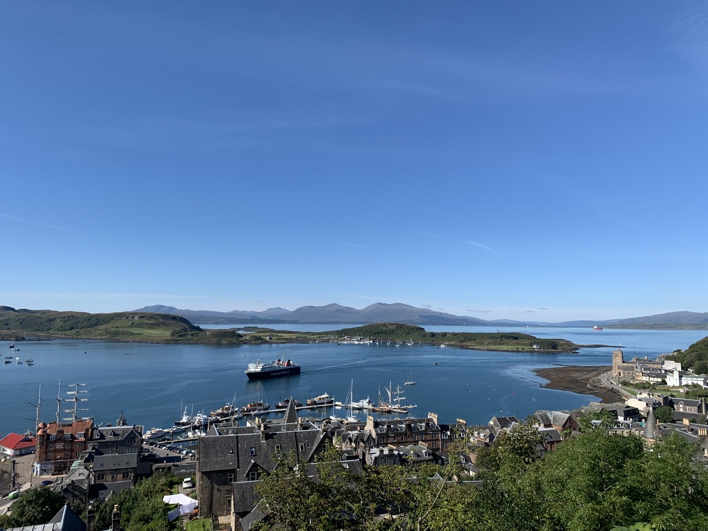
The journey to Oban is truly beautiful, snaking along Loch Lomond before threading its way through Arrochar hills and finally to the west coast. Once you arrive in Oban, you will likely have some time to enjoy the harbour and the seafront, and I recommend checking out McCaig’s Folly that stands above the town, plus the superb Hinba Coffee Shop!
The ferry terminal is directly opposite the train, so you should have no issues in finding it. Bikes are fairly cheap on Calmac ferries. For the five-hour journey to Barra we paid around £30 each. The return ferry from Stornoway to Ullapool was around £20 each. You pay as a foot passenger and your bike is free.
Remember: You should book your ferry from Oban to Castlebay on Barra in advance, plus your return ferry from Stornoway to Ullapool. The ferries on the Hebrides themselves do not require booking and are very cheap for cyclists.
To get back to Inverness, we cycled from Ullapool (as I will explain), but there are buses that allow bikes as well as transfer companies.
Planning your Hebridean Way
How far you want to go each day is completely up to you, and will be dictated by whether you want to camp or stay in hotels and bunkhouses. Despite their recent fame as a tourist destination, the Hebrides are still remote at their heart, so plan ahead with your accommodation plans.
Beyond the usual booking.com and Airbnb, check out the Gatliff Hostels and other independent youth hostels on the islands.
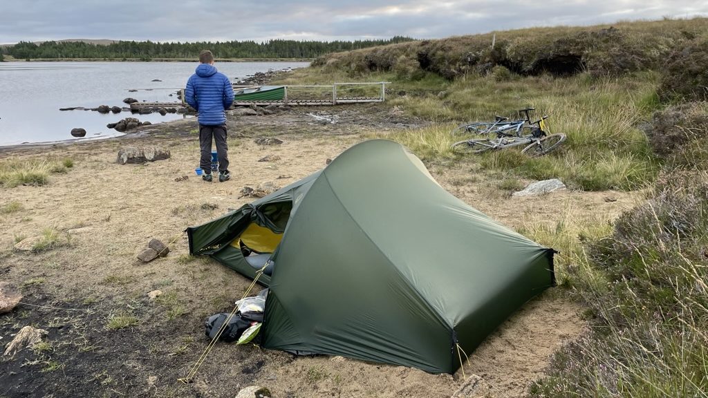
We chose to camp two nights, hostel one night and bothy for the last night. This allowed us a nice mix of flexibility with camping plus the knowledge of a warm bed a couple nights!
When it comes to packing for the Hebridean Way, all I can say is pack for the worst and hope for the best! The Hebrides are the first landing point for weather rolling off the Atlantic Ocean so can be battered with heavy rain and gale-force winds. Still, they can be graced with surprisingly amazing weather, so best to pack for all seasons in a day!
A note on Sundays
The Outer Hebrides remain a staunchly religious area and you will struggle to find facilities open on a Sunday. Make sure you have a plan in place if your trip crosses a Sunday. Accommodation is still open, but pubs, shops and restaurants are extremely limited. Ferries also run on amended timetables, so make sure you double-check!
Our Hebridean Way
Reaching Glasgow at 8am, we caught the 8.21am train to Oban, which meant we had some spare time before our ferry left for the Isle of Barra at 1.30pm. Ironically, the day we spent the most time travelling on public transport would be the best weather we would see for the rest of the trip!
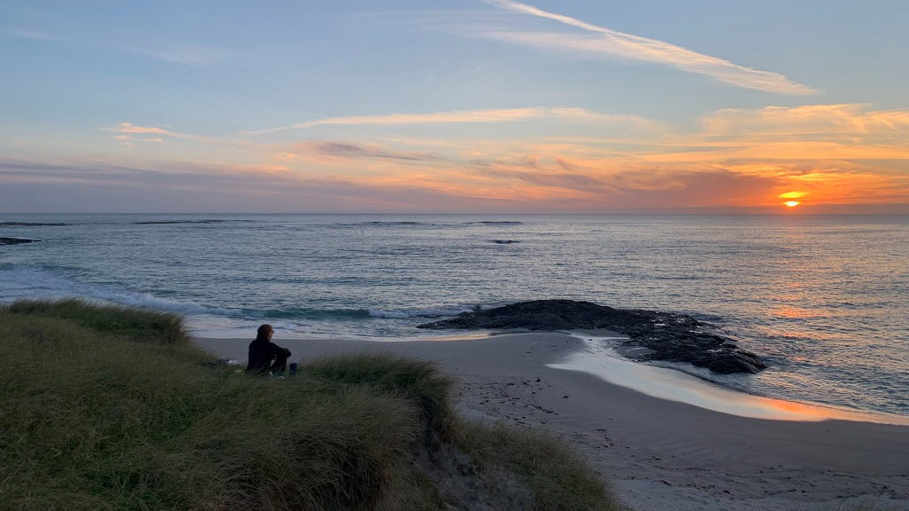
Starting in Barra meant we had the prevailing south-westerly wind to our backs, though that is not an exact science, as we would discover! Upon reaching Barra, we found a secluded campspot and enjoyed dinner looking across the Atlantic as the sun dropped below the horizon, ready for our first day of cycling tomorrow!


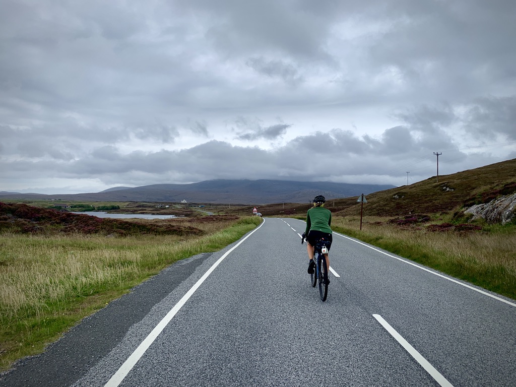
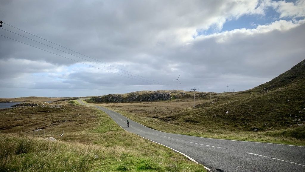
Day 1: Barra to Berneray (151km/630m)
The clear skies of the previous evening had been shrouded by a blanket of grey cloud. It was Sunday, and so the roads and villages were utterly silent as we made the short journey to Aird Mhor ferry terminal. Arriving at the terminal, a Golden Eagle flew over our heads, closer than I have ever seen one.
Despite the heavy winds, our 8.55am ferry was still expected, so we spent the 30 minutes sheltering from the gale in the Ardmhor Coffee store, chatting to fellow cyclists including a pair from the USA on a grand tour of Scotland.
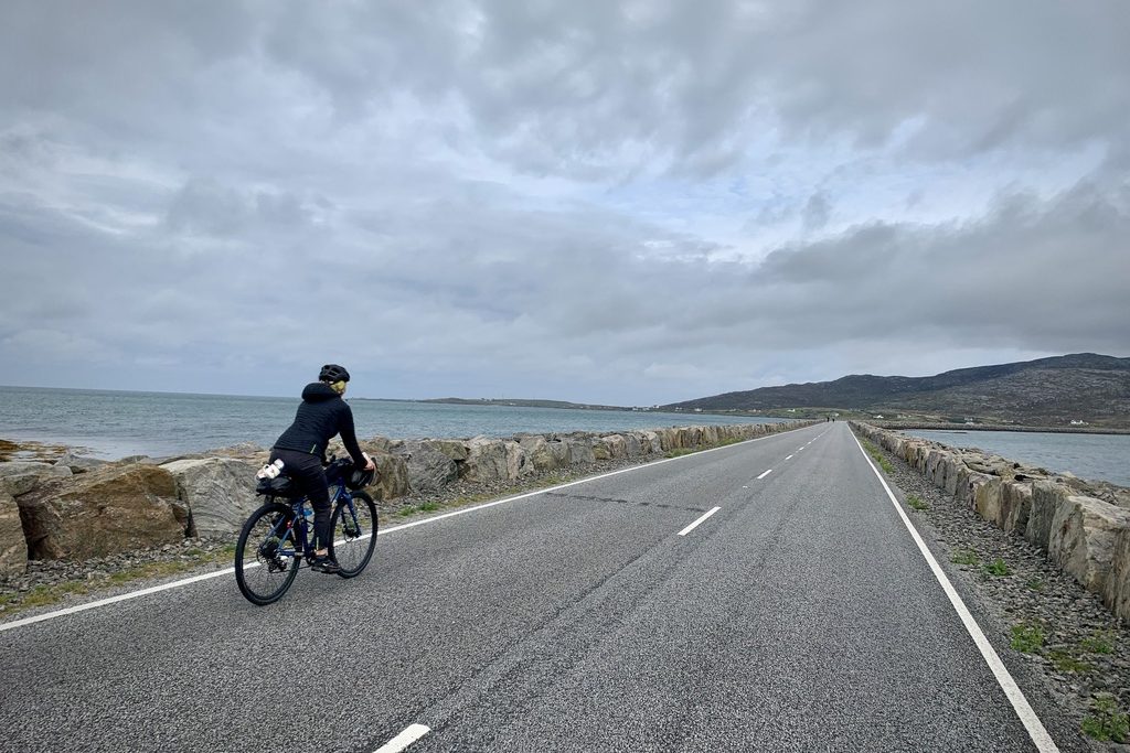
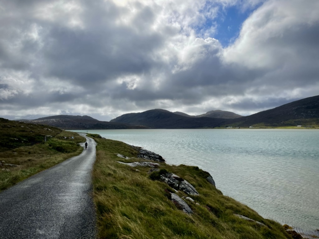
After a choppy sailing, we landed on Eriskay and turned our backs to the wind, which pushed us onwards through the flat, exposed landscape of South Uist. That morning, we also crossed our first and probably longest causeway – a truly incredible feat of engineering to connect Eriskay with South Uist.
The eerie silence of that Sunday morning was punctuated only by the greetings of our fellow Hebridean Way cyclists, who we leapfrogged for much of the day as we stuck true to the squiggles of the Way while some of them cut them off on the main road. I do not regret this: the official Way takes you to the shore, affording impressive views over the ocean.
As the day rolled on, energy began to flag but we thankfully had the prospect of a hostel that night in Berneray. After a few heavy showers, the loss of one of my sandals from my saddle pack (tragedy) and a ferocious tailwind, we arrived in Berneray on North Uist.
We had originally intended to stay in the Berneray Gatliff Hostel, but this is a solid 20-minute ride from the ferry terminal, where we would catch a very early ferry to Harris the next morning. Instead, we stumbled across a ‘Vacancies’ sign pointing towards ‘John’s Bunkhouse‘, where we waited out the storm which blew in overnight.
Day 2: Berneray to Isle of Lewis (105km/1120m)
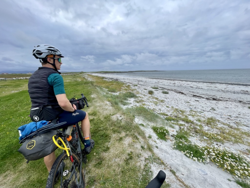
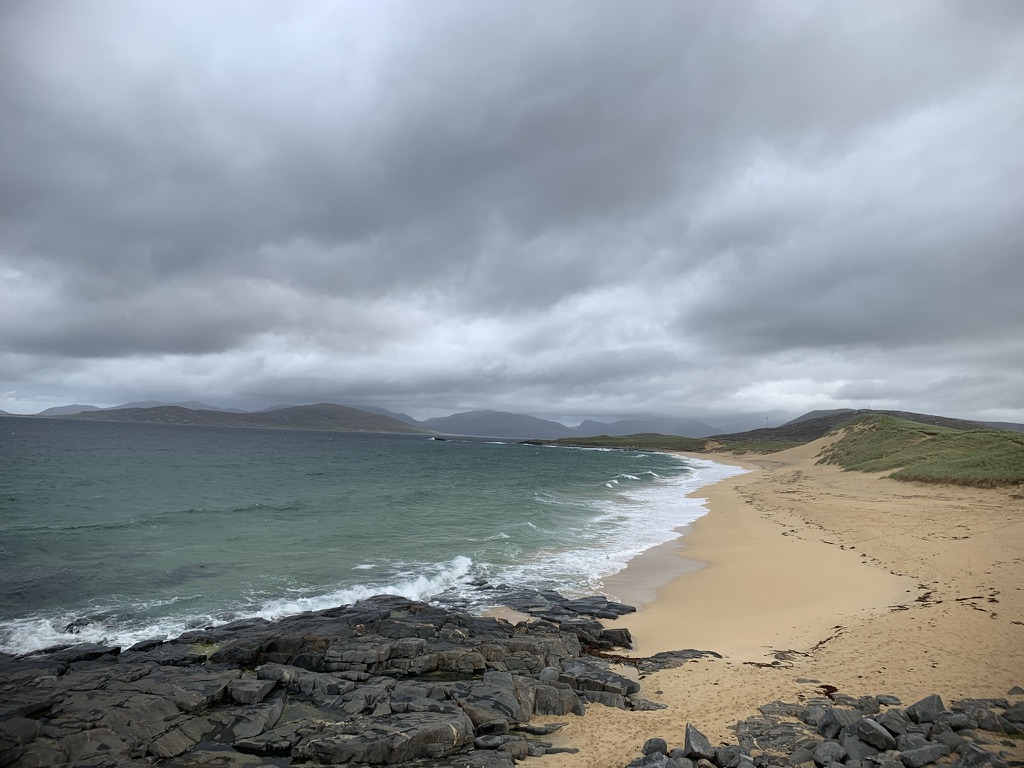
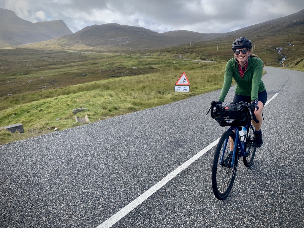
If there was one island I was most excited about on this trip, it was the Isle of Harris. Famed for being home to the glorious beaches of Luskentyre, Hushinish and North Tolsta, Harris is the hilliest island of the Hebrides.
As we watched the sun rise in the east, its early rays glinting on the sea where gannets dived for fish, we glanced west and saw the beautiful dawn juxtaposed by menacing clouds over the Atlantic. Another day in the Western Isles!

The rain swept in as we landed on Harris, so Bo, my fiancee, ducked into a waiting room while I grabbed us some breakfast rolls. Time was not so precious today: we had no ferries to catch and were planning to camp on Lewis that night. The wind, however, had changed from a south-westerly to a westerly, meaning some stiff crosswinds all day and a block headwind to finish.
With the rain dying off, we set off, stopping at the Talla na Mara visitor centre, base of the community-run West Harris Trust. Vast swathes of Harris are managed by community trusts who, like the West Harris Trust, are dedicated to the sustainable economic development of the island.


Grabbing chocolate from the visitor centre, we pedalled down towards Luskentyre as a fresh deluge rolled in off the sea. We would become accustomed to donning and shedding layers every 30 minutes or so on this trip. After having our hopes of a morning coffee and cake dashed by the ‘closed’ sign at Talla na Mara, we were thrilled to find a small blue box by the roadside en route to Luskentyre – The Cake Shed*.
Inside was a treasure trove of goodies; freshly-baked Biscoff biscuits, scones, brownies and all manner of treats. Popping our cash into the honesty box, we rolled down to the famous beach to sit down and enjoy our scones, marvelling at the emerald blue sea which crashed on the golden sands.

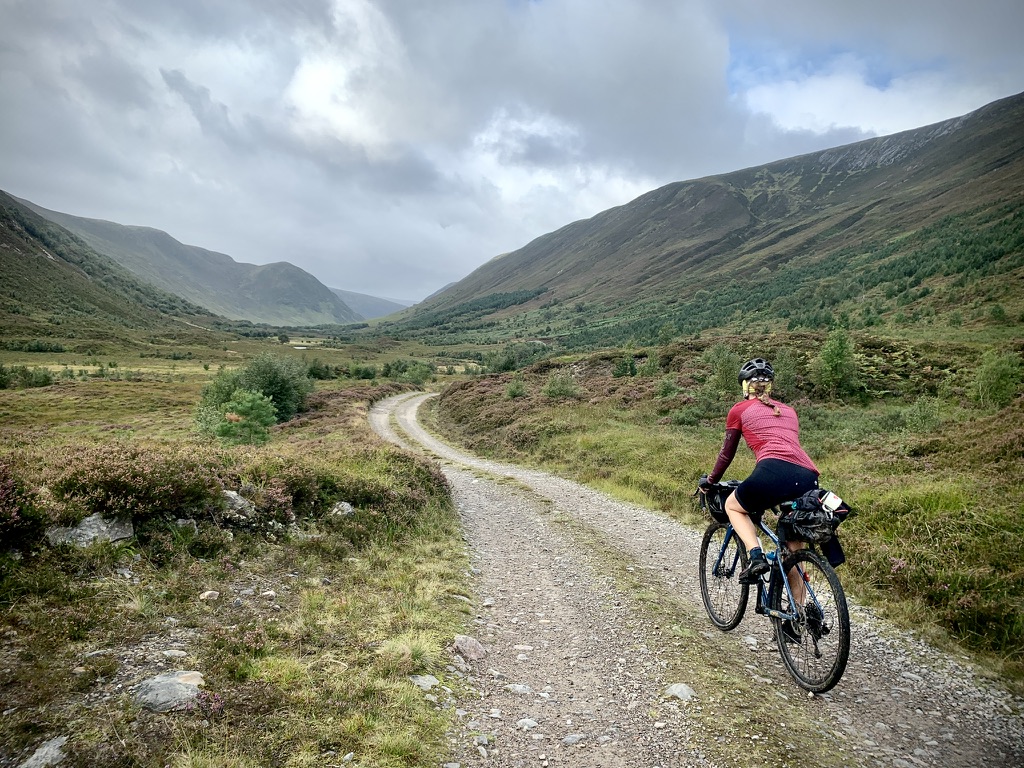
Once we eventually pulled ourselves away, we set course for Tarbert and the first of our Harris climbs. As we made our way over some steady gradients, the landscape unfurled ahead like a pop-up book, with mighty hills growing on the horizon. Harris contains no real ‘mountains’, but the meeting of land and sea makes these hills all the more striking.
In particular, as we left Tarbert, we climbed what I dubbed the Col du Mhorghain. This beautiful ascent swiftly took us high above the sea to Loch a’Mhorghain, a small lochan surrounded by hills. The views only continued to delight, with the panorma over Loch Seaforth potentially even more dramatic.

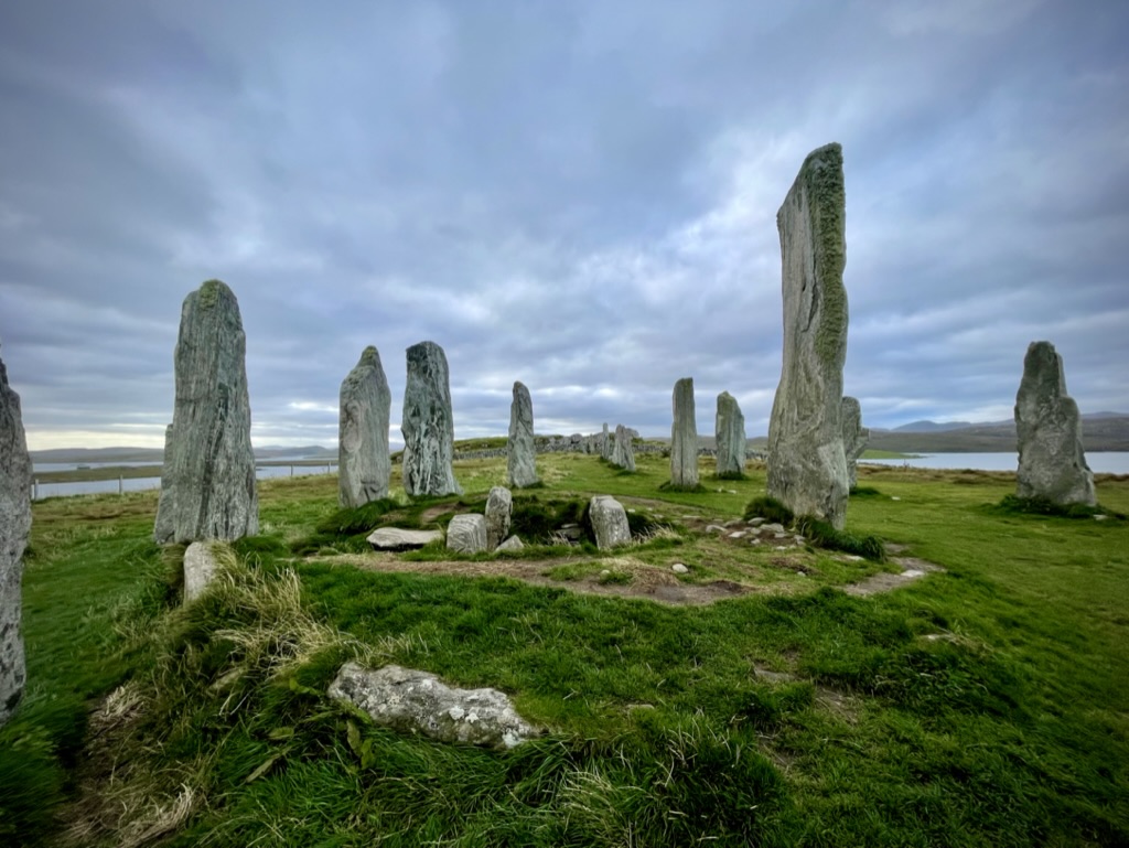
Sadly, our time of Harris came to an anti-climactic end as we crossed the invisible border to the Isle of Lewis and its exposed plains. The boundary has a long history, potentially stemming back to a split in the Clan Macleod, who presided over much of the Western Isles.
The final leg of the day saw me taking the head of our two-person peloton and sticking my nose into a brutal headwind as we hunted for our camp spot for the night. After 15km, we veered off the road and traipsed over rutted ground towards a loch, passing stands of cut peat to finally pitch our tent on a fairly marginal spot on the lochside.
Day 3: Isle of Lewis to Knockdamph Bothy (75km/750m)
It was sad to leave the Outer Hebrides so soon. We knew this trip would only scratch the surface of this beautifully rugged archipelago, but it was a shame to leave after such a short visit.
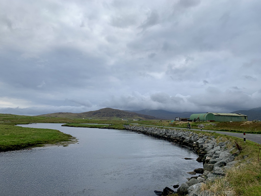
Our first 50km saw us ride around the west coast of Lewis through Carloway before cutting inland towards Stornoway. This cut-through saw us miss the Butt of Lewis – the official finish of the Way – but was necessary for us to reach our 2pm ferry. Despite that, we were not being let off lightly. Our final 20km to Stornoway featured a tortuous drag of a climb over the aptly named Black Moor. This seemingly endless road undulated its way over barren, bleak moorland, with faster traffic than much of what we’d experienced until then.
After what felt like the umpteenth “Just one more summit to go” from me, we finally zoomed downhill into Stornoway with the Peat & Diesel song of the same name stuck in my head the whole way. With time to kill, we refuelled in The Hub Cafe adjoined to Bespoke Cycles, gorging ourselves on paninis and cake.
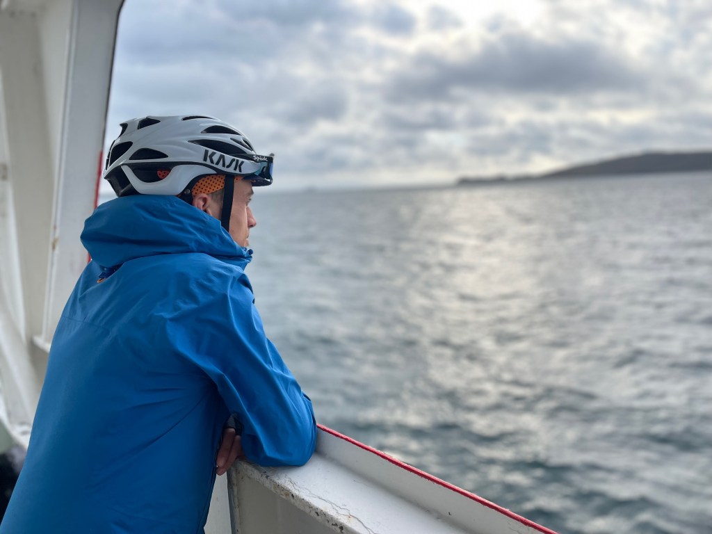
The terminal at Stornoway was a much more industrial affair than we had encountered so far, evidently the busier of the ferries we had travelled on. After tying our bikes up on the car deck, we sat and watched the sea roll by, soon followed by the Summer Isles and, eventually, the mainland.
Before we made our final voyage for the day, we hopped off the boat in Ullapool and made our way to the famous Seafood Shack. The Shack is one of the best restaurants in Ullapool – fresh seafood served from a van. This is not just any van, though. This van has comfortable outside seating with umbrellas overhead and a pop-up gin bar.
You’re right: we had some gin.
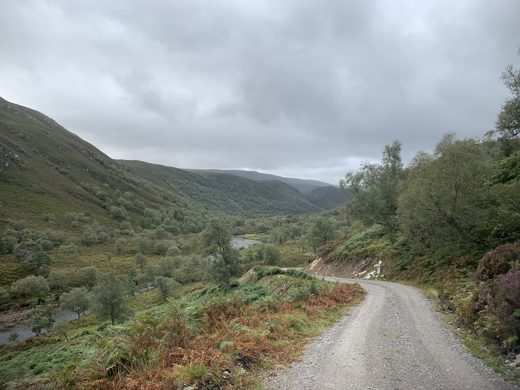
With full bellies, it was time for our final push into the unknown. When planning this route, I spotted a series of gravel tracks heading north-east out of Ullapool and eventually popping out close to Inverness. Given we had time and the ‘right’ bikes, I figured this would add a little more adventure to the trip.
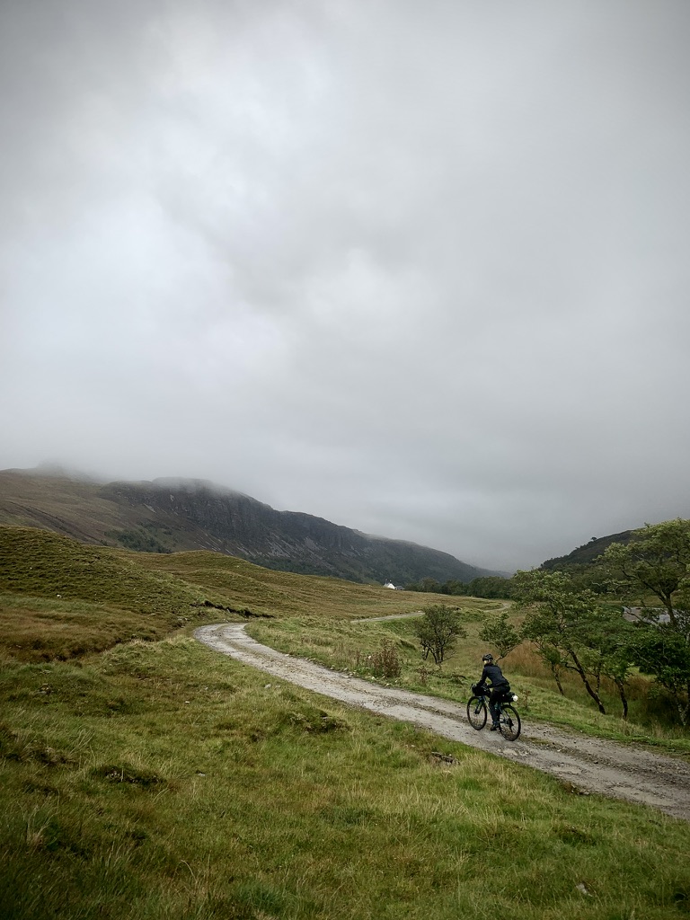
It was not without trepidation, though. I had heard rumour of singletrack, hike-a-bike and rough roads…but it was worth a try. After passing the tarmac-cum-gravel road past a quarry, we joined some excellent gravel tracks to East Rhiddoroch Estate. The landscape around us became increasingly rugged and remote, with high hills disappearing into the thick cloud overhead. Meanwhile, rain chased us up the glen as our thoughts turned towards our bothy bedroom.
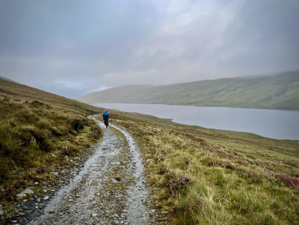
Following East Rhiddoroch there was a challenging section of steep, rough gravel which required some pushing. We were rewarded with a dramatic (if obscured) view over Loch an Daimh – the view which indicated we were close to Knockdamph Bothy. After what felt like eternity, we eventually made it to our shelter for the night, just before darkness descended.
Without coal or wood, we settled in for a cold night by an empty fire. Thankfully, the bothy was well-insulated, and with a few whiskies purchased in a Stornoway shop, we were cosy in our little home.


Day 4: Knockdamph to Inverness (108km/1090m)
The rain which had smeared the window all night continued in the morning. Rivers gushed and the tracks were waterlogged as we made our descent towards Schoolhouse Bothy.
Our unity as a pair was tested that morning. With a train time lodged in my mind, I was too focused on battering on down the relatively technical descents while Bo struggled to hold on, her hands beginning to hurt from the constant breaking and shaking on rough ground. In short, words were said and lessons learned this day!

It would prove to be one of the most challenging days. While not singletrack or hike-a-bike, our gravel bikes with their 40-43mm tyres and their riders were at their limits at times – goodness knows how we didn’t puncutre!
Our efforts were not in vain, thankfully. The Alladale Wilderness Reserve is famous in conservation circles for its edgy rewilding tactics, masterminded by owner Paul Lister. It’s website describes it as ‘the wild side of the Highlands’, and it’s clear why. Turning the corner off a farm track, we moved from a typical Scottish landscape into one abundant with trees and wild rivers. It was as though we had teleported to the Cairngorms.
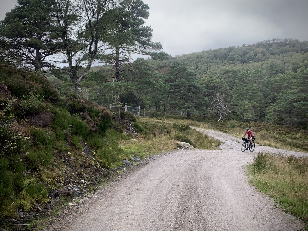

Everywhere, Scots Pines groaned over the gravel track which led to the estate with every turn revealing another stunningly natural view. How has something so ‘natural’ become almost unnatural? There was a feeling of manufactured beauty about it, as though being in a safari. Despite it being an oasis for nature in a landscape dominated by excessive deer numbers and human development, Alladale was one of the most memorable places of this trip.
The gravel waxed and waned in its quality as we continued our journey south towards the main road, but we suddenly popped out of the Land Rover tracks onto a tarmac road to take us to the main A834.
With the wind on our backs, we breezed through towards Garve. After such a challenging morning on the gravel, we discussed whether to stay on the road or opt for the off-road via Strathpeffer. In the end, the gravel won, so we took a left over a marvellous little bridge to join the forestry tracks to Strathpeffer.
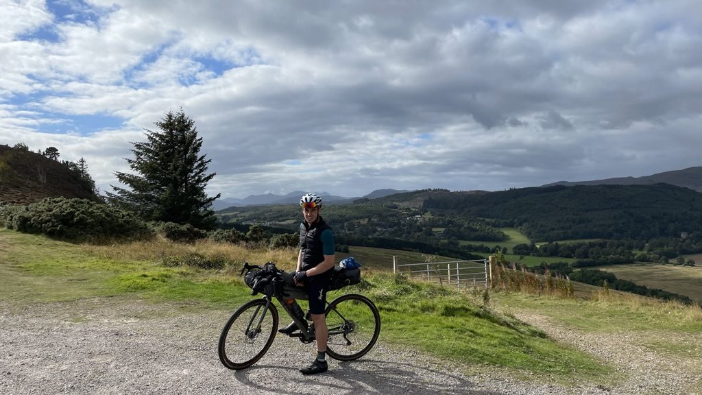
The final few hours were spent following the cycle network into Inverness, over the Kessock Bridge and into the town centre. There, we were greeted by the alluring sight of the Black Isle Bar and the promise of beer and pizzas within.
After 450km, those pizzas tasted divine. With fully bellies and hearts, we rolled into the train station with dessert under our arms and made the journey back south to where it began.
*Don’t worry about the opening times of the Cake Shed. We took a gamble and it was open. Depends on the baking schedule!
See the komoot collection here.

Hi Ross
I am really interested in doing this route but wondered what time of year you did it? I was thinking of April with midges in mind. It sounds a fabulous adventure of which I’m sure weather plays a large part.
I look forward to hearing from you.
Kind regards
Adam
LikeLike
Hi Adam! We did this in September. There were the occasional midges in secluded areas. To be honest, it is so windy at times they cannot hold on! But April/May would be absolutely perfect.
LikeLike
Thank you Ross, Really loved reading your experience of the Hebridean Way and also the route you took from Ullapool to Garve – Alladale sounds magical – and I would love to ride this next September after the Heb Way but wonder if the tracks are too rough with a bike with panniers and full camping gear on board.
LikeLike
Hi Laura! I think you’d be fine but better with mountain bikes. Panniers just add that much more weight I’d like to have the security of a mountain bike. Obviously this depends on your own bike handling, you might be grand on a drop bar bike (I.e. road bike style).
LikeLike
Thanks Ross, mine is quite an old hybrid; a heavier tourer frame with flat handlebars and chunkier tyres. I don’t mind a bit of pushing up hills or walking rougher sections so will most likely give it a go 🙂
LikeLike
Hi Ross, just to say that last week I returned home from an epic solo tour of the Hebridean Way and also made it back to Inverness via the track route from Ullapool to School House Bothy, then via Alladale to Loch Vaich and Garve, then some of the tracks to Strathpeffer and finally to Inverness. It was amazing but hard work with the heavily laden bike but loved every minute of it! Thanks for such a great route review and inspiration!
LikeLiked by 1 person
Hey Laura! I am so delighted you gave it a shot. Yes, it’s a troublesome trail but the effort put in is definitely matched in the reward. Well done!
LikeLike