Below is a full description of our experience on the GJT. To view the Komoot collection, click here.
The Grande Traversée du Jura (the GTJ or Jura Grand Traverse) is a 400km-long trail following the Jura Mountains that stretch along the border between France and Switzerland.
Europe is famous for its long-distance Grande Randonnée (GR) trails and, indeed, you could easily be drawn down several that run over and along these sub-alpine mountains.
When planning our trip to Jura, we were keen to remain on French soil, for the simple reason that things are not as expensive as in Switzerland. The Jura Ridgeway (or Jura Crest Trail) is a famous long-distance route, but remains solidly on Swiss soil, and so our eyes were drawn elsewhere.
We stumbled across the GTJ which – we realised later – is a family of routes. In fact, you can complete the GTJ is seven different ways, with paths designated for walking, cycling, snowshoeing, skiing and even horse riding.
The trail worked perfectly for us: We were staying with family in the Morvan, which meant the Jura Mountains were just a few hours away.
We had a slight logistical hurdle to overcome in deciding just which part of the trail we wanted to run.
Spanning from the northern tip of Switzerland’s border with France, the GTJ wiggles its way through forest and over lush rolling mountains to the southernmost point near Lac du Bourget (close to Annecy).
Originally, we had intended to get a train or bus back to the start. That, plus the fact we only had three days to do the trail meant we selected a 100km section between Pontarlier in the north and Morbier in the south.
Albeit we would be missing the highest point of the trail (Grand Cret at 1702m), we would still have nearly 3000m to ascend over our 100km route.
Day 1 – Pontarlier to Chez Liadet (42km, 1800m)
Pontarlier sits astride the Doubs River, which would be our companion for much of the day and to the source of which we would visit that day.
With an hour to go before we reached Pontarlier, we were already starting to feel the more alpine climate emerging around us, with thick forests carpeting the hillsides. I was incredibly excited: Though I had studied the map and plotted the route, I was still very unsure as to what would await us on this trail.
Without realising it, we had driven to a height of 900m above sea level already, before dropping into Pontarlier at 840m.
Driving through Pontarlier, we made for Chateau de Joux, where we had spotted an aire on the map that we reckoned we could leave the car.
Chateau de Joux is an underrated chateau. Now a fort, it commands an enviable position above Cluse de Pontarlier perched right at the top of a rocky outcrop and, if it were in a more popular region, would likely be the most photographed chateau in all of France.
Had we not been focused on getting started on the trail (and had it not been closed for renovations) we may have stayed a while to look around; it felt almost rude to park here only to run away from this stunning building.
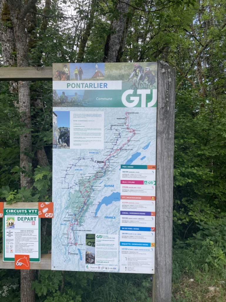
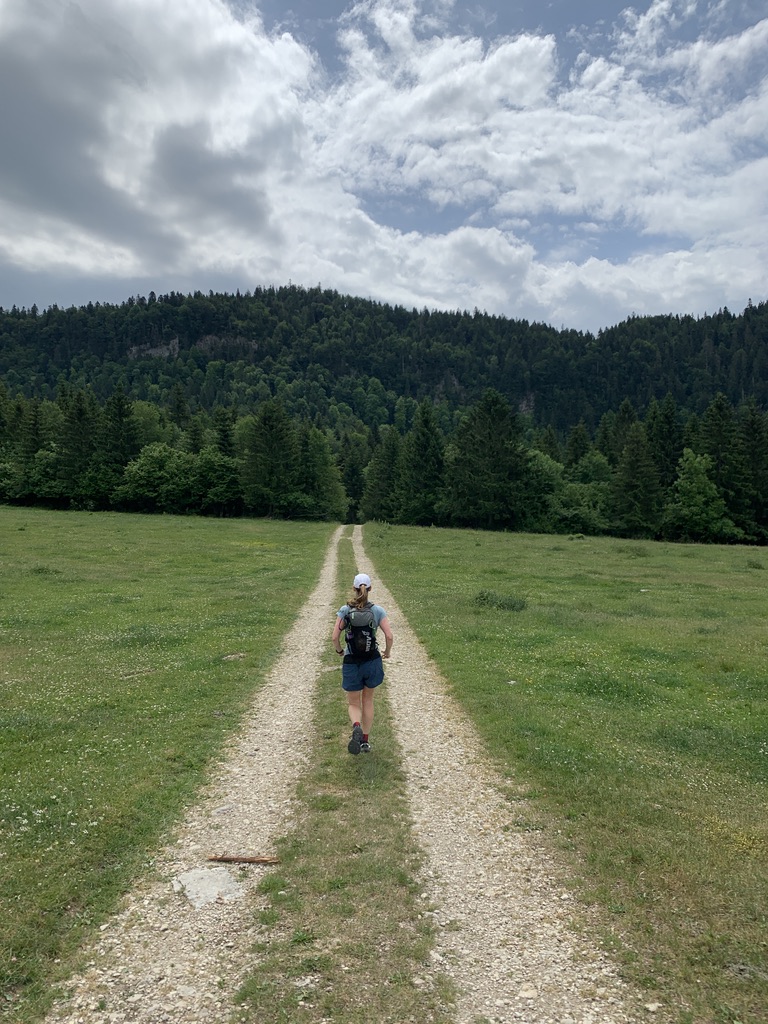
After a customary selfie in front of the GTJ route board, we followed the famous white-and-red stripes out of the car park and down the hillside through the heavily shaded forest. As a side note, if you happen to be looking for a trail to run in summer, this may well be a good option as the abundance of trees allows for a cool run throughout the heat of the day!
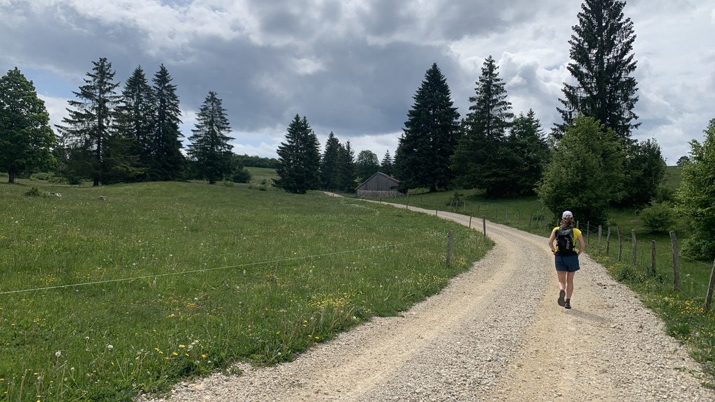
The day started with a couple of punchy little climbs followed by long, gradual descents on quiet roads towards Montperreux. This is where we had our first encounter with the French habit of everything being closed during the day.
We had hoped to stop in Malbuisson on the banks of Lac de Saint-Point, but we discovered both were shut and so we cut out the dog-leg down to the town and instead headed straight uphill towards Les Hopitaux Neufs.
It was no great chore. The forest tracks – wavering between tarmac and gravel – were hemmed in by a beautiful mixture of woodlands, with pines and broadleaves happily nestled together.
What we quickly came to realise was that, bar one other person, we were the only two people we had seen on the trail that day. In fact, everywhere we went, we seemed to be alone except for the omnipresent chimes of cow bells that wandered to us through the trees. This would become a theme for the whole trip, actually.
We emerged from the forest to the warmth of the day and could look down upon Les Hopitaux Viex and Neufs. Ahead, the rising bump of the Métabief ski slopes loomed – our biggest climb and highest point of the whole trail.
Hopitaux Neufs looked very much like somewhere you’d expect to see the Tour de Romandie peloton passing through, with a wide central road and quaint stone buildings either side of it. We wolfed down our pastries and baguettes, fuelling up before the long climb to Métabief.
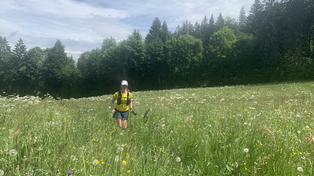
The trail started on meandering trails, every now and then passing over the ski slopes and downhill mountain bike tracks that zigzag through the forests. It was also where we came across one of the most spectacular highlights of the GTJ: the wildflower meadows.
Jura is dairy cow country. Morbier, our final town of the trail, is famous for its Morbier cheese. Because of this, the dairy cows require a diverse range of food, and so Jura is bursting with these enormous wildflower meadows which the cows visit rotationally.
Morbier cheese is distinctive thanks to the black line running through the centre of it. Traditionally, when making comté cheese, the cheesemakers would leave the leftover curd overnight and cover it with a layer of ash to preserve it. The next morning, they would add a second layer to it, and so Morbier cheese was born.
These floral oases were straight from a Sound of Music scene. The sun shone down on the hundreds of flowers nodding lazily in the light breeze. As we climbed higher, the meadows gave way to the Alpine climate of the top slopes. Any time I looked at my feet, I could see Alpine Lady’s Mantle carpeting the ground.
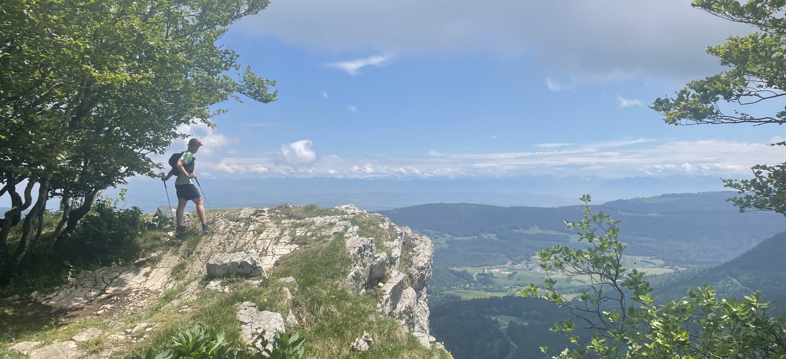
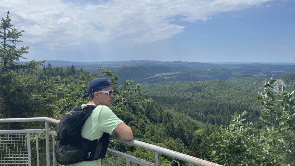
We headed straight up the ski slope. No one was around, so we had the opportunity to enjoy the expanding vista of the French-Swiss border alone, savouring the mountain air and sun.
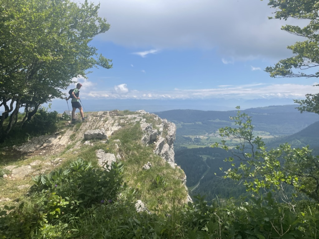
Eventually, we popped out at over 1400m. From the summit at the Métabief ski centre, we looked south over the famous limestone escarpment towards Mont d’Or, just 500m from the Swiss border.
The steep descent to the artificial lake is followed by a lazy climb to the escarpment, which provides some exquisite trail running – a sense of running in the sky as the earth disappears to one side of you. Water Avens hugged the edges of the footpath; a plant you would ordinarily have to go well out of your way to find in the UK was sat right here by the path, essentially in a cow field.
We dropped west off the side of Mont d’Or, back into cow pastures and wildflower meadows. About halfway down, we came across an auberge which was miraculously open, so we stopped for a coffee and a water refill before setting off on the final 10km towards Mouthe.
My watch had said the rest of the trail was downhill to Mouthe, but every so often there’d be just a little climb to break up your stride. After just under two hours, we arrived at the Source du Doubs – the source of the Doubs River.
We had originally planned to stay at the hostel nearby, but after a bit of a miscommunication ended up booking a stay at Chez Liadet, which we thought was “just around the corner” – but in fact turned out to be a further 3km away up a drag of a hill.
At the bottom of the climb, I was thinking of dinner and beer, so the poles came out and we marched up the hill at under 10min/km pace. Finally, after the long climb, we reached the flat tarmac road that leads to Chez Liadet.
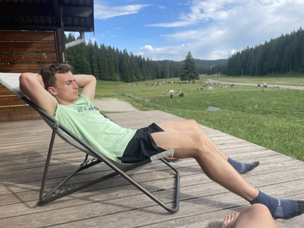
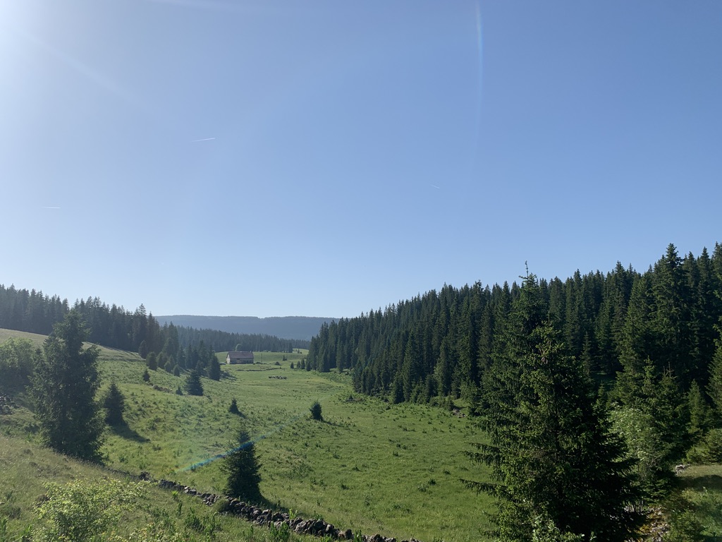
Chez Liadet, it transpired, was a small collection of log cabins next to a large house and barn, in one of the quietest valleys we had been in, broken only by the soft ringing of cowbells.
We went to check-in at reception, but were waylaid but a huge, lazy Bernese Mountain Dog, who almost instantly rolled onto his back to get a belly rub. Chez Liadet is run by a family, who are all passionate about the mountains. Nicolas, one of the owners, bore a Salomon t-shirt and wouldn’t look out of place at the start of UTMB.
After a heavy pot of fondue and a bottle of beer, we headed to bed, falling asleep in minutes – dreams filled with the soft tinkling of cowbells.
Day 2 – Chez Liadet to Foncine Le Haut (33km, 723m)
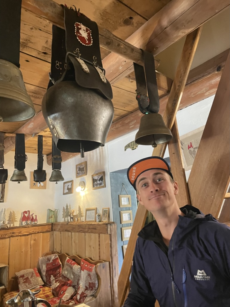
Over our breakfast table hung a dozen enormous cowbells, some of which I struggled to conceive how massive their owners must have been. According to our paper placemats, this was the family business: Making cowbells.
Leaving our tranquil valley behind in the blue-green hue of the morning, we followed dew-heavy trails back down the hill we had come the previous afternoon to Mouthe. Our objective for the day was Foncine-Le-Haut.
When planning the route, this day had raised an eyebrow a couple of times. The route through the valley had some strong heatmap traces on Suunto, but the route of the GTJ actually headed up the other side of the valley and into some forests, in which there was little sign of any previous runners of walkers. It meant the 8km valley trail from Mouthe to Foncine-Le-Haut was actually a 33km day for us.
We debated whether to take the well-worn trail through the valley, but decided the alternative provided a greater opportunity for adventure, and was truer to the GTJ hiking route. After grabbing extra water in Mouthe, along with a couple of baguettes (knowing this was the last time we’d see a shop all day) we headed uphill towards Les Pontets.
The heat of the day quickly rose. The mid-layers we had on were quickly discarded, with the humidity incredible high. We were in need of a good thunderstorm to clear the air.
We had a fun time of trying to evade the enormous swarms of bluebottles that were happily feasting on fresh cow muck across the roads and trails. Any time we’d get to a long stretch of them, we’d run around them together as though evading land mines, causing swarms of them to burst forth as we passed. Fun? Yes. Pleasant? No.
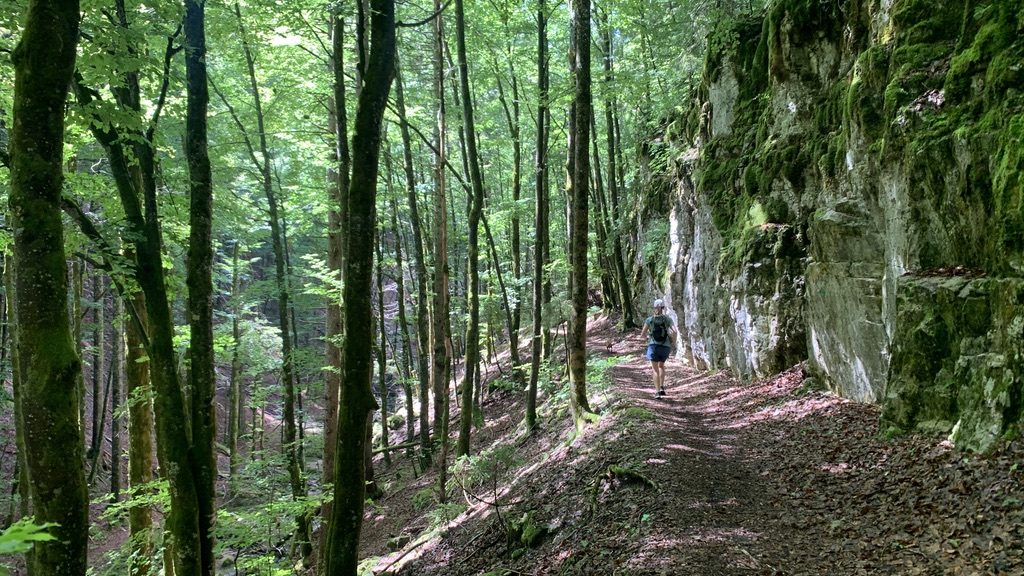
Finally, we entered the cooling air of the forest, continuing on a tarmac road uphill to Cerniébaud. It was here we again encountered the odd feeling of being the only people on Earth. I suppose it was mid-week out of peak season, and a number of the houses would be second homes, but there was an eery quietness to the towns, as though they had been forgotten but were lightly maintained for appearances. At one point we passed a primary school full of shouting children, which seemed at complete odds to their surroundings.
It felt as though we had been on (rough) tarmac for much of the day, so it was a relief to finally turn into the forest again and find some gravel tracks. The dappled understory provided a tranquil setting as we headed slowly up the long climb of the day, which would eventually zigzag to bring us to 1100m above sea level.
Bo had a bit of a bonk at this point. Thanks to the tarmac and reasonably flat roads, we had done quite a lot of running until that point, and had possibly not taken on as much fuel as we needed. Thankfully, we always seem to leapfrog one another in our energy dips, so one person has the chance to gee the other up. I handed her a heavily loaded baguette of cheese and ham, a pole, and put on the Moulin Rouge soundtrack to pull us up the long forested climb.
After an unexpectedly steep section through churned up mud and grass, we reached the flat top of the forest, which began to open up to show the final climb of the day ahead, up to a towering mast. We made a quick check on Google Maps to see if there were any shops open in Foncine-Le-Haut and found a tobacco shop that was apparently open until 10pm. Result!…
Our short respite of flat ground was quickly over as the trail turned upwards again and, this time, required the poles to come out for both of us. Despite it being just 150m of ascent, the gradient was punishing on tired legs, and even turned into steps close to the top, which seem so much harder than a simple pine needle-covered trail.
At the top of the knoll, we were treated to a panoramic view of a seemingly endless carpet of forested countryside, unfolding onto a hazy horizon. Leaving our treetop vantage behind, we dropped down through the forest – first gradually, then steeply as we made our way down into the hot basin and our destination of Foncine-Le-Haut.
Our hopes of a refreshment at the local tobacco shop were dashed as we quickly came to realise that Google Maps’ advertisement of opening times and the reality on the ground differed vastly. So we sat, slowly wilting in the clammy afternoon sun, waiting for the nearest auberge to reopen.
Day 3 – Foncine-Le-Haut to Morbier (22km, 490m)
That night, we were treated to one of the most fearsome thunderstorms I have ever experienced. At around midnight, the light show started, with flashes almost every second as though we were in a nightclub with flashing strobes.
It made sleeping in a small box of a cabin in the hills an electrifying experience, to say the least.
However, it did mean the next morning dawned clear and dew-covered, making the air far less stifling and much more agreeable for running. Leaving our hilltop cabin behind, we ran up through the forest again.
The day started quintessentially Swiss, with soft morning rays piercing through clearings in the pines. Except for the ringing cowbells, we were alone, enjoying the tranquillity of the morning along singletrack trails.
Our first town of the day, Chapelle de Bois, sits close to the border with Switzerland, watched over by a huge iron cross sat high on the cliffs above. We dunked our hats into the fountain before making our way through town to the foot of the cliffs.
Here, we turned to run south-west, heading towards our destination of Morbier and passing the twin lakes of contrasting names, Lac de Bellefontaine and Lac de Mortes – Lake of the Beautiful Fountain and Lake of Death.
The mercury was slowly rising as the morning passed into midday, with a large chunk of the route so far being on tarmac roads. While my legs felt fine, I noticed I was dipping in energy levels earlier than I had the previous two days. The previous night’s storm had kept me awake for a time, so by the time we reached Bellefontaine I was starting to flag in the heat.
We chomped down some supplies and kept moving, sticking to the shade as much as possible and throwing the dog in the rivers where we found them. As we made it to 18km for the day, we waved goodbye to the official GTJ route to head to Morbier, home of the famous cheese.
After running through a sleepy wooded gorge, we began a stiff climb which would eventually tip down into Morbier sat nestled in amongst the hills. As we rounded a corner in the hillside, the ground dropped to our left, revealing the valley below and the town of Morez which neighbours with Morbier.
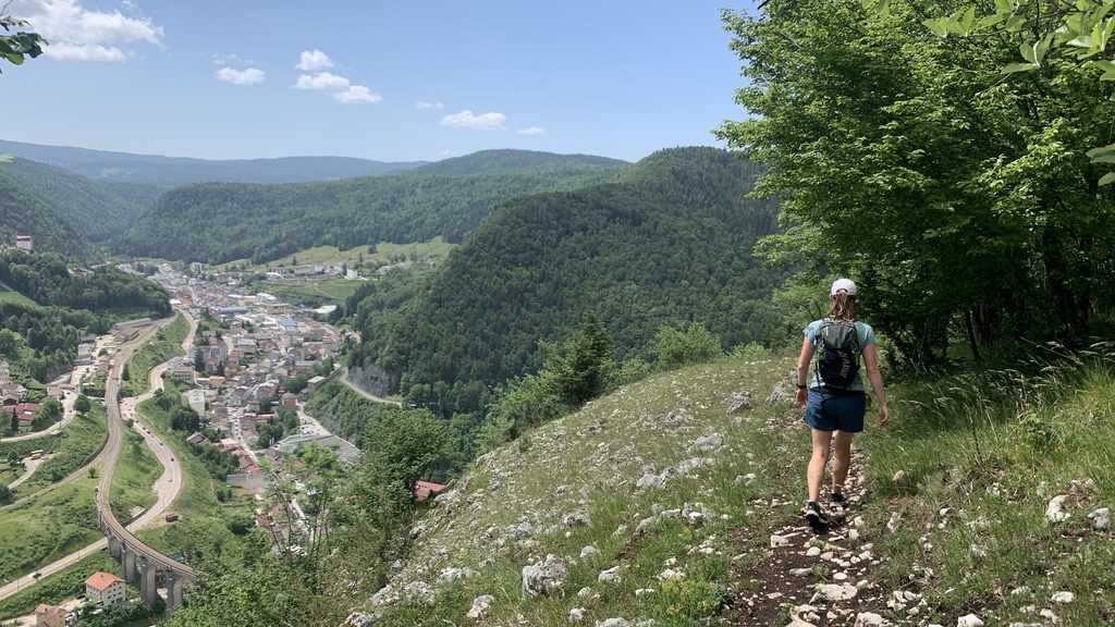
The descent into Morbier is very steep, with an exposed drop to one side, which I became acutely aware of after nearly stumbling down the edge of the hillside!
Arriving in Morbier, we rendezvoused with family. Sadly, because this is France, we could not sample the famous cheese – because nearly everything was closed. Had we not had the luxury of meeting family, we would have taken the TER P8 bus that runs twice a day to Andelot and then the TER P18 to Potarlier.
Summary
In summary, the GTJ is an excellent trail running experience, despite my grumblings of closed cafes! Had we had more time, I would love to have experienced more of the trail and get into the heart of the mountainous region of Haut Jura.
If you want to do the trail yourself, you can do as we did and drive there. There is the option of a flight to Geneva airport followed by public transport to Potarlier; or, if you want to take on the full distance, there is the option of Bern in the north to reach Audincourt and Geneva for the southerly point on the shores of Lac du Bourget.
If you have any questions about the trail, just drop me a message and see our Komoot collection for the full route.

2 thoughts on “Fastpacking the Grande Traversée du Jura (GTJ)”